Near Earleville in Cecil County, Maryland — The American Northeast (Mid-Atlantic)
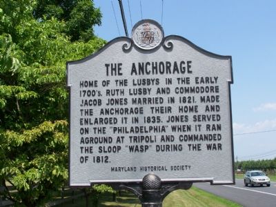
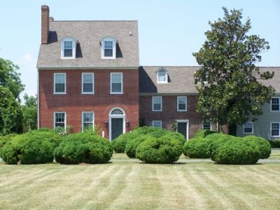
The Anchorage
Erected by Maryland Historical Society.
Topics. This historical marker is listed in these topic lists: Colonial Era • Settlements & Settlers • War of 1812. A significant historical year for this entry is 1821.
Location. 39° 25.375′ N, 75° 51.64′ W. Marker is near Earleville, Maryland, in Cecil County. Marker is on Augustine Herman Highway (Route 213) half a mile south of Mill Lane, on the right when traveling south. Touch for map. Marker is in this post office area: Earleville MD 21919, United States of America. Touch for directions.
Other nearby markers. At least 8 other markers are within 3 miles of this marker, measured as the crow flies. St. Francis Xavier Church (approx. 0.7 miles away); Founded on Friendship (approx. 1.4 miles away); Bohemia (approx. 1.8 miles away); “Worsell Mannor” (approx. 2 miles away); Greenfield (approx. 2.4 miles away); Essex Lodge (approx. 2.7 miles away); Original Vestry House Memorial (approx. 3 miles away); St. Peters Episcopal Church Bell (approx. 3.1 miles away). Touch for a list and map of all markers in Earleville.
Credits. This page was last revised on February 15, 2020. It was originally submitted on July 6, 2007, by Bill Pfingsten of Bel Air, Maryland. This page has been viewed 2,909 times since then and 52 times this year. Last updated on February 15, 2020, by Carl Gordon Moore Jr. of North East, Maryland. Photos: 1, 2. submitted on July 6, 2007, by Bill Pfingsten of Bel Air, Maryland.

