Saint John in Saint John County, New Brunswick — The Atlantic Provinces (North America)
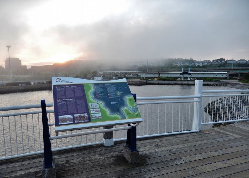
Defending the Harbour
À la défense du port
— Harbour Passage Trail —
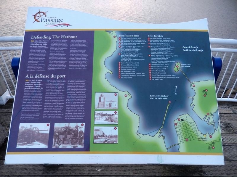
Saint John Harbour has long been strategically important. There are many sites in and around the harbour relating to its defense — from Fort Saint Marie, now known as Fort LaTour, a fortified fur-trading settlement built in 1631, through the fortifications on Partridge Island built in response to the War of 1812, to Fort Mispec, built in 1940. These and the many other sites illustrate defensive responses to changing offensive naval technology and were collectively designated a Millennium Provincial Historic Site in 2000.
From the mid 1600s, to protect their interests, the French built and re-built a fort at the mouth of the harbour, renaming it each time. Their presence came to an end in 1755 when they blew up their latest fort, Fort Menagouche, fearing its capture by the British. In 1758, the British built their own fort, Fort Frederick, on its ruins. Later, in 1775, Fort Frederick was captured and burnt by an armed American sloop from Machias, Maine, which then withdrew, leaving the British to rebuild.
This pattern of feverish military construction during times of crisis, followed by deterioration during the ensuing peace, was typical for most military installations built to protect Saint John. For example, the threat of attack from the Americans after their Civil War led to the construction of the Red Head and Negro Point batteries. And, the threat of attack during both World Wars, when U-boats entered the Bay of Fundy, reaching Saint John, led to the extensive construction of more military works.
Today, the most extensive original military structures in Saint John are located on Partridge Island. Designated as both a National and Provincial Historic site, most of its gun battery foundations, some two dozen structures, are still intact.
Another military installation, visible from this location, is the Carleton Martello Tower, seen through this viewing tube. The base of the tower is part of the original structure built by the British in response to the War of 1812. It provided a commanding view and control of the land and sea approaches to the harbour. The tower was adapted for use in the Second World War as a fire command post for Saint John, when the concrete superstructure was added. The tower is now restored as a National Historic Site with interpretive exhibits.
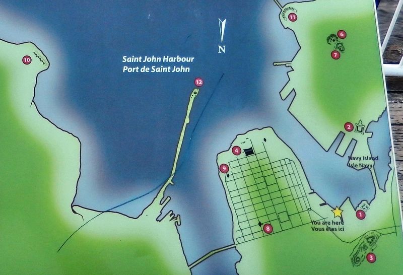
Fortification Sites
1 • Fort Saint Marie /Fort LaTour (1631)
2 • Fort D'Aulnay (1648); Fort Villebon (1698); Fort Menagouche (1750); Fort Frederick (1758)
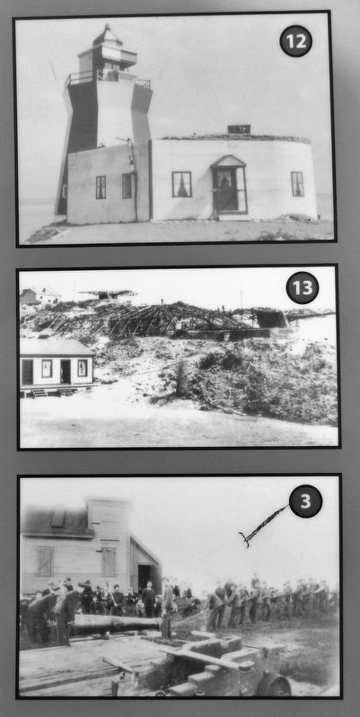
3 • Fort Howe (Western Battery, Signal Station, Eastern Blockhouse) (1778)
4 • Lower Cove Military Works (Lower Cove Battery, Prince Edward Battery, Grave Yard Battery, Mortar Battery, Dorchester Blockhouse) (1793); Barrack Green Armoury (1911)
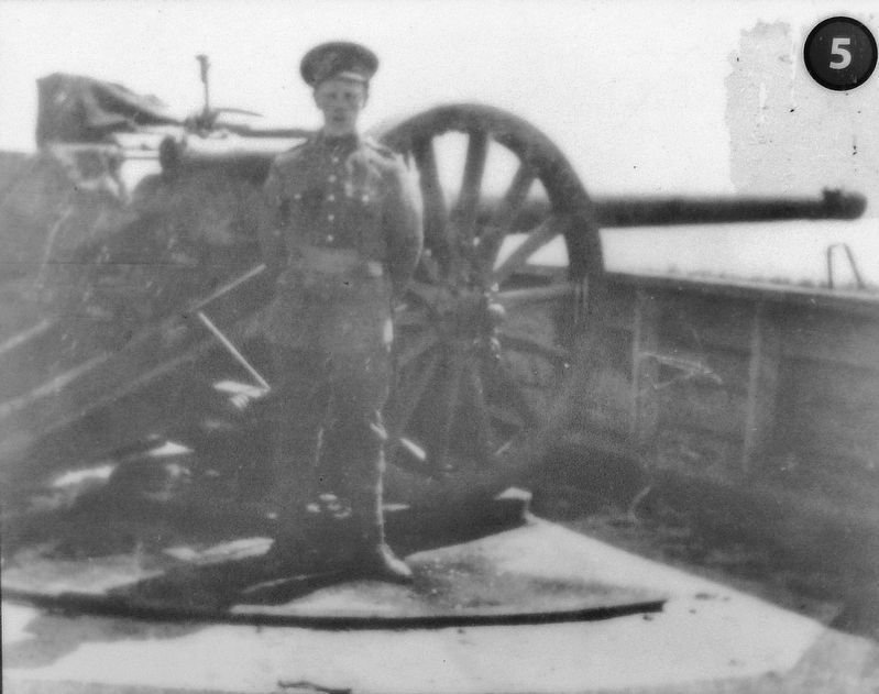
5 • Partridge Island Signal Battery (1800);
Royal Artillery Battery (1813);
Western Graveyard and Eastern Battery
(World War One);
Examination Battery and Channel Battery
(World War Two)
6 • Carleton Martello Tower (1812)
7 • Drummond Blockhouse (1812)
8 • Johnson Blockhouse (1813)
9 • Southeast Battery (1813)
10 • Red Head Battery (1863)
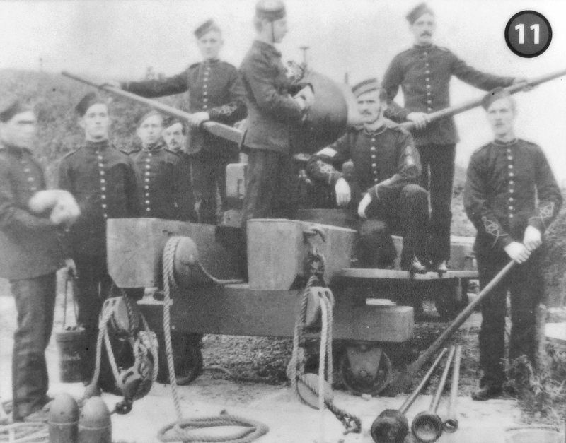
11 • Negro Point Battery/Fort Dufferin (1863)
12 • Courtenay Bay Breakwater Battery (1939)
13 • Fort Mispec (1940)
Le port de Saint John a depuis longtemps une importance stratégique. Dans le port et ses environs, de nombreux sites témoignent des efforts déployés pour le défendre : du fort Sainte-Marie, établissement fortifié bâti en 1631 pour la traite des fourrures et maintenant connu sous le nom de fort LaTour, jusqu’aux fortifications de l'île Partridge, érigées dans le contexte de la guerre de 1812, en passant par le fort Mispec, construit en 1940. Ces sites et de nombreux autres illustrent les réponses défensives à la technologie évolutive en matière d'attaque navale. En 2000, ils ont été collectivement désignés «Lieu historique provincial du millénaire».
À partir du milieu des années 1600, les Français, pour protéger leurs intérêts, ont bâti et rebâti un fort à l'embouchure du port, le renommant chaque fois. Leur présence prend fin en 1755, lorsqu'ils font exploser leur dernier ouvrage, le fort Menagouche, craignant que les Britanniques s'en emparent. En 1758, ces derniers érigent leur propre structure, le fort Frederick, sur ses ruines. Plus tard, en 1775, le fort Frederick est pris et brûlé par un sloop armé américain venu de Machias (Maine). Après le départ des Américains, les Britanniques le reconstruisent.
Cette succession d'élans effrénés de construction militaire en temps de crise, suivis par des périodes de détérioration en temps de paix, est typique de l'évolution de la plupart des installations militaires destinées à protéger Saint John. Par exemple, la menace d'une attaque américaine après la guerre de Sécession conduit à la construction des batteries de Red Head et de Negro Point. Au cours des deux Guerres mondiales, c'est la menace d'une attaque des U-boots — après tout, ils ont pénétré dans la baie de Fundy et atteint Saint John — qui motive l'érection d'un nombre important d'ouvrages militaires.
Aujourd'hui, les structures militaires originales les plus imposantes de Saint John se trouvent dans l'île Partridge. Désigné lieu historique national et provincial, la majeure partie des fondations de sa batterie d'artillerie, quelque vingtquatre structures, sont encore intactes.
Une autre installation militaire, visible de cet endroit grâce à ces jumelles, est la tour martello de Carleton. Sa base faisait partie de la structure originale bâtie par les Britanniques en réaction à la guerre de 1812. De la tour, on peut observer, et donc contrôler, les voies d'accès terrestres et maritimes au port. Elle est adaptée pendant la Deuxième Guerre mondiale pour servir de poste de commandement de tir pour la défense de Saint John, avec l'ajout de la superstructure en béton. À présent restaurée, elle est devenue lieu historique national du Canada Tour-Martello-de-Carleton et offre des expositions interprétatives.
Sites fortifiés
1 • Fort Sainte-Marie/fort LaTour (1631)
2 • Fort D'Aulnay (1648); fort Villebon (1698);
fort Menagouche (1750); fort Frederick (1758)
3 • Fort Howe (batterie Ouest, poste de transmission, blockhaus Est) (1778)
4 • Ouvrages militaires de Lower Cove
(batterie Lower Cove, batterie Prince Edward,
batterie Grave Yard//batterie du cimetière,
batterie de mortier//batterie Mortar,
blockhaus
Dorchester) (1793);
dépôt de munitions Barrack Green (1911)
5 • Batterie de transmission de l'île Partridge (1800);
batterie du Royal Artillery (1813);
cimetière Ouest et batterie Est
(Première Guerre mondiale);
batterie d'observation et batterie du chenal
(Deuxième Guerre mondiale)
6 • Tour Martello Carleton (1812)
7 • Blockhaus Drummond (1812)
8 • Blockhaus Johnson (1813)
9 • Batterie Sud-Est (1813)
10 • Batterie Red Head (1863)
11 • Batterie Negro Point/fort Dufferin (1863)
12 • Batterie du brise-mer de la baie Courtenay (1939)
13 • Fort Mispec (1940)
Topics. This historical marker is listed in these topic lists: Forts and Castles • Waterways & Vessels. A significant historical year for this entry is 1631.
Location. 45° 16.424′ N, 66° 4.017′ W. Marker is in Saint John, New Brunswick, in Saint John County. Marker is on Union Street just west of Smythe Street when traveling west. Marker is located along the Harbour Passage Trail, at the west end of Union Street. Touch for map. Marker is in this post office area: Saint John NB E2L 5A7, Canada. Touch for directions.
Other nearby markers. At least 8 other markers are within walking distance of this marker. Saint John Harbour Defensive Network (here, next to this marker); Electrifying the Uptown (within shouting distance of this marker); Dock Street Generating Station (about 120 meters away, measured in a direct line); Saint John – The Working Port (about 120 meters away); Partridge Island (about 150 meters away); Canada’s Original City (about 180 meters away); Oland Family Breweries (approx. 0.3 kilometers away); The Landing of the Loyalists (approx. 0.3 kilometers away). Touch for a list and map of all markers in Saint John.
Related markers. Click here for a list of markers that are related to this marker. Saint John Harbour Defenses
Also see . . . Saint John Harbour Defenses. (Submitted on February 22, 2020, by Cosmos Mariner of Cape Canaveral, Florida.)
Credits. This page was last revised on November 3, 2022. It was originally submitted on February 18, 2020, by Cosmos Mariner of Cape Canaveral, Florida. This page has been viewed 114 times since then and 8 times this year. Photos: 1, 2, 3, 4, 5, 6. submitted on February 21, 2020, by Cosmos Mariner of Cape Canaveral, Florida.
