
Prestonburg in Floyd County, Kentucky — The American South (East South Central)
Ferguson Town Branch Ferry and Dock

Photographed by J. J. Prats, October 19, 2019
1. Ferguson Town Branch Ferry and Dock Marker
Erected by Tour Southern and Eastern Kentucky .com.
Topics. This historical marker is listed in this topic list: Waterways & Vessels.
Location. 37° 39.88′ N, 82° 46.416′ W. Marker is in Prestonburg, Kentucky, in Floyd County. It is at the intersection of South Front Avenue (County Route 3384) and West Graham Street, on the right when traveling south on South Front Avenue. It is at the northern end of the bridge over the Levisa Fork of the Big Sandy River. Touch for map. Marker is at or near this postal address: 255 W Graham St, Prestonsburg KY 41653, United States of America. Touch for directions.

Regionally, this marker is in Eastern Kentucky and in the Cumberland Plateau. It is also in the American South, specifically
this page online
Other nearby markers. At least 8 other markers are within walking distance of this marker: Early Commerce (about 700 feet away, measured in a direct line); Prestonsburg Toll Bridge / Chesapeake & Ohio Railway System (approx. 0.2 miles away); John Graham (approx. 0.2 miles away); Civil War Event (approx. 0.2 miles away); Floyd County Veterans Memorial (approx. ¼ mile away); Greenville R. Davidson (approx. ¼ mile away); County Named, 1799 (approx. ¼ mile away); The Burns House / A Brief History of the Garfield Place (approx. 0.4 miles away). Touch for a list and map of all markers in Prestonburg.

Photographed by J. J. Prats, October 19, 2019
2. Ferguson Town Branch Ferry and Dock Marker
It is at the north end of the Woodrow Burchett Memorial Bridge over the Levisa Fork.
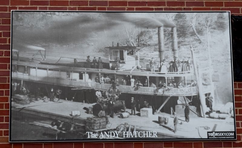
Photographed by J. J. Prats, October 19, 2019
3. The Andy Hatcher
This mural-sized photograph is posted on the side of 128 S Front Ave. three blocks north.
Credits. This page was last revised on March 29, 2021. It was originally submitted on March 2, 2020, by J. J. Prats of Powell, Ohio. This page has been viewed 523 times since then and 49 times this year. Photos: 1, 2, 3. submitted on March 2, 2020, by J. J. Prats of Powell, Ohio.
