Hyattsville in Prince George's County, Maryland — The American Northeast (Mid-Atlantic)
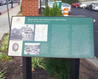
Route One, Our Hometown Main Street
City of Hyattsville
In March 1845, Christopher Clarke Hyatt purchased his first parcel in the same area. The presence of the railroad and telegraph made the location ideal for settlement, and the surrounding farmland began to be sub-divided into housing lots. By 1859, the area had officially become known as Hyattsville by the U. S. Post Office and cartographers, and in 1886, the City of Hyattsville was incorporated.
The city grew quickly as both a year round community and as a summer residence for Washingtonians beleagured by the city's hot, humid weather. During the mid- 20th century, Hyattsville was the center of commercial and political activities in Prince George's County. In 2004, a large portion of the city was placed on the National Register of Historic Places, doubling the number of properties within the original district established in 1982.
Today, Hyattsville is a thriving suburb, enjoying the advantages of a small town. Homes cover the spectrum from Victorian Mansions to bungalows, contemporary town homes to modern houses and apartments. Just as the housing stock is diverse, so too are the backgrounds and interests of the active citizenry. Many projects are underway focusing on education, art, the environment, historic preservation and revitalization along Route One, our main street. For example, Franklin's original building once served Hyattsville as a fire house, a hardware store and now as a restaurant. The Gateway Arts District, designated in 2002, includes sites all along our Main Street, Two nearby Metro Stations on the Green Line expand our opportunities and our boundaries and continue our transportation traditions. Visit and Enjoy our Renaissance.
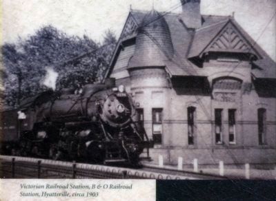
Photo caption 1
Victorian Railroad Station, B & O Railroad Station, Hyattsville, circa 1905
Photo caption 2
Map of Hyattsville, 1972, by E. R. McKean
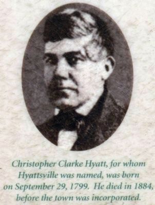
Photo caption 3
Christopher Clarke Hyatt, for whom Hyattsville was named, was born on September 19, 1799. He died in 1884 before the town was incorporated.
Photo caption 4
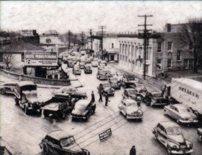
Downtown Hyattsville after Hurricane Connie ripped through the area in 1955. Connie's torrential rain saturated the Northeastern U. S., setting it up for massive flooding when, just five days later, Hurricane Diane spun up the East Coast and drenched the mid-Atlantic and the Northeast. In 1955, the names Connie and Diane were retired from the National Hurricane Center's list of names due to the large amount of damage caused by the storms.
Erected 2008 by Anacostia Trails Heritage Area.
Topics. This historical marker is listed in these topic lists: Disasters • Notable Places • Political Subdivisions • Railroads & Streetcars • Roads & Vehicles. A significant historical month for this entry is March 1845.
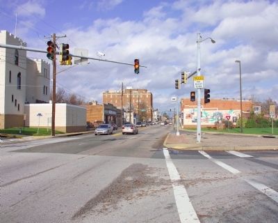
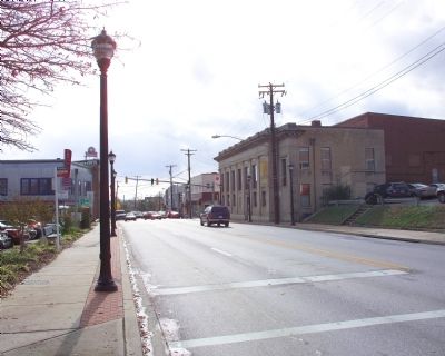
Location. 38° 57.163′ N, 76° 56.426′ W. Marker is in Hyattsville, Maryland, in Prince George's County. Marker is at the intersection of Baltimore Avenue (U.S. 1) and Gallatin Street, on the right when traveling north on Baltimore Avenue. Touch for map. Marker is in this post office area: Hyattsville MD 20781, United States of America. Touch for directions.
Other nearby markers. At least 8 other markers are within walking distance of this marker. The City of Hyattsville (within shouting distance of this marker); The Hyattsville National Historic District (approx. 0.2 miles away); Adam F. Plummer (approx. 0.4 miles away); Rhode Island Ave Trolley Trail (approx. half a mile away); Suffrage Motorcade (approx. 0.6 miles away); Riversdale (approx. 0.6 miles away); The Harry Smith House (approx. 0.6 miles away); This Demiculverin (approx. 0.7 miles away). Touch for a list and map of all markers in Hyattsville.
Also see . . .
1. Impossible Challenge: The Baltimore and Ohio (B&O) Railroad in Maryland. (Submitted on November 17, 2008, by Tom Fuchs of Greenbelt, Maryland.)
2. Impossible Challenge II: Baltimore to Washington and Harpers Ferry from 1828 to 1994. (Submitted on November 17, 2008, by Tom Fuchs of Greenbelt, Maryland.)
3. Royal Blue Line. (Submitted on November 17, 2008, by Tom Fuchs of Greenbelt, Maryland.)
4. Royal Blue Line: The Classic B & O Train Between Washington and New York. (Submitted on November 17, 2008, by Tom Fuchs of Greenbelt, Maryland.)
5. Otto Mears Goes East: The Chesapeake Beach Railway, 3rd Edition. (Submitted on November 17, 2008, by Tom Fuchs of Greenbelt, Maryland.)
Photographed By Allen C. Browne, August 25, 2013
9. Downtown Hyattsville, 1955
Downtown Hyattsville after Hurricane Connie ripped through the area in 1955. Connie's torrential rail saturated the Northeastern U.S., setting it up for massive flooding when, just five days later, Hurricane Diane spun up the East Coast and drenched the mid-Atlantic and the Norteast. In 1955, the names Connie and Diane were retired from the National Hurricane Center's list of name due to the large amount of damage caused by the storms.Close-up of photo on marker
Credits. This page was last revised on June 16, 2016. It was originally submitted on November 17, 2008, by Tom Fuchs of Greenbelt, Maryland. This page has been viewed 1,530 times since then and 27 times this year. Last updated on December 22, 2008, by Richard E. Miller of Oxon Hill, Maryland. Photos: 1, 2, 3, 4, 5, 6. submitted on November 17, 2008, by Tom Fuchs of Greenbelt, Maryland. 7, 8, 9. submitted on December 15, 2013, by Allen C. Browne of Silver Spring, Maryland. • Kevin W. was the editor who published this page.
