Near Eva in Benton County, Tennessee — The American South (East South Central)
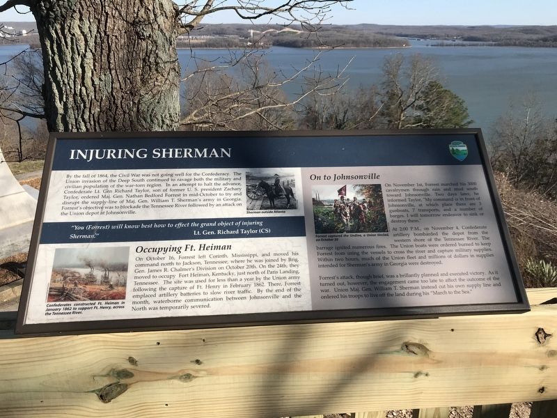
Injuring Sherman
"You (Forrest) will know best how to effect the grand object of injuring Sherman."
Lt. Gen. Richard Taylor (CS)
Occupying Ft. Heiman
On October 16, Forrest left Corinth, Mississippi, and moved his command north to Jackson, Tennessee, where he was joined by Brig. Gen. James R. Chalmer's Division on October 20th. On the 24th, they moved to occupy Fort Heiman, Kentucky, just north of Paris Landing, Tennessee. The site was used for less than a year by the Union army following the capture of Ft. Henry in February 1862. There, Forrest emplaced artillery batteries to slow river traffic. By the end of the month, waterborne communication between Johnsonville and the North was temporarily severed.
On to Johnsonville
On November 1st, Forrest marched his 3000 cavalrymen through rain and mud south toward Johnsonville. Two days later, he informed Taylor, "My command is in front of Johnsonville, at which place there are 3 gunboats, 7 transports, and a number of barges. I will tomorrow endeavor to sink or destroy them."
At 2:00 P.M., on November 4, Confederate artillery bombarded the depot from the western shore of the Tennessee River. The barrage ignited numerous fires. The Union boats were ordered burned to keep Forrest from using the vessels to cross the river and capture military supplies. Within two hours, much of the Union fleet and millions of dollars in supplies intended for Sherman's army in Georgia were destroyed.
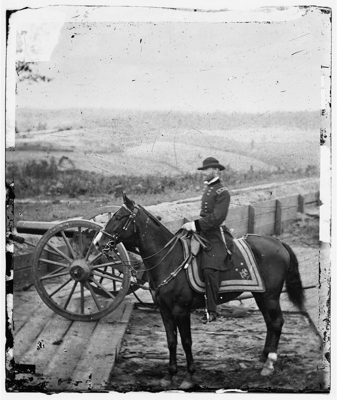
Forrest's attack, though brief, was a brilliantly planned and executed victory. As it turned out, however, the engagement came too late to affect the outcome of the war. Union Maj. Gen. William T. Sherman instead cut his own supply line and ordered his troops to live off the land during his "March to the Sea."
Erected by Tennessee State Parks.
Topics and series. This historical marker is listed in these topic lists: Forts and Castles • War, US Civil. In addition, it is included in the Former U.S. Presidents: #12 Zachary Taylor series list. A significant historical year for this entry is 1864.
Location.
36° 5.311′ N, 87° 58.445′ W. Marker is near Eva, Tennessee, in Benton County. Marker can be reached from Pilot Knob Road (Tennessee Route 191) 0.2 miles east of Cherry Ridge Road. Located at Tennessee River Folklife Museum within Nathan Bedford Forrest State Park. Touch for map. Marker is at or near this postal address: 2898 Pilot Knob Road, Eva TN 38333, United States of America. Touch for directions.
Other nearby markers. At least 8 other markers are within 2 miles of this marker, measured as the crow flies. Nathan Bedford Forrest Monument (here, next to this marker); Forrest's Artillery (here, next to this marker); Battle of Johnsonville (within shouting distance of this marker); Cabin Logs (approx. ¼ mile away); Artillery at Johnsonville (approx. 1.8 miles away); The Tennessee River in the Civil War (approx. 1.8 miles away); The Union Supply Depot (approx. 1.8 miles away); The Horse Corral (approx. 1.8 miles away). Touch for a list and map of all markers in Eva.
Credits. This page was last revised on June 28, 2022. It was originally submitted on March 9, 2020, by Duane and Tracy Marsteller of Murfreesboro, Tennessee. This page has been viewed 237 times since then and 25 times this year. Photos: 1. submitted on March 9, 2020, by Duane and Tracy Marsteller of Murfreesboro, Tennessee. 2. submitted on March 10, 2020, by Bernard Fisher of Richmond, Virginia. • Bernard Fisher was the editor who published this page.
Editor’s want-list for this marker. Wide shot of marker and its surroundings. • Can you help?

