Civic Center in Manhattan in New York County, New York — The American Northeast (Mid-Atlantic)
“The Tombs” – A Mausoleum for the Living
New York Landmarks Preservation
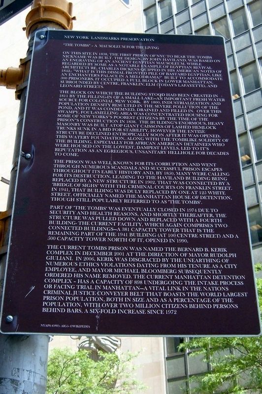
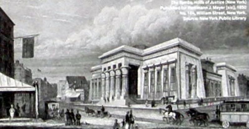
On this site in 1838, the first prison of NYC to bear The Tombs nickname was built. The design, by John Haviland, was based on an engraving of an ancient Egyptian mausoleum. While regarded by some as a notable example of Egyptian Revival architecture, Charles Dickens quipped in his American Notes of 1842: “What is this dismal fronted pile of bastard Egyptian, like an enchanter’s palace in a melodrama?” Built to accommodate 300 prisoners, it occupied a full block in Lower Manhattan, surrounded by Centre, Franklin, Elm (today’s Lafayette), and Leonard Streets.
The block on which the building stood had been created in 1811 by the filling-in of a small lake – an important fresh water source for colonial New York. By 1800, industrialization and population density resulted in the severe pollution of the pond, and it was condemned, drained and filled in. Over this swampy, foul-smelling area was concentrated housing for some of New York”s (sic) poorest citizens by the time of the prison’s construction in 1838. The building’s enormous, heavy masonry was built atop giant caissons of lashed hemlock trunks sunk in a bid for stability, however the entire structure declined entropically soon after it was opened. This watery foundation,(sic) along with the tomblike solidity of this building, especially for African American detainees who were housed on the lowest, dampest levels, led to it’s (sic) reputation as an egregious, unsanitary hellhole for decades to come.
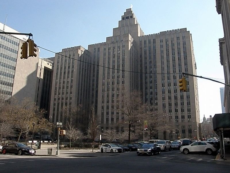
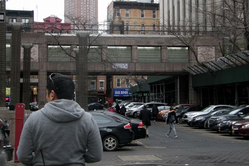
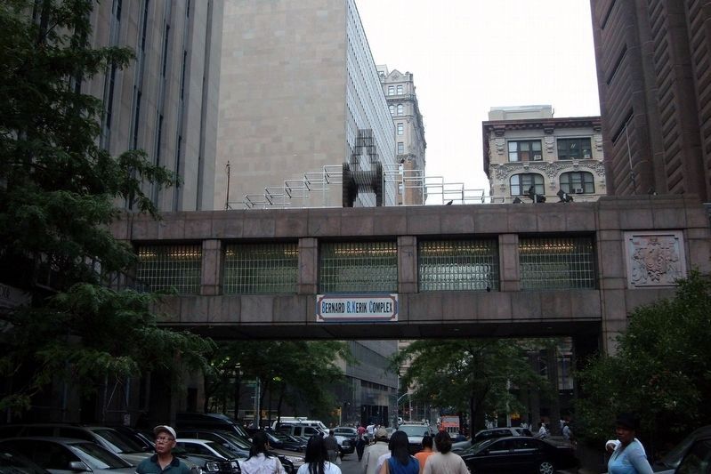
The prison was well known for its corruption and went through numerous scandals and successful prison escapes throughout its early history and, by 1850, many were calling for its destruction, leading to the Haviland building being replaced by a new structure in 1902,(sic) that was connected by a “Bridge of Sighs” with the Criminal Courts on Franklin Street. In 1941, that building was duly replaced by one at 125 White Street, officially named the Manhattan House of Detention, though still popularly referred to as “The Tombs”.
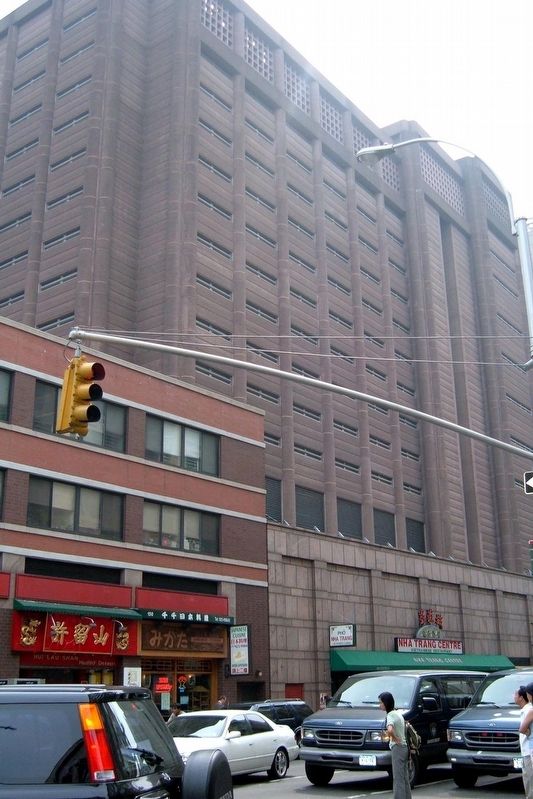
Part of “The Tombs” was eventually closed in 1974 due to security and health reasons, and shortly thereafter, the structure was pulled down and replaced with a fourth building – the current facility, which again comprises two connected buildings – a 381 capacity tower that is the remaining part of the 1941 building (at 100 Centre Street) and 500 capacity tower north of it, opened in 1990.
The current Tombs Prison was named the Bernard B. Kerik Complex in December 2001 at the direction of Mayor Rudolph Giuliani. In 2006, Kerik was disgraced by the unearthing of numerous ethics violations dating from his tenure as a city employee, and
Mayor Michael Bloomberg subsequently ordered his name removed. The current Manhattan Detention Complex –(sic) has a capacity of 898 undergoing the intake process or facing trial in Manhattan – a vital link in the nations (sic) criminal justice conveyor belt that boasts the world (sic) largest prison population, both in size and as a percentage of the population, with over two million citizens behind persons behind bars (sic), a six-fold increase since 1972
Topics. This historical marker is listed in these topic lists: Architecture • Law Enforcement. A significant historical month for this entry is December 2001.
Location. Marker has been reported missing. It was located near 40° 42.972′ N, 74° 0.085′ W. Marker was in Manhattan, New York, in New York County. It was in Civic Center. Marker could be reached from Centre Street, on the left when traveling north. Touch for map. Marker was at or near this postal address: across from 100 Centre Street, New York NY 10013, United States of America. Touch for directions.
Other nearby markers. At least 8 other markers are within walking distance of this location. From Collect Pond To Park (within shouting distance of this marker); The Legendary Collect Pond (within shouting distance of this marker); Death of the Collect Pond (within shouting distance of this marker); Collect Pond and the City (within shouting distance of this marker); Collect Pond Before The City (within shouting distance of this marker); 孫中山先生 [Mr. Sun Yat-sen] (about 400 feet away, measured in a direct line); Dr. Sun Yat-sen (about 400 feet away); Engine Company 31 (about 400 feet away). Touch for a list and map of all markers in Manhattan.
More about this marker. There’s something fishy about this marker - the errors of grammar, form, and punctuation; the overall negative tone; and the accreditation that should read “New York Landmarks Preservation Foundation - all of which would suggest that this is less-than-official signage.
Its removal (noticed 04/04/2019) might support this view.
Regarding “The Tombs” – A Mausoleum for the Living. Both buildings are listed in the "AIA (American Institute of Architects) Guide to New York City, Fifth Edition".
Also see . . . The Lost City Prison - "The Tombs", 101 Centre Street. Daytonian in Manhattan entry (Submitted on September 27, 2021, by Larry Gertner of New York, New York.)
Credits. This page was last revised on January 31, 2023. It was originally submitted on March 10, 2019, by Larry Gertner of New York, New York. This page has been viewed 985 times since then and 126 times this year. Last updated on March 11, 2020, by Larry Gertner of New York, New York. Photos: 1, 2, 3, 4, 5, 6. submitted on March 10, 2019, by Larry Gertner of New York, New York. • Michael Herrick was the editor who published this page.
