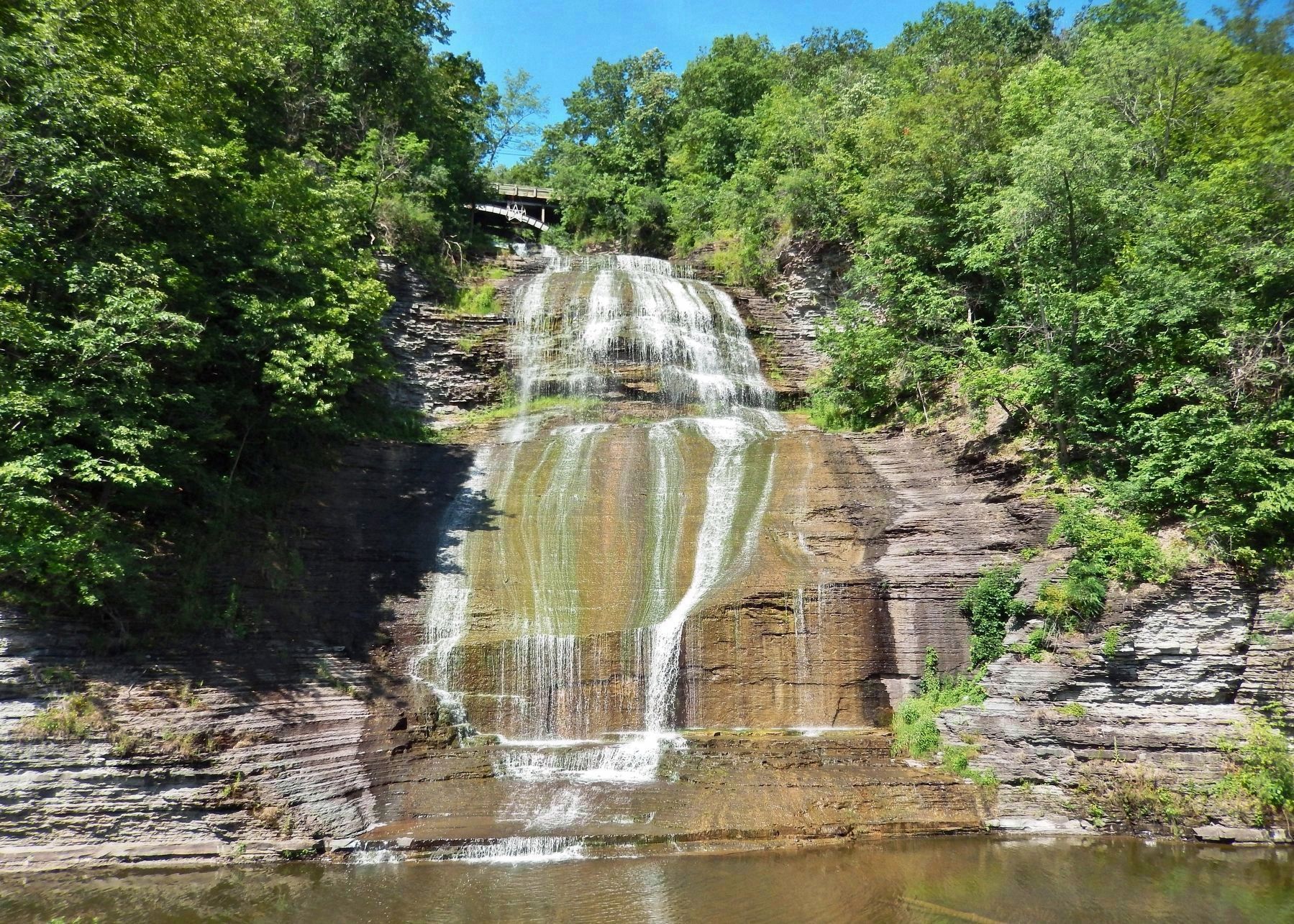
Montour Falls in Schuyler County, New York — The American Northeast (Mid-Atlantic)
Montour Falls
...the valley of tumbling waters, where a waterfall cascades 156 feet into the heart of an historic village...
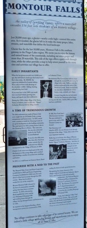
Just 20,000 years ago, a glacier — nearly a mile high — covered this entire area. As it receded, the glacier left in its wake the many gorges, lakes, streams, and waterfalls that define the local landscape.
Glacier free for the last 10,000 years, Montour Falls is the southern gateway to the Finger Lakes region. We invite you to enjoy the history and natural beauty of the countryside, including our seven gorges and more than 20 waterfalls. This side of the sign offers a quick walk through time, while the other provides a map to help orient yourself to the many sites and activities our village has to offer.
Early Inhabitants
When the last glaciers receded over 10,000 years ago, they left behind a landscape that looked much like it does today. By 2500 BC the region was inhabited by Lamoka Indians. These early residents took advantage of the abundant wildlife — fishing, hunting, and gathering their food.
If you were here in the 1300's you would have seen local Indians growing corn, beans, and squash near their settlements.
During the 1700's a large village of the Seneca Nation of Indians, stood on this site. "Queen" Catharine Montour led the village, known as Catharine's Town.
Revolutionary War General John Sullivan swept through the area in 1779, destroying the village in his wake. Sullivan drove the Indians northward to the safety of the British in Canada. Some returned after the war only to find little left of their homes, crops, orchards, and villages.
It wasn't long after the war had ended that the first American settlers began moving into the area. And by 1802 a post office had been established.
A Time of Tremendous Growth
The little settlement just south of Seneca Lake soon caught the eye of Charles Cook, a young entrepreneur and businessman. In 1829, armed with a contract to build the Chemung Canal, he set up his headquarters in the budding community. The canal opened in 1833, joining Seneca Lake to the Chemung River in Elmira. That same year, the area also welcomed tracks for the North Central Railroad.
It was less than fifty years after those first American settlers arrived, that the settlement was officially incorporated as the Village of Havana, in 1836.
Charles Cook went on to fund much of the early development of the young village and is credited with building a number of assorted civic buildings and homes.
In 1845, in a small house on Genesee Street, David B. Hill, New York State's 29th Governor was born. The area continued to grow in size, and in 1854 Schuyler County was formed.
The Chemung canal closed in 1878 — for over 40 years it ran through the heart of the village. Today, little is left of this once important waterway.
Reflecting on its history, the village of Havana changed its name to Montour in 1894 in honor of Indian "Queen" Catharine Montour. And then, in 1895, the name was changed one last time to its current moniker of Montour Falls.
Progress with a Nod to the Past
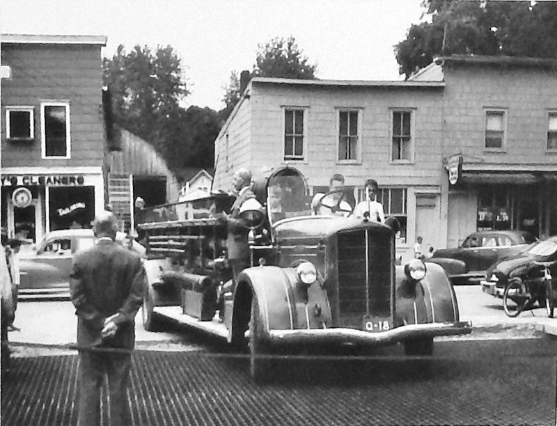
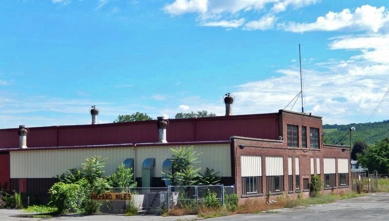
The Shepard-Niles Crane and Hoist Corporation (established in 1903) and Seneca Engineering Company (established in 1904) were the main drivers of the local economy through the 20th century. Many local residents worked for one of the companies.
Because Montour Falls is located at the base of a tremendous waterfall, spring rains have been a constant concern. In 1935 a devastating flood engulfed the town, roaring over Shequaga (Chequaga) falls and crashing down through the village, leaving damaged homes and businesses in its wake.
In response to the frequent flooding, a flood management system was constructed in 1940, ending the threat of wide spread destruction.
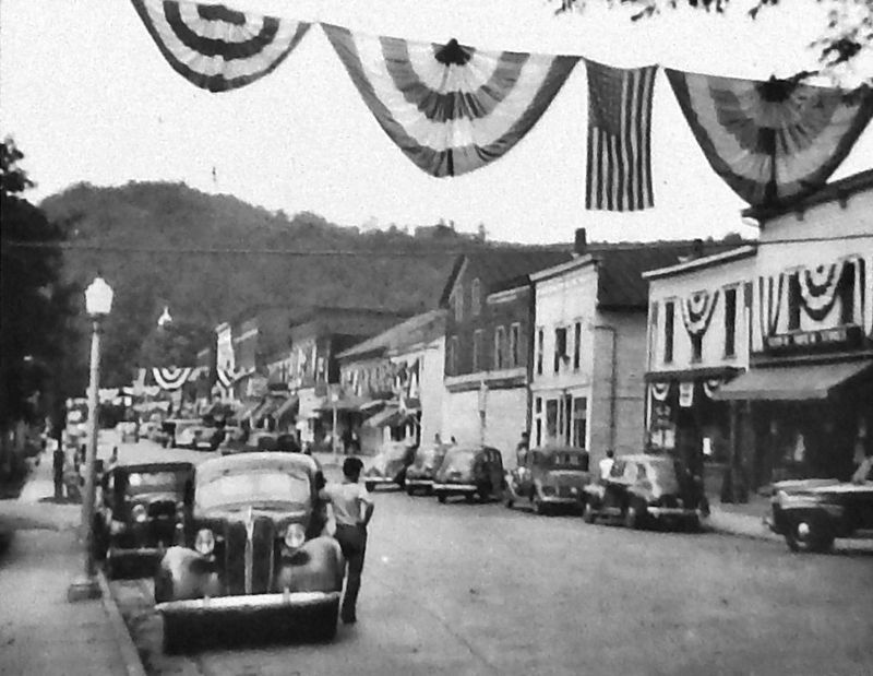
Recognizing the unique character of the village — with its Greek Revival, Italianate, Queen Anne, and Victorian residential and public architecture — the National Register of Historical Places designated the Glorious T an historic district
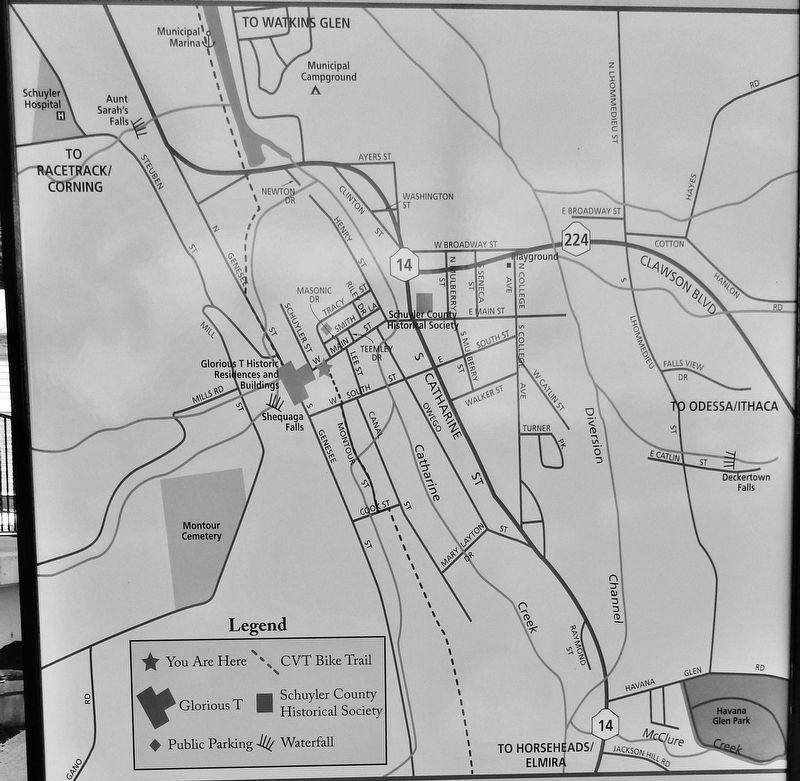
3. Marker detail: Montour Falls Map
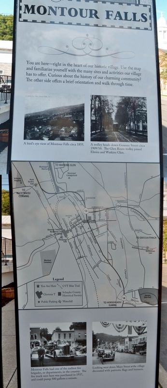
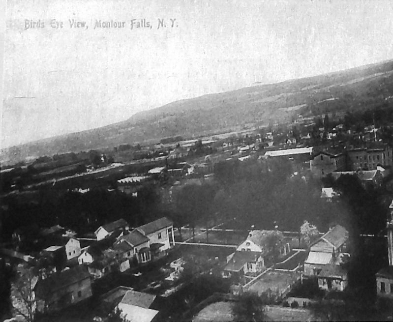
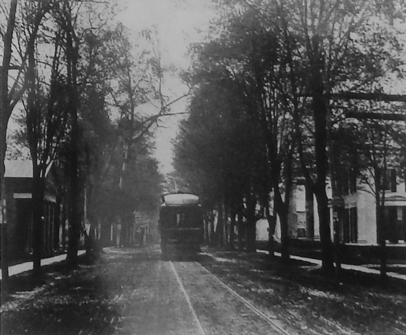
You are here — right in the heart of our historic village. Use the map and familiarize yourself with the many sites and activities our village has to offer. Curious about the history of our charming community? The other side offers a brief orientation and walk through time.
Today, the Catherine Valley Trail runs through the heart of town. The scenic path follows the old North Central Railroad bed and the former Chemung Canal towpath.
The village continues to take advantage of its natural beauty. We are indeed a little village with a big history and we welcome you to enjoy all we have to offer.
Topics. This historical marker is listed in these topic lists: Architecture • Native Americans • Settlements & Settlers • War, US Revolutionary.
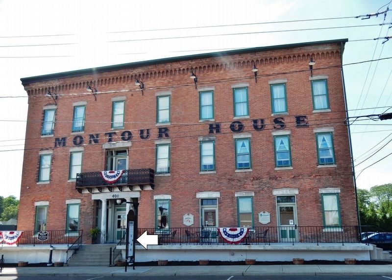
Location. 42° 20.744′ N, 76° 50.932′ W. Marker is in Montour Falls, New York, in Schuyler County. Marker is on West Main Street just west of Montour Street, on the left when traveling west. Marker is located along the sidewalk, directly in front of the Montour House building. Touch for map. Marker is at or near this postal address: 401 West Main Street, Montour Falls NY 14865, United States of America. Touch for directions.
Other nearby markers. At least 8 other markers are within walking distance of this marker. Montour House (here, next to this marker); Montour Falls Memorial Library (within shouting distance of this marker); She-Qua-Ga (about
400 feet away, measured in a direct line); David Bennett Hill (approx. 0.2 miles away); James A. Shepard (approx. 0.2 miles away); Catherine's Landing (approx. 0.2 miles away); Brick Tavern Stand (approx. ¼ mile away); Chemung Canal (approx. 0.4 miles away). Touch for a list and map of all markers in Montour Falls.
Regarding Montour Falls. Montour Falls Historic District, National Register of Historic Places #78001911
Also see . . .
1. Catherine Montour. Wikipedia entry:
Catherine Montour and her husband, a Seneca chief named Telenemut, also known as Thomas Hudson, lived in the Finger Lakes region at Queanettquaga, a Seneca town that became known as Catherine's Town. After the village was destroyed by rebel continental forces during the 1779 Sullivan Expedition in the American Revolutionary War, Montour relocated with other Seneca to Niagara. When Schuyler County in western New York was settled by European Americans following the revolution and United States independence, they named several places after Catharine Montour. (Submitted on March 13, 2020, by Cosmos Mariner of Cape Canaveral, Florida.)
2. Television series features Montour Falls scene. The Observer/Review Express website entry:
He's always liked the view down Main Street in Montour Falls toward Shequaga Falls. But when he saw it on the opening of a Hallmark mystery series on television, James Sgrecci said, "Nah, that can't be it." He saw it again, and thought the same thing. "By the time you think about it, it's already gone. It's only on for about eight seconds." The third time he saw it, he was sure. There was the village hall with its domed cupola, Quinlan's Pharmacy, the white pillared house in front of the falls. The Aurora Teagarden series, starring Candace Cameron Bure, is actually filmed in Vancouver, British Columbia. (Submitted on March 15, 2020, by Cosmos Mariner of Cape Canaveral, Florida.)
Credits. This page was last revised on September 12, 2023. It was originally submitted on March 12, 2020, by Cosmos Mariner of Cape Canaveral, Florida. This page has been viewed 951 times since then and 267 times this year. Photos: 1. submitted on March 12, 2020, by Cosmos Mariner of Cape Canaveral, Florida. 2, 3, 4, 5, 6, 7, 8, 9, 10. submitted on March 13, 2020, by Cosmos Mariner of Cape Canaveral, Florida.
