Near Lugert in Greer County, Oklahoma — The American South (West South Central)
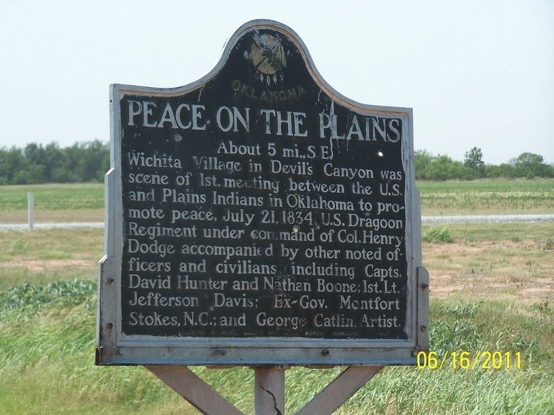
Peace on the Plains
About 5 mi., S.E.
Photographed by Jason Armstrong, June 16, 2011
1. Peace On The Plains Marker
Wichita Village in Devil's Canyon was scene of 1st. meeting between the U.S. and Plains Indians in Oklahoma to promote peace, July 21, 1834. U.S. Dragoon Regiment under command of Col. Henry Dodge accompanied by other noted officers and civilians including Capts. David Hunter and Nathan Boone; 1st. Lt. Jefferson Davis; Ex-Gov. Montfort Stokes, N.C.; and George Catlin, Artist.
Erected by Oklahoma Historical Society.
Topics and series. This historical marker is listed in these topic lists: Indigenous Peoples and Communities • Peace. In addition, it is included in the Oklahoma Historical Society series list. A significant historical date for this entry is July 21, 1834.
Location. 34° 51.392′ N, 99° 19.844′ W. Marker is near Lugert, Oklahoma, in Greer County. It is on U.S. 283, on the right when traveling south. Touch for map. Marker is in this post office area: Lone Wolf OK 73655, United States of America. Touch for directions.

Regionally, this marker is in Oklahoma’s Kiowa Tribe, in the Comanche Nation, and in Southwest Oklahoma. It is also in the American South, specifically on the prairies, and on the Southern
this page online
Other nearby markers. At least 8 other markers are within 10 miles of this marker, measured as the crow flies: Civilian Conservation Corps and Quartz Mountain State Park (approx. 3.1 miles away); Lugert, Oklahoma (approx. 3.2 miles away); Granite Community Memorial (approx. 7.9 miles away); The 36th Infantry Division's 132nd Machine Gun Battalion (approx. 7.9 miles away); Welcome to Comecos Cemetery (approx. 8.2 miles away); Dr. Fowler Border / John Andrew Jackson (approx. 10.1 miles away); George Washington Boyd / Louis Tittle (approx. 10.1 miles away); Pearlene (Davis) Weston / Myrtle Lee Hill Summers (approx. 10.1 miles away). Touch for a list and map of all markers in Lugert.
Credits. This page was last revised on March 14, 2020. It was originally submitted on March 13, 2020, by Jason Armstrong of Talihina, Oklahoma. This page has been viewed 570 times since then and 44 times this year. Photo 1. submitted on March 13, 2020, by Jason Armstrong of Talihina, Oklahoma. • J. Makali Bruton was the editor who published this page.
