Near Atoka in Fauquier County, Virginia — The American South (Mid-Atlantic)
Mosby’s Rangers

Photographed by Craig Swain, June 22, 2007
1. Mosby's Rangers Marker
Here at Atoka (Rector’s Crossroads) on June 10, 1863, Company “A”, 43rd Battalion of Partisan Rangers, known as “Mosby’s Rangers”, was formally organized. James William Foster was elected Captain; Thomas Turner, First Lieutenant; W. L. Hunter, Second Lieutenant; and G. H. Whitescarver, Third Lieutenant. Shortly after, Brawner’s Company of Prince William Cavalry joined the command.
Erected 1962 by Virginia State Library. (Marker Number B-25.)
Topics and series. This historical marker is listed in this topic list: War, US Civil. In addition, it is included in the Virginia Department of Historic Resources (DHR) series list. A significant historical month for this entry is June 1853.
Location. This marker has been replaced by another marker nearby. It was located near 38° 58.526′ N, 77° 48.382′ W. Marker was near Atoka, Virginia, in Fauquier County. It was at the intersection of John S. Mosby Highway (U.S. 50) and Atoka Road (County Route 713), on the left when traveling west on John S. Mosby Highway. Touch for map. Marker was in this post office area: Marshall VA 20115, United States of America. Touch for directions.

Regionally,
this page online
Other nearby markers. At least 8 other markers are within walking distance of this location: Welbourne (here, next to this marker); Rector’s Crossroads (about 400 feet away, measured in a direct line); Rector House (about 600 feet away); Organization of Mosby's Rangers (about 600 feet away); Civil War Cavalry Equipment (approx. 0.9 miles away); In Appreciation of the Fauquier and Loudoun Garden Club (approx. 0.9 miles away); Preserving The Battlefield (approx. 0.9 miles away); Attack At Goose Creek Bridge (approx. 0.9 miles away). Touch for a list and map of all markers in Atoka.
Another marker is no longer nearby. Rector House (was about 700 feet away
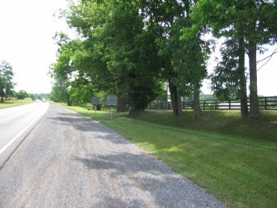
Photographed by Craig Swain, June 22, 2007
2. Two Markers near Atoka, Virginia
Also see . . . Mosby’s Rangers. Short history of the rangers from the Mosby Heritage Area Association. (Submitted on June 29, 2007, by Craig Swain of Leesburg, Virginia.)
Credits. This page was last revised on October 25, 2026. It was originally submitted on June 29, 2007, by Craig Swain of Leesburg, Virginia. This page has been viewed 3,768 times since then and 84 times this year. Photos: 1, 2. submitted on June 29, 2007, by Craig Swain of Leesburg, Virginia. • J. J. Prats was the editor who published this page.
