Safety Harbor in Pinellas County, Florida — The American South (South Atlantic)
Safety Harbor Historical Site: Lover's Oak
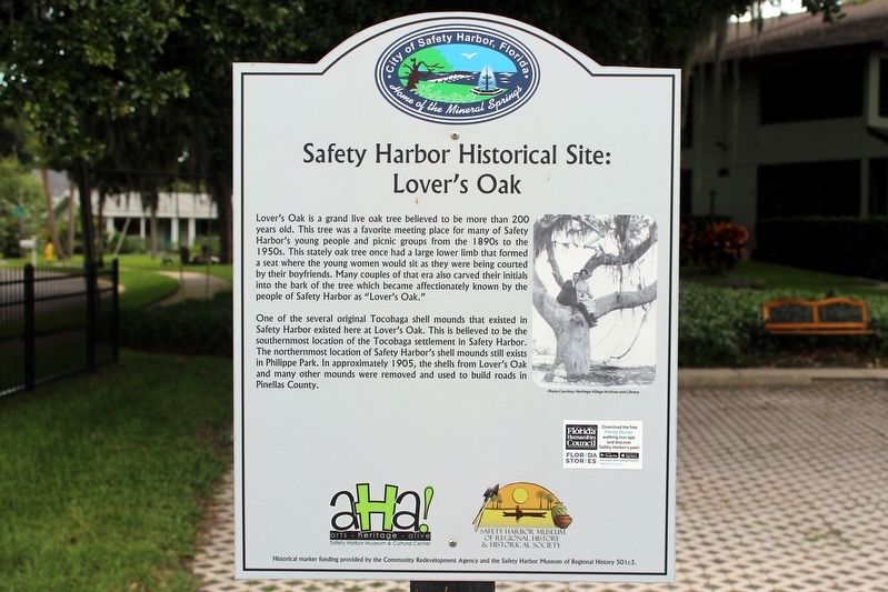
Photographed by Tim Fillmon, June 15, 2019
1. Safety Harbor Historical Site: Lover's Oak Marker
One of the several original Tocobaga shell mounds that existed in Safety Harbor existed here at Lover's Oak. This is believed to be the southernmost location of the Tocobaga settlement in Safety Harbor. The northernmost location of Safety Harbor's shell mounds still exists in Phillippe Park. In approximately 1905, the shells from Lover's Oak and many other mounds were removed and used to build roads in Pinellas County.
Erected by Safety Harbor Museum & Cultural Center and Safety Harbor Museum of Regional History & Historical Societ.
Topics. This historical marker is listed in these topic lists: Horticulture & Forestry
this page online
Location. 27° 59.257′ N, 82° 41.431′ W. Marker is in Safety Harbor, Florida, in Pinellas County. It is at the intersection of South Bayshore Boulevard and 5th Street South, on the right when traveling south on South Bayshore Boulevard. Marker is mounted along the fence with the Oak to the west. Touch for map. Marker is in this post office area: Safety Harbor FL 34695, United States of America. Touch for directions.

Regionally, this marker is on the Gulf Coast and on Tampa Bay. It is also in the American South and on the Gulf Coast. Globally, it is in the North Atlantic Region, North America, a Gulf of Mexico state, the Western Hemisphere, the Western World, and the Anglosphere. Historically, it finds itself in what was once New Spain, the territory of the Mississippian Culture, one of the Confederate States of America, and the Antebellum South.
Other nearby markers. At least 8 other markers are within walking distance of this marker: Safety Harbor Historical Site: Native American Burial Mound (about 500 feet away, measured in a

Photographed by Tim Fillmon, June 15, 2019
2. Safety Harbor Historical Site: Lover's Oak Marker with oak in the background
Credits. This page was last revised on March 23, 2020. It was originally submitted on March 21, 2020, by Tim Fillmon of Webster, Florida. This page has been viewed 894 times since then and 80 times this year. Photos: 1, 2. submitted on March 21, 2020, by Tim Fillmon of Webster, Florida. • Bernard Fisher was the editor who published this page.
