Canastota in Madison County, New York — The American Northeast (Mid-Atlantic)
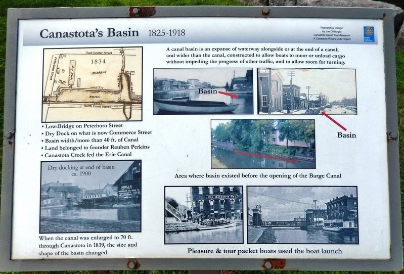
Canastota's Basin
1825-1918
Photographed by Cosmos Mariner, August 18, 2019
1. Canastota's Basin Marker
Canastota Canal Town Museum
A Canastota Rotary Club Project
Erected by Canastota Rotary Club.
Topics and series. This historical marker is listed in these topic lists: Industry & Commerce • Waterways & Vessels. In addition, it is included in the Rotary International series list. A significant historical year for this entry is 1825.
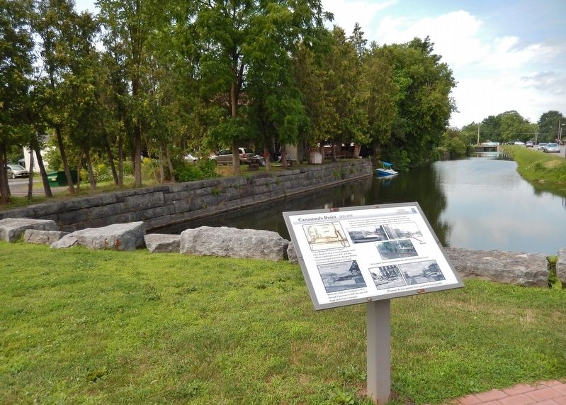
Location. 43° 4.763′ N, 75° 45.127′ W. Marker is in Canastota, New York, in Madison County. It is at the intersection of Canal Street (County Route 76) and Commerce Street, on the left when traveling west on Canal Street. Marker is located near the southwest corner of the intersection, overlooking a former section of the Erie Canal now known as Pools Brook. Touch for map. Marker is in this post office area: Canastota NY 13032, United States of America. Touch for directions.

Regionally, this marker is in Upstate New York,
this page online
Other nearby markers. At least 8 other markers are within walking distance of this marker: The Abolition Road (here, next to this marker); Enlarging the Erie Canal (here, next to this marker); George A. Wyman (a few steps from this marker); Canal Town (within shouting distance of this marker); Canal Street (within shouting distance of this marker); Canastota's Lift Bridge (within shouting distance of this marker); Peterboro Street Lift Bridge (within shouting distance of this marker); Reuben Perkins (within shouting distance of this marker). Touch for a list and map of all markers in Canastota.
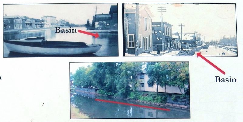
2. Marker detail: Area where basin existed before the opening of the Barge Canal
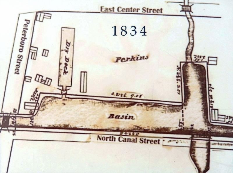
3. Marker detail: 1834 Map
• Low Bridge on Peterboro Street
• Dry Dock on what is now Commerce Street
• Basin width/more than 40 ft. of Canal
• Land belonged to founder Reuben Perkins
• Canastota Creek fed the Erie Canal
• Dry Dock on what is now Commerce Street
• Basin width/more than 40 ft. of Canal
• Land belonged to founder Reuben Perkins
• Canastota Creek fed the Erie Canal
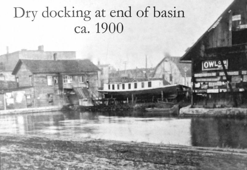
4. Marker detail: Dry docking at end of basin, ca. 1900
When the canal was enlarged to 70 ft. through Canastota in 1839, the size and shape of the basin changed.
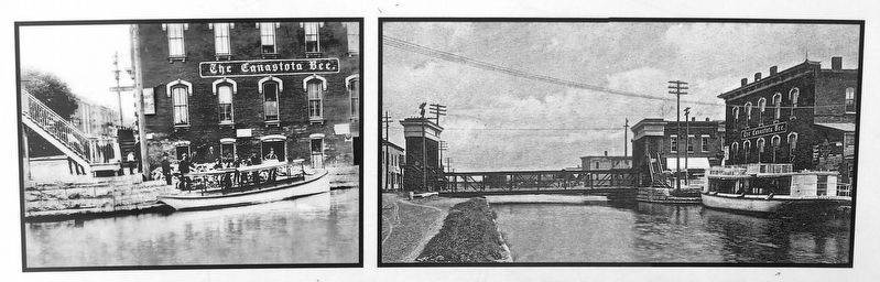
5. Marker detail: Pleasure & tour packet boats used the boat launch
Photographed by Cosmos Mariner, August 18, 2019
6. Canastota's Basin Marker
Credits. This page was last revised on March 23, 2020. It was originally submitted on March 21, 2020, by Cosmos Mariner of Cape Canaveral, Florida. This page has been viewed 355 times since then and 27 times this year. Photos: 1, 2, 3, 4, 5, 6. submitted on March 23, 2020, by Cosmos Mariner of Cape Canaveral, Florida.
