Puerta de Tierra in San Juan in Municipio de San Juan, Puerto Rico — The Caribbean (The West Indies)
First Line of Defense
Primera línea de defensa
Inscription.
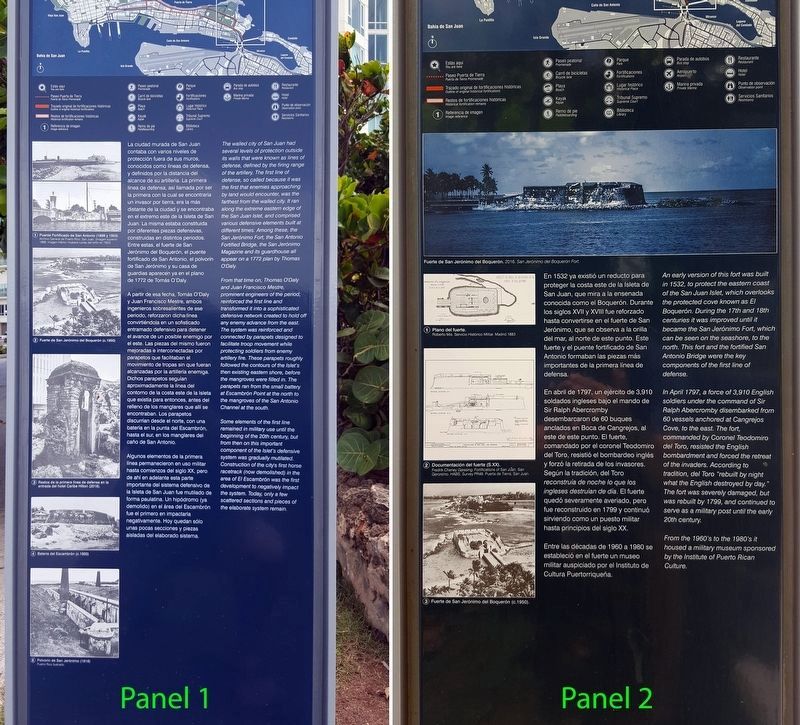
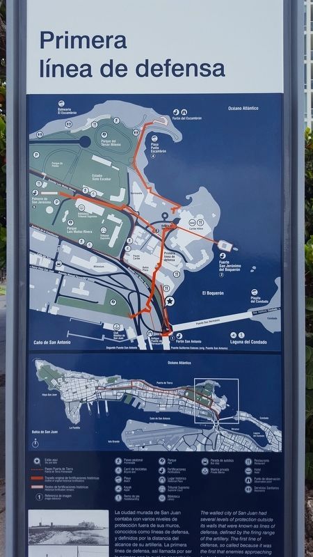
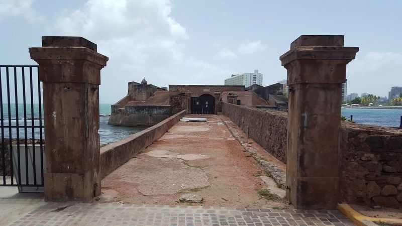
The walled city of San Juan had several levels of protection outside its wall that were known as lines of defense, defined by the firing range of the artillery. The first line of defense, so called because it was the first that enemies approaching by land would encounter, was the farthest from the walled city. It ran along the extreme eastern edge of the San Juan Islet, and compromised various defensive elements built at different times. Among these, the San Jerónimo Fort, the San Antonio Fortified Bridge, the San Jerónimo Magazine and its guardhouse all appear on a 1772 plan by Thomas O'Daly.
From that time on, Thomas O'Daly and Juan Francisco Mestre, prominent engineers of the period, reinforced the first line and transformed it into a sophisticated defensive network created to hold off any enemy advance from the east. The system was reinforced and connected by parapets designed to facilitate troop movement while protecting soldiers from enemy artillery fire. These parapets roughly followed the contours of the Islet's then existing eastern shore, before the mangroves were filled in. The parapets ran from the small battery at Escambrón Point at the north to the mangroves of the San Antonio Channel at the south.
Some elements of the first line remained in military use until the beginning of the 20th century, but from then on this important component of the Islet's defensive system was gradually mutilated. Construction of the city's first horse racetrack (now demolished) in the area of El Escambrón was the first development to negatively impact the system. Today, only a few scattered sections and pieces of the elaborate system remain.
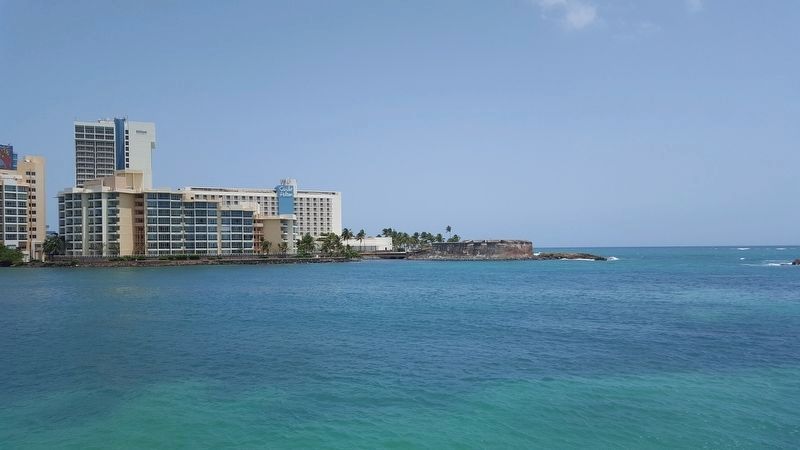
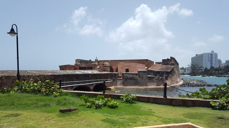
An early version of this fort was built in 1532, to protect the eastern coast of the San Juan Islet, which overlooks the protected cove known as El Boquerón. During the 17th and 18th centuries it was improved until it became the San Jerónimo Fort, which can be seen on the seashore, to the north. This fort and the fortified San Antonio Bridge were the key components of the first line of defense.
In April 1797, a force of 3,910 English soldiers under the command of Sir Ralph Abercromby disembarked from 60 vessels anchored at Cangrejos Cove, to the east. The fort, commanded by Coronel Teodomiro del Toro, resisted the English bombardment and forced the retreat of the invaders. According to tradition, del Toro “rebuilt by night what the English destroyed by day.” The fort was severely damaged,
but was rebuilt by 1799, and continued to serve as a military post until the early 20th century.
From the 1960's to the 1980's it housed a military museum sponsored by the Institute of Puerto Rican Culture.
La ciudad murada de San Juan contaba con varios niveles de protección fuera de sus muros, conocidos como líneas de defensa, y definidos por la distancia del alcance de su artilleria. La primera linea de defensa, así llamada por ser la primera con la cual se encontraria un invasor por tierra, era la más distante de la ciudad y se encontraba en el extremo este de la Isleta de San Juan. La misma estaba constituida por diferentes piezas defensivas, construidas en distintos periodos. Entre estas, el fuerte de San Jerónimo del Boquerón, el puente fortificado de San Antonio, el polvorin de San Jerónimo y su casa de guardias aparecen ya en el plano de 1772 de Tomas O'Daly A partir de esa fecha, Tomás O'Daly y Juan Francisco Mestre, ambos ingenieros sobresalientes de ese periodo, reforzaron dicha linea convirtiéndola en un sofisticado entramado defensivo para detener el avance de un posible enemigo por el este. Las piezas del mismo fueron mejoradas e interconectadas por parapetos que facilitaban el movimiento de tropas sin que fueran alcanzadas por la artillería enemiga. Dichos parapetos
seguían
aproximadamente la linea del
contorno de la costa este de la Isleta
que existía para entonces, antes del
relleno de los manglares que allí se
encontraban. Los parapetos
discurrían desde el norte, con una
batería en la punta del Escambrón,
hasta el sur, en los manglares del
cano de San Antonio
Algunos elementos de la primera
linea permanecieron en uso militar
hasta comienzos del siglo XX, pero
de ahí en adelante esta parte
importante del sistema defensivo de
la Isleta de San Juan fue mutilado de
forma paulatina. Un hipódromo (ya
demolido) en el área del Escambrón
fue el primero en impactarla
negativamente. Hoy quedan sólo
unas pocas secciones y piezas
aisladas del elaborado sistema.
Pie de fotos:
1. Puente Fortificado de San Antonio (1898 y 1953)
Archivo General de Puerto Rico, San Juan. (Imagen superior: 1898; imagen inferior muestra ruinas del fortín en 1953)
2. Fuerte de San Jerónimo del Boquerón (c. 1950)
3. Restos de la primera línea de defensa en al entrada del hotel Caribe Hilton (2016)
4. Batería del Escambrón (c. 1950)
5. Polvorín de San Jerónimo (1916)
Puerto Rico Ilustrado.
En 1532 ya existió un reducto para proteger la costa este de la Isleta de San Juan, que mira a la ensenada conocida como el Boquerón. Durante los siglos XVII y XVIII fue reforzado hasta convertirse en el fuerte
de San
Jerónimo, que se observa a la orilla
del mar, al norte de este punto. Este
fuerte y el puente fortificado de San
Antonio formaban las piezas más
importantes de la primera línea de
defensa
En abril de 1797, un ejército de 3,910
soldados ingleses bajo el mando de
Sir Ralph Abercromby
desembarcaron de 60 buques
anclados en Boca de Cangrejos, al
este de este punto. El fuerte,
comandado por el coronel Teodomiro
del Toro, resistió el bombardeo inglés
y forzó la retirada de los invasores.
Según la tradición, del Toro
reconstruía de noche lo que los
ingleses destruían de día. El fuerte
quedó severamente averiado, pero
fue reconstruido en 1799 y continuó
sirviendo como un puesto militar
hasta principios del siglo XX.
Entre las décadas de 1960 a 1980 se
estableció en el fuerte un museo
militar auspiciado por el Instituto de
Cultura Puertorriqueña.
Pie de fotos:
Fuerte de San Jerónimo del Boquerón. 2016. San Jerónimo del Boquerón Fort.
1. Plano del fuerte.
Roberto Mis. Servicio Histórico Militar. Madrid. 1883
2. Documentación del fuerte (S. XX).
Fredrik Cheney Gjessing. Fortifications of San Juan, San Gerónimo. HABS. Survey PR49. Puerta de Tierra, San Juan.
3. Fuerte de San Jerónimo del Boquerón (c. 1950).
Erected by Paseo Puerta de Tierra.
Topics. This historical marker is listed in these topic lists: Colonial Era • Forts and Castles. A significant historical year for this entry is 1772.
Location. 18° 27.649′ N, 66° 5.184′ W. Marker is in San Juan in Municipio de San Juan, Puerto Rico. It is in Puerta de Tierra. Marker is on PR-1 north of Asford Avenue, on the right when traveling north. Touch for map. Marker is in this post office area: San Juan PR 00907, United States of America. Touch for directions.
Other nearby markers. At least 8 other markers are within walking distance of this marker. Ataques a la Isleta (within shouting distance of this marker); Guillermo Esteves Bridge (about 400 feet away, measured in a direct line); Fort San Antonio (about 500 feet away); Capilla Nuestra Señora de Lourdes (approx. half a kilometer away); Polvorín de San Jerónimo (approx. 0.6 kilometers away); Memorial de Pulse (Pulse Memorial) (approx. 0.6 kilometers away); Palma real (approx. 0.9 kilometers away); Segunda línea de defensa (approx. 1.1 kilometers away). Touch for a list and map of all markers in San Juan.
More about this marker. This marker is one of a number of markers that may be visited as part of a cycling park through Paseo Puerta de Tierra.
Credits. This page was last revised on February 16, 2023. It was originally submitted on March 29, 2020, by Douglass Halvorsen of Klamath Falls, Oregon. This page has been viewed 195 times since then and 22 times this year. Photos: 1, 2, 3, 4, 5, 6. submitted on March 29, 2020, by Douglass Halvorsen of Klamath Falls, Oregon. • J. Makali Bruton was the editor who published this page.
