Near Ford City in Colbert County, Alabama — The American South (East South Central)
The Old Brick Presbyterian Church
1820

Photographed by Lugnuts, March 1, 2020
1. The Old Brick Presbyterian Church Marker
Erected 1995 by Alabama Historical Association.
Topics and series. This historical marker is listed in these topic lists: Cemeteries & Burial Sites • Religion & Religious Structures. In addition, it is included in the Alabama Historical Association series list. A significant historical year for this entry is 1820.
Location. 34° 46.246′ N, 87° 31.461′ W. Marker is near Ford City, Alabama, in Colbert County. It is on Mt. Pleasant Road (County Road 66) 0.3 miles east of County Line Road (County Road 48), on the right when traveling east. Located on the grounds of the Old Brick
this page online

Regionally, this marker is in North Alabama and in the Shoals. It is also in the American South, specifically in the Deep South, in Appalachia, and specifically in Southern Appalachia. Globally, it is in North America, a Gulf of Mexico state, the Western Hemisphere, the Western World, and the Anglosphere. Historically, it finds itself in what was once the territory of the Mississippian Culture, one of the Confederate States of America, and the Antebellum South.
Other nearby markers. At least 8 other markers are within 5 miles of this marker, measured as the crow flies: Clyde Carter House (approx. 1.4 miles away); Confederate Retreat at the Tennessee River (approx. 2.6 miles away); Bainbridge (approx. 3.4 miles away); The Shaw Home (approx. 4.3 miles away); Alabama's Historic Byler Road (approx. 4.7 miles away); History of Leighton (approx. 4.7 miles away); Frank R. King (1859-1939) (approx. 4.9 miles away); Leighton Training School (approx. 4.9 miles away).
Also see . . . History from the church website.

Photographed by Lugnuts, March 1, 2020
2. Old Brick Presbyterian Church
The marker can be seen near the church
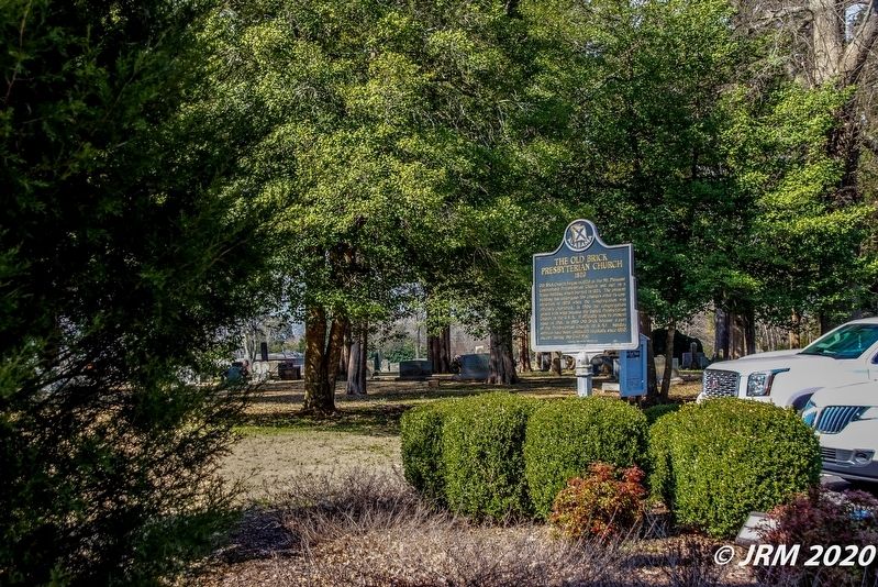
Photographed by Lugnuts, March 1, 2020
3. Old Brick Presbyterian Church Cemetery and Marker
The marker is located between the church and its cemetery.
Credits. This page was last revised on July 22, 2020. It was originally submitted on March 30, 2020, by Lugnuts of Germantown, Wisconsin. This page has been viewed 779 times since then and 70 times this year. Photos: 1, 2, 3. submitted on March 30, 2020, by Lugnuts of Germantown, Wisconsin. • Mark Hilton was the editor who published this page.
