Fort Ann in Washington County, New York — The American Northeast (Mid-Atlantic)
Lakes to Locks Passage
The Champlain Canal Region
— Fort Ann —
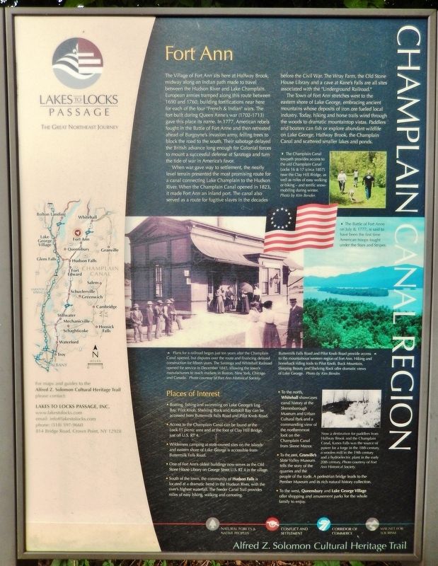
When war gave way to settlement, the nearly level terrain presented the most promising route for a canal connecting Lake Champlain to the Hudson River. When the Champlain Canal opened in 1823, it made Fort Ann an inland port. The canal also served as a route for fugitive slaves in the decades before the Civil War. The Wray Farm, the Old Stone House Library and a cave at Kane's Falls are all sites associated with the “Underground Railroad.”
The Town of Fort Ann stretches west to the eastern shore of Lake George, embracing ancient mountains whose deposits of iron ore fueled local industry. Today, hiking and horse trails wind through the woods to dramatic mountaintop vistas. Paddlers and boaters can fish or explore abundant wildlife on Lake George, Halfway Brook, the Champlain Canal and scattered smaller lakes and ponds.
Places of Interest
• Boating, fishing and swimming on Lake George's Log Bay, Pilot Knob, Shelving Rock and Kattskill Bay can be accessed from Buttermilk Falls Road and Pilot Knob Road.
• Access to the Champlain Canal can be found at the Lock 11 picnic area and at the foot of Clay Hill Bridge, just off U.S. RT 4.
• Wilderness camping at state-owned sites on the islands and eastern shore of Lake George is accessible from Buttermilk Falls Road.
• One of Fort Ann's oldest buildings now serves as the Old Stone House Library on George Street U.S. RT 4 in the village.
• South of the town, the community of Hudson Falls is located at a dramatic bend in the Hudson River, with the river's highest waterfall. The Feeder Canal Trail provides miles of easy biking, walking and canoeing.
• To the north, Whitehall showcases canal history at the Skenesborough Museum and Urban Cultural Park and a commanding view of the northernmost lock on the Champlain Canal from Skene Manor.
• To the east, Granville's Slate Valley Museum tells the story of the quarries and the people of the trade. A pedestrian bridge leads to the Pember Museum and its rich natural history collection.
• To the west, Queensbury and Lake George Village offer shopping and amusement parks for the whole family to enjoy.
(photo captions)
• The Champlain Canal towpath provides access to the old Champlain Canal Locks 16 & 17 (circa 1857), near the Clay Hill Bridge, as well as miles of easy walking or biking — and terrific snowmobiling during winter. Photo by Kim Bender.
• Buttermilk Falls Road and Pilot Knob Road provide access to the mountainous western region of Fort Ann. Hiking and horseback riding trails to Pilot Knob, Buck Mountain, Sleeping Beauty and Shelving Rock offer dramatic views of Lake George. Photo by Kim Bender.
• Now a destination for paddlers from Halfway Brook and the Champlain Canal, Kanes Falls was the source of power for a forge in the 18th century, a woolen mill in the 19th century and a hydroelectric plant in the early 20th century. Photo courtesy of Fort Ann Historical Society.
Waypoint Communities are poised to greet the traveler along Lakes to Locks Passage, offering sites to visit, lodging, dining and shopping experiences. Streams of history flow through these valleys, reflecting "lives” that continue to unfold. Be sure to visit the Waypoint Community Heritage Centers located throughout the region for interpretive

Courtesy Fort Ann Historical Society
3. Marker detail: Saratoga and Whitehall Railroad
Plans for a railroad began just ten years after-the Champlain Canal opened, but disputes over the route and financing delayed construction for fifteen years. The Saratoga and Whitehall Railroad opened for service in December 1847, allowing the town's manufacturers to reach markets in Boston, New York, Chicago and Canada.
The Battle of Fort Anne on July 8, 1777, is said to have been the first time American troops fought under the Stars and Stripes.
The Battle of Fort Anne on July 8, 1777, is said to have been the first time American troops fought under the Stars and Stripes.
The Four Lives
Natural Forces and Native Peoples shaped the landscape and culture of the inland waterway rich with resources.
Conflict and Settlement traces the exploration, warfare and peacekeeping activities of nation-building along the waterway.
Corridor of Commerce explores the trade in furs, timber, stone, minerals, farm products and technology that flows through these valleys.
Magnet for Tourism reveals the evolution of tourism and stewardship of the environment.
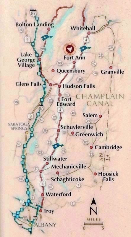
Lakes to Locks Passage takes you through a spectacular landscape laden with history. Follow this map to find your way through four story-filled regions that connect the historic waters of Lake Champlain and Lake George with the Champlain Canal and Hudson River to the south and the Chambly Canal to the Richelieu and St. Lawrence Rivers of Quebec to the north.
(photo caption)
• Overlooking Lake George. Photo by Gary Randorf.
Erected by State of New York, New York Scenic Byways, America’s Byways.
Topics. This historical marker is listed in these topic lists: Abolition & Underground RR • Forts and Castles • War, US Revolutionary • Waterways & Vessels. A significant historical month for this entry is December 1847.
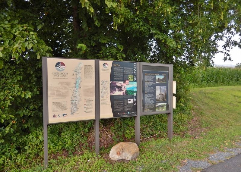
Location. 43° 25.139′ N, 73° 29.204′ W. Marker is in Fort Ann, New York, in Washington County. Marker is on George Street (U.S. 4) 0.1 miles north of Crandall Lane, on the left when traveling north. Marker is located in the Fort Ann interpretive pull-out on the west side of George Street. Touch for map. Marker is in this post office area: Fort Ann NY 12827, United States of America. Touch for directions.
Other nearby markers. At least 8 other markers are within walking distance of this marker. Fort Ann Through History (a few steps from this marker); Fort Anne (within shouting distance of this marker); Half-Way Creek (about 500 feet away, measured in a direct line); a different marker also named Fort Anne (approx. 0.2 miles away); Old Well (approx. 0.2 miles away); Oldest House (approx. 0.2 miles away); Fort Anne First Baptist Church (approx. 0.4 miles away); Fort Ann War Memorial / Henry Sartwell / Lester Archer (approx. 0.4 miles away). Touch for a list and map of all markers in Fort Ann.
Also see . . . Fort Ann, New York (Wikipedia). Fort Ann is located on the historic route linking the French and English colonies. The area was the site of several forts built by various nations.
Fort Anne was rebuilt in 1757 by the English, during the French and Indian War. The 1777 Battle of Fort Anne occurred here during the Saratoga Campaign of the American Revolutionary War. In 1823, the Champlain Canal was completed, linking the area to the outside world. Later the Delaware and Hudson Railway established a depot at Fort Ann village. (Submitted on April 4, 2020, by Cosmos Mariner of Cape Canaveral, Florida.)
Credits. This page was last revised on April 4, 2020. It was originally submitted on April 4, 2020, by Cosmos Mariner of Cape Canaveral, Florida. This page has been viewed 253 times since then and 32 times this year. Photos: 1, 2, 3, 4, 5, 6. submitted on April 4, 2020, by Cosmos Mariner of Cape Canaveral, Florida.


