Crewe in Nottoway County, Virginia — The American South (Mid-Atlantic)
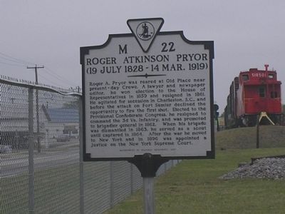
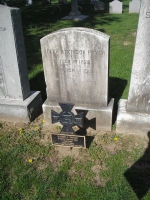
Roger Atkinson Pryor
(19 July 1828 – 14 Mar. 1919)
Erected 1957 by Department of Historic Resources. (Marker Number M-22.)
Topics and series. This historical marker is listed in these topic lists: Government & Politics • War, US Civil. In addition, it is included in the Virginia Department of Historic Resources (DHR) series list. A significant historical year for this entry is 1859.
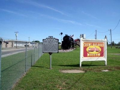
Location. 37° 10.612′ N, 78° 7.65′ W. Marker is in Crewe, Virginia, in Nottoway County. Marker is at the intersection of W Virginia Avenue (U.S. 460) and Meade Street, on the left when traveling north on W Virginia Avenue. Touch for map. Marker is in this post office area: Crewe VA 23930, United States of America. Touch for directions.
Other nearby markers. At least 8 other markers are within 2 miles of this marker, measured as the crow flies. Crewe (within shouting distance of this marker); Peter Francisco: Washington's One Man Army (about 400 feet away, measured in a direct line); Peter Francisco: Hercules of the Revolution (about 400 feet away); Peter Francisco's Fight: Fact or Fiction? (about 700 feet away); Tarleton's Southside Virginia Raid (about 700 feet away); Veterans Memorial (about 800 feet away); Lottie Moon (approx. 0.6 miles away); Civilian Conservation Corps Company 1370 (approx. 1.1 miles away). Touch for a list and map of all markers in Crewe.
Also see . . . Biography of Roger Atkinson Pryor. Wikipedia, the free encyclopedia. (Submitted on December 27, 2008, by Bill Coughlin of Woodland Park, New Jersey.)
Additional commentary.
1. Wilson-Kautz Raid
Gen. Pryor's local knowledge allowed Confederate cavalry to intercept a raiding Union force seven miles southeast of here at the "Battle of the Grove" on June 23, 1864.
[Excerpt from Black's and White's Station CWT marker] Former Congressman and Gen. Roger Atkinson Pryor, a native of Nottoway County, was riding with Gen. W.H.F. “Rooney” Lee’s cavalry when it arrived here. Pryor directed the Confederates to a shortcut at Hardy’s Fork to allow Lee’s cavalry to get in front of Wilson. The two forces collided just a few miles east of Nottoway Court House as Wilson tried to regain the road.
— Submitted June 16, 2010.
Credits. This page was last revised on June 16, 2016. It was originally submitted on December 27, 2008, by Bill Coughlin of Woodland Park, New Jersey. This page has been viewed 1,268 times since then and 30 times this year. Photos: 1. submitted on December 27, 2008, by Bill Coughlin of Woodland Park, New Jersey. 2. submitted on May 16, 2009, by Bernard Fisher of Richmond, Virginia. 3. submitted on December 27, 2008, by Bill Coughlin of Woodland Park, New Jersey.


