High Falls in Ulster County, New York — The American Northeast (Mid-Atlantic)
Discovery of Cement
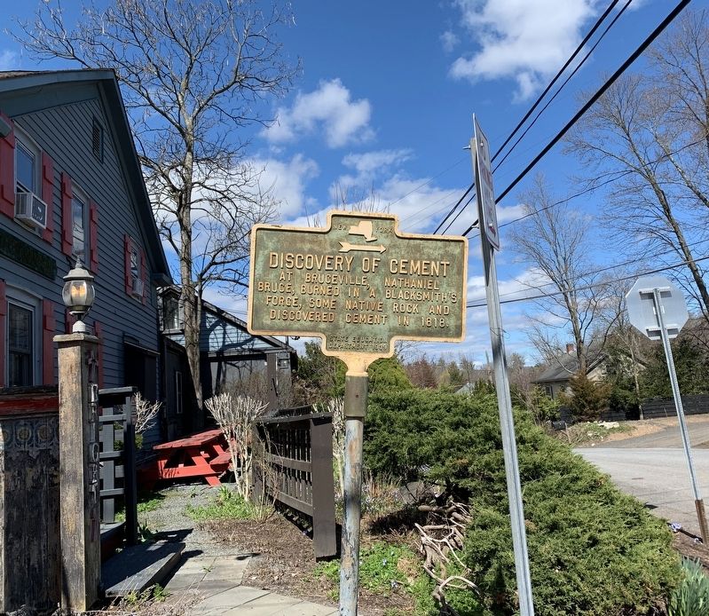
Photographed by Steve Stoessel, April 4, 2020
1. Discovery of Cement Marker
Erected 1939 by State Education Department.
Topics. This historical marker is listed in these topic lists: Industry & Commerce • Science & Medicine. A significant historical year for this entry is 1818.
Location. Marker is missing. It was located near 41° 49.62′ N, 74° 7.578′ W. Marker was in High Falls, New York, in Ulster County. It was at the intersection of Main Street (New York State Route 213) and Bruceville Road, on the right when traveling west on Main Street. Touch for map. Marker was in this post office area: High Falls NY 12440, United States of America. Touch for directions.

Regionally, this marker was in Upstate New York and in the Hudson Valley. It was also in the American Northeast, in the Mid-Atlantic, and on the Eastern Seaboard. Globally, it was in the North Atlantic Region, North America, the Western Hemisphere, the Western World, and the Anglosphere. Historically, it found itself in what was once New Netherland and also one of the original Thirteen Colonies.
Other nearby markers. At
this page online
More about this marker. Marker was pointing the wrong way. It should point down Bruceville Road. Instead it is pointing east along NY 213.
Also see . . . Natural Cement Chemistry. Rosendale Natural Cement Products website entry (Submitted on April 6, 2020, by Steve Stoessel of Niskayuna, New York.)
Additional commentary.
1. Discovery of Cement
The D+H Canal engineers were recently off the Erie Canal job where they had recognized the limestone in High Falls was identical as what they had used in Syracuse. This would be significant in two ways;
1) They did not have to pay to transport the Syracuse hydraulic cement to the Delaware and Hudson Canal.
2)The discovery started a local cement industry and its' transportation made them the first customer of the D&H Canal. This cement was referred to as Rosendale Cement.
Anecdote: when the canal was closed, the cement section remained open to the tide water lock and the Hudson River.That made the Rosendale Cement industry the Last customer of the D+H Canal.
Additionally those mines not along the canal pooled their resources and built a horse railroad to the tidewater in Eddyville - the same place where the canal's tidewater lock was/is located.
— Submitted September 9, 2021, by Chester T. Hartwell of Angier, North Carolina.
2. Discovery of (hydraulic) Cement (actually the re-discovery).
The marker has been removed to build a ramp to an outdoor patio. I am seeking further information from the D&H Canal Museum. Note To Editor only visible by Contributor and editor
— Submitted September 25, 2026, by Chester T. Hartwell of Angier, North Carolina.
Credits. This page was last revised on October 20, 2026. It was originally submitted on April 6, 2020, by Steve Stoessel of Niskayuna, New York. This page has been viewed 1,231 times since then and 58 times this year. Photo 1. submitted on April 6, 2020, by Steve Stoessel of Niskayuna, New York. • Michael Herrick was the editor who published this page.
Editor’s want-list for this marker. A wide angle photo of the marker and its surroundings. • Can you help?
