North East in Cecil County, Maryland — The American Northeast (Mid-Atlantic)
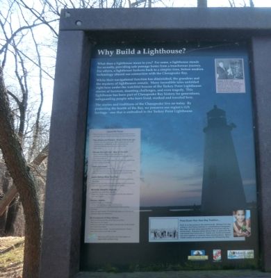
Why Build a Lighthouse?
Photographed by Don Morfe, January 16, 2015
1. Why Build a Lighthouse? Marker
What does a lighthouse mean to you? For some, a lighthouse stands for security, providing safe passage home from a treacherous journey. For others, a lighthouse harkens back to a simpler time, before modern technology altered our connection with the Chesapeake Bay.
While their navigational function has diminished, the grandeur and the mystery of lighthouses remain. Many incredible tales unfolded right here under the watchful beacon of the Turkey Point Lighthouse stories of heroism, daunting challenges, and even tragedy. This lighthouse has been part of Chesapeake Bay history for generations, safeguarding people who have lived, worked and traveled there.
The stories and traditions of the Chesapeake live on today. By protecting the health of the Bay, we preserve our region’s rich heritage-one that is embodied in the Turkey Point Lighthouse.
[Caption:]
Keeper of the Light:
Fannie May Salter (above) faithfully tended the Turkey Point Lighthouse from 1925 until 1947. In 1943, the light was switched from oil to electric: a major improvement! Salter was one of four women who tended the lighthouse between 1833 and 1947.
Erected by Maryland
this page online
Topics and series. This historical marker is listed in these topic lists: Man-Made Features • Waterways & Vessels. In addition, it is included in the Lighthouses series list. A significant historical year for this entry is 1925.
Location. 39° 27.582′ N, 76° 0.366′ W. Marker is in North East, Maryland, in Cecil County. It is on Turkey Point Road (Maryland Route 272). The marker is located in Elk Neck State Park. Touch for map. Marker is in this post office area: North East MD 21901, United States of America. Touch for directions.

Regionally, this marker is in Greater Wilmington, on the Eastern Shore, and in Greater Philadelphia. It is also in the American Mid-Atlantic, on the Delmarva Peninsula, in the Tidewater, in the Chesapeake Bay Region, and on the Eastern Seaboard. Globally, it is in the North Atlantic Region, North America, the Western Hemisphere, the Western World, and the Anglosphere. Historically, it finds itself in what was once one of the original Thirteen Colonies and also the Antebellum South.
Other nearby markers. At least 8 other markers are within 5 miles of this marker,
Photographed by Don Morfe, January 16, 2015
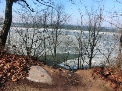
2. Chesapeake Bay partially frozen-marker near this point
Credits. This page was last revised on May 23, 2025. It was originally submitted on January 18, 2015, by Don Morfe of Baltimore, Maryland. This page has been viewed 567 times since then and 39 times this year. Last updated on April 6, 2020, by Carl Gordon Moore Jr. of North East, Maryland. Photos: 1, 2. submitted on January 18, 2015, by Don Morfe of Baltimore, Maryland. • Bill Pfingsten was the editor who published this page.
