Straban Township near Gettysburg in Adams County, Pennsylvania — The American Northeast (Mid-Atlantic)
Carrington's Battery - Jones's Artillery Battalion
Early's Division - Ewell's Corps
| — | Army of Northern Virginia | — |
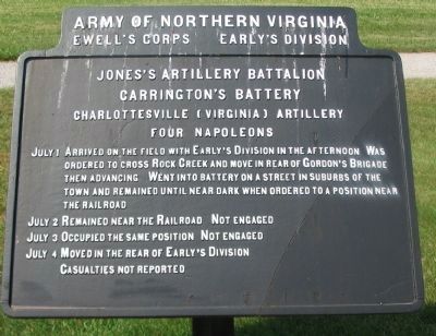
Photographed by Craig Swain, June 28, 2008
1. Carrington's Battery Tablet
Ewell's Corps - Early's Division
Jones's Artillery Battalion
Carrington's Battery
Charlottesville (Virginia) Artillery
Four Napoleons
July 1 Arrived on the field with Early's Division in the afternoon. Was ordered to cross Rock Creek and move in rear of Gordon's Brigade the advancing. Went into battery on a street in suburbs of the town and remained until near dark when ordered to a position near the railroad.
July 2 Remained near the Railroad. Not engaged.
July 3 Occupied the same position. Not engaged.
July 4 Moved in the rear of Early's Division.
Casualties not reported.
Erected 1910 by Gettysburg National Military Park Commission.
Topics. This historical marker is listed in this topic list: War, US Civil. A significant historical month for this entry is July 1796.
Location. 39° 51.04′ N, 77° 13.027′ W. Marker is near Gettysburg, Pennsylvania, in Adams County. It is in Straban Township. It is at the intersection of Jones Avenue and Old Harrisburg Road (Business U.S. 15), on the left when traveling east on Jones Avenue. Located in Gettysburg National Military Park. Touch for map. Marker is in this post office
this page online

Regionally, this marker is in South-Central Pennsylvania. It is also in the American Northeast, in the Mid-Atlantic, in Appalachia, and specifically in Northern Appalachia. Globally, it is in North America, the Western Hemisphere, the Western World, and the Anglosphere. Historically, it finds itself in what was once the Haudenosaunee (Iroquois) Confederacy and also one of the original Thirteen Colonies.
Other nearby markers. At least 8 other markers are within walking distance of this marker: Jones's Artillery Battalion (within shouting distance of this marker); Jacob Kime Farm (about 600 feet away, measured in a direct line); a different marker also named The Jacob Kime Farm (about 700 feet away); Garber's Battery - Jones's Artillery Battalion (approx. 0.2 miles away); Tanner's Battery - Jones's Artillery Battalion (approx. 0.2 miles away); Green's Battery - Jones's Artillery Battalion (approx. 0.2 miles away); From Farm to Hospital (approx. 0.4 miles away); Josiah Benner Farm (approx. 0.4 miles away). Touch for a list and map of all markers in Gettysburg.
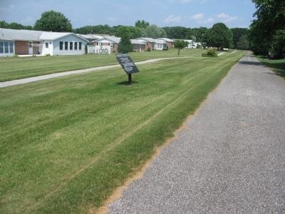
Photographed by Craig Swain, June 28, 2008
2. Carrington's Battery Tablet
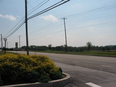
Photographed by Craig Swain, June 28, 2008
3. Old Harrisburg Road
Looking south from the intersection of Old Harrisburg Road and Jones Avenue. Carrington's Battery remained limbered while the other guns in Jones's Battalion deployed on the ridge, now traversed by Jones Avenue. Carrington's Battery actually advanced into Gettysburg and deployed near the railroad on the east side of town.
Credits. This page was last revised on February 7, 2023. It was originally submitted on September 2, 2008, by Craig Swain of Leesburg, Virginia. This page has been viewed 1,142 times since then and 24 times this year. Last updated on April 7, 2020, by Brian Dillon of Gettysburg, Pennsylvania. Photos: 1, 2, 3. submitted on September 2, 2008, by Craig Swain of Leesburg, Virginia. • Bill Pfingsten was the editor who published this page.
