Saint John in Saint John County, New Brunswick — The Atlantic Provinces (North America)
Touch Two Ancient Continents
Toucher à deux anciens continents
— Harbour Passage Trail —
Inscription.
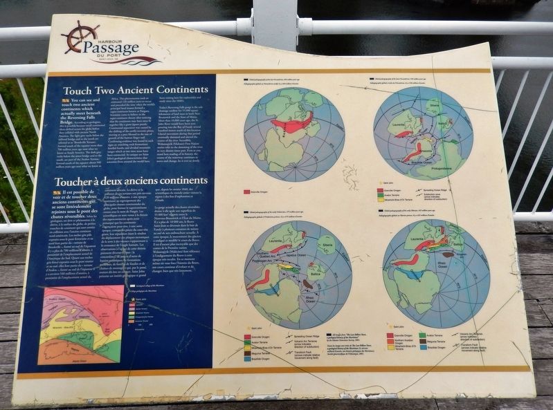
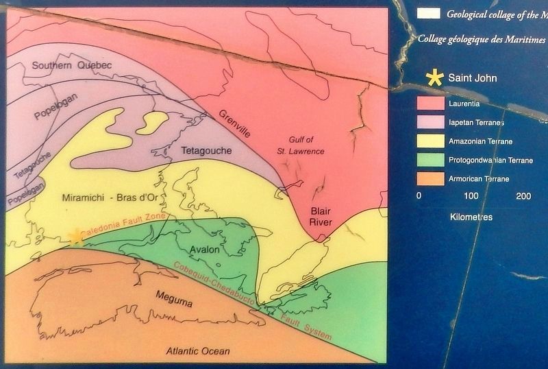
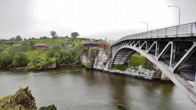
You can see and touch two ancient continents which actually meet beneath the Reversing Falls Bridge. According to geologists, this is possible because small continental slices drifted across the globe before they collided with ancient North America. The light grey rocks below the railroad bridge and to the north are referred to as “Brookville Terrane,” formed south of the equator more than 700 million years ago near what we know as South America. The dark grey rocks below the street bridge and to the south, are part of the “Avalon Terrane,” formed south of the equator about 540 million years ago near what we know as Africa. This phenomenon took an estimated 120 million years to occur and preceded the time when the world's principal land masses formed a super-continent known as Pangaea. Scientists came to believe in the super-continent theory after noticing that the continents may have once fit together like a giant jigsaw puzzle. Continental separation was caused by the shifting of the earth's tectonic plates, moving at a pace likened to the rate of growth of the human finger nail. Confirming evidence was found in such signs as: matching rock formations; familial fossils; and divided mountain ranges which at one time must have been connected. So unique are Saint John's geological characteristics that scientists from around the world have been visiting here for exploration and study since the 1840's.
Today's Reversing Falls gorge is the sole drainage outflow for 55,000 square kilometers of land mass in both New Brunswick and the State of Maine. More than 10,000 years ago, the St. John River would have been seen pouring into the Bay of Fundy several hundred meters south of this location. Glacial movement during that period eventually dammed and altered the course of the river. Incredibly, Wolastoqiyik (Maliseet) First Nation stories refer to the damming of the river in very distant times past. Even as you stand here reading of its history, the course of the waterway continues to move and change, be it ever so slowly.
Il est possible de voir et de toucher deux anciens continents qui se sont littéralement rejoints sous le pont des chutes réversibles. Selon les géologues, on doit ce phénomène à la dérive, à la surface du globe, de petites tranches de continent qui sont entrées en collision avec l'ancien continent nord-américain. Les roches gris pâle exposées sous le pont ferroviaire et au nord font partie du « terrane de Brookville », formé au sud de l'équateur il y a plus de 700 millions d'années, à proximité de l'emplacement actuel de l'Amérique du Sud. Quant aux roches gris foncé exposées sous le pont routier et au sud, elles font partie du « terrane d'Avalon », formé au sud de l'équateur ii y a environ 540 millions d'années, à proximité de l'emplacement actuel du continent africain. La dérive et la collision de ces terranes ont pris environ 120 millions d’anées, à une époque antérieure au regroupement des principales masses continentales du globe, pour former le supercontinent connu sous le nom de Pangée. Les scientifiques en sont venus à la théorie des supercontinents après avoir remarqué que les continents s’agençaient peut-être, à une autre époque, comme les pièces du casse-tête géant, leur séparation étant le résultat du déplacement des plaques tectoniques de la terre à des vitesses s'apparentant à la croissance de l'ongle humain. Les observations à l’appui de cette théorie prennent diverses formes : la concordance, de part et d'autre de bassins océaniques, de formations rocheuses, de familles de fossiles et de chaînes de montagnes qui, par le passé, avaient dû être en contact. Saint John présente un intérêt géologique si grand que, depuis les années 1840, des scientifiques du monde entier visitent la région à des fins d'exploration et d'étude.
La gorge actuelle des chutes réversibles
draine à elle seule une superficie de 55 000 km2 répartie entre le Nouveau-Brunswick et l'État du Maine. Il y a plus de 10 000 ans, le fleuve Saint-Jean se déversait dans la baie de Fundy à plusieurs centaines de mètres au sud de son embouchure actuelle. À cette époque, le mouvement des glaciers a endigué et modifié le cours du fleuve. Il est d'autant plus incroyable que des contes de la Première nation Wolastoqiyik (Malécites) font référence à l'endiguement du fleuve à cette époque très reculée. En ce moment même où vous lisez l'histoire du fleuve, son cours continue d'évoluer et de changer, bien que très lentement.
Topics. This historical marker is listed in this topic list: Natural Features.
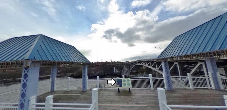
Location. 45° 15.58′ N, 66° 5.145′ W. Marker is in Saint John, New Brunswick, in Saint John County. Marker can be reached from the intersection of Chesley Drive (New Brunswick Route 100) and Douglas Avenue, on the right when traveling north. Marker is located along the Harbour Passage Trail, at the Reversing Falls Lookout Point. Touch for map. Marker is in this post office area: Saint John NB E2K 5L6, Canada. Touch for directions.
Other nearby markers. At least 8 other markers are within walking distance of this marker. Koluskap and Beaver (approx. 0.4 kilometers away); Land of the Dawn (approx. 0.4 kilometers away); Wolastoq Park (approx. 0.4 kilometers away); Samuel de Champlain
(approx. 0.4 kilometers away); Mills at Union Point (approx. 0.4 kilometers away); Françoise Marie Jacquelin (approx. 0.4 kilometers away); The New Community of Saint John (approx. 0.4 kilometers away); Rebels Attack (approx. 0.4 kilometers away). Touch for a list and map of all markers in Saint John.
Credits. This page was last revised on November 2, 2022. It was originally submitted on April 7, 2020, by Cosmos Mariner of Cape Canaveral, Florida. This page has been viewed 226 times since then and 19 times this year. Photos: 1, 2, 3, 4. submitted on April 8, 2020, by Cosmos Mariner of Cape Canaveral, Florida.


