Saint John in Saint John County, New Brunswick — The Atlantic Provinces (North America)
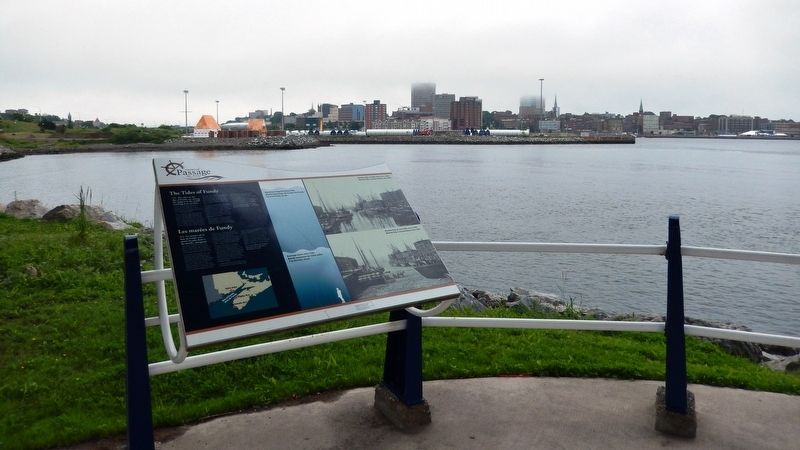
The Tides of Fundy
Les Marées de Fundy
— Harbour Passage Trail —
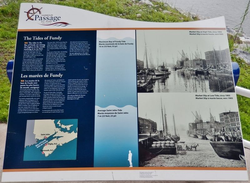
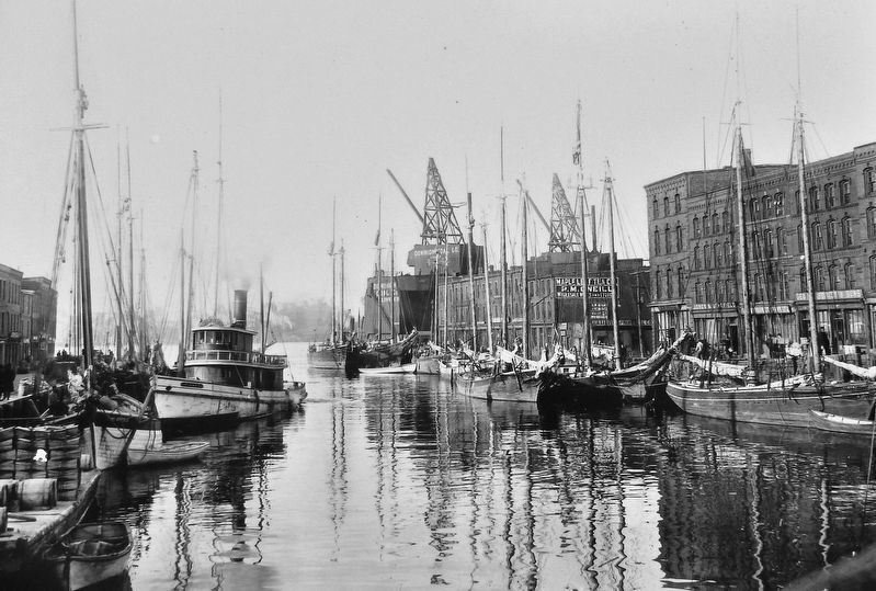
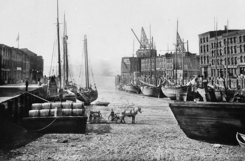
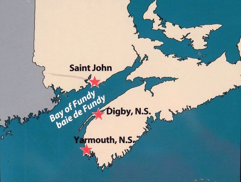
The tides in the Bay of Fundy are among the highest in the world, reaching 16 m (53 feet) at the head of the bay. Closer to the mouth, the tidal range is less. At Saint John it averages 7 m (23 feet), still enough to make this the port with the world's highest tides.
These exceptional tides are due mainly to the particular length and depth of the Bay and adjoining Gulf of Maine. Water can be made to rock back and forth (and up and down) in this system, as in a bathtub. The natural rhythm of such a rocking wave in the Bay is about 13 hours. This is close to the rhythm of the ocean tides, which sweep along the Atlantic coast every 12 ½ hours. In so doing, they amplify the Fundy tides, like an adult making a child go higher on a swing by pushing at just the right time.
For the port of Saint John, the berthing and departure of larger vessels has to take place during the “tidal window,” the time either side of high tide, about five hours in total, when the water depth is greatest. Smaller vessels that draw less than 8 m (28 feet) can enter and depart at any time.
The movement of vessels in and out of the harbour is controlled by the Harbour Master, who keeps track of all vessels that want to use the harbour, their planned arrival and departure times, the water depth they require, and how long it will take them to make their passage. Using this information, along with data on the time of the highest tides, the Harbour Master ensures that all vessels arrive and depart safely.
For more information on this subject, please visit the New Brunswick Museum.
Les marées de la baie de Fundy sont parmi les plus hautes du monde, atteignant 16 m (53 pi) au fond de la baie. Plus près de l'embouchure, elles sont plus basses. À Saint John, elles atteignent en moyenne 7 m (23 pi), ce qui en fait le port aux plus hautes marées du monde.
Ces marées exceptionnelles sont essentiellement dues à la longueur et à la profondeur particulières de la baie et du plan d'eau voisin, le golfe du Maine. Dans ce système, l'eau est ballottée en tout sens, comme dans un bain. Le rythme naturel de ce va-et-vient incessant dans la baie est d'environ 13 heures, ce qui correspond presque au rythme des marées de l'océan, qui balaient la côte de l'Atlantique toutes les 12 heures et demie. Le mouvement de ces dernières amplifie les marées de Fundy, à la manière d'un adulte qui pousse un enfant sur une balançoire, juste au bon
moment, pour le faire aller plus haut.
Au port de Saint John, l'accostage et le départ des gros navires doivent s'effect-uer au «moment propice», c'est-à-dire quand les marées sont hautes, soit lorsque le chenal est à son plus profond. Cette période dure environ cinq heures. Quant aux bateaux plus petits dont le tirant d'eau est inférieur 8 m (28 pi), ils peuvent entrer et sortir du port n'importe quand.
Le mouvement des navires dans le port est contrôlé par le maître du port, aussi appelé capitaine du port, qui enregistre tous les bateaux qui veulent l'utiliser, l'heure à laquelle ils prévoient arriver et repartir, le tirant d'eau dont ils ont besoin et la durée de leur passage. À l'aide de ces renseignements et des données sur l'heure des plus hautes marées, il s'assure que les arrivées et les départs s'effectuent en toute sécurité.
Une visite au Musée du Nouveau-Brunswick vous en apprendra davantage sur le sujet.
Topics. This historical marker is listed in this topic list: Waterways & Vessels.
Location. 45° 16.266′ N, 66° 4.504′ W. Marker is in Saint John, New Brunswick, in Saint John County. Marker can be reached from Navy Way, 0.1 kilometers east of Chesley Drive (New Brunswick Route 100), on the right when traveling east. Marker is located along the Harbour
Passage Trail, underneath the elevated St. John Throughway, overlooking the St. John River. Touch for map. Marker is in this post office area: Saint John NB E2K 5L6, Canada. Touch for directions.
Other nearby markers. At least 8 other markers are within walking distance of this marker. The Saint John Harbour Bridge | Le pont du port de Saint John (here, next to this marker); The Shards of Time (about 210 meters away, measured in a direct line); Fishing the Harbour (about 210 meters away); Navy Island (Ouigoudy Island) (about 210 meters away); Fort La Tour (approx. 0.3 kilometers away); a different marker also named Fort La Tour (approx. 0.3 kilometers away); Menahkwesk "Saint John" (approx. 0.3 kilometers away); a different marker also named Fort La Tour (approx. 0.3 kilometers away). Touch for a list and map of all markers in Saint John.
Also see . . . Bay of Fundy Tides: The Highest Tides in the World!.
(this link presents professional timelapse videos of the tide action) Twice everyday the bay fills and empties of a billion tonnes of water during each tide cycle—that’s more than the flow of all the world’s freshwater rivers combined. (Submitted on April 8, 2020, by Cosmos Mariner of Cape Canaveral, Florida.)
Credits. This page was last revised on November 3, 2022. It was originally submitted on April 7, 2020, by Cosmos Mariner of Cape Canaveral, Florida. This page has been viewed 147 times since then and 12 times this year. Photos: 1. submitted on April 7, 2020, by Cosmos Mariner of Cape Canaveral, Florida. 2, 3, 4, 5. submitted on April 8, 2020, by Cosmos Mariner of Cape Canaveral, Florida.
