New Hope in Bucks County, Pennsylvania — The American Northeast (Mid-Atlantic)
Vansant House
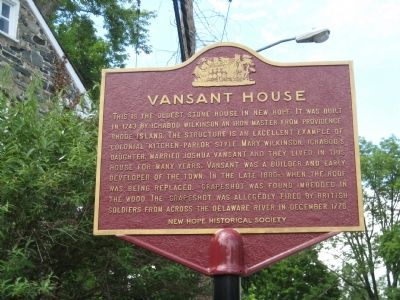
Photographed by Alan Edelson, June 19, 2009
1. Vansant House Marker
Erected by New Hope Historical Society.
Topics. This historical marker is listed in these topic lists: Architecture • Colonial Era • Industry & Commerce • War, US Revolutionary. A significant historical year for this entry is 1743.
Location. 40° 21.716′ N, 74° 57.035′ W. Marker is in New Hope, Pennsylvania, in Bucks County. It is at the intersection of Main Street and W. Mechanic Street, on the left when traveling north on Main Street. Touch for map. Marker is in this post office area: New Hope PA 18938, United States of America. Touch for directions.

Regionally,
this page online
Other nearby markers. At least 8 other markers are within walking distance of this marker: Aquetong Creek (within shouting distance of this marker); New Hope Mills (about 300 feet away, measured in a direct line); Ferry Landing (about 500 feet away); Road to Monmouth Battlefield (about 500 feet away); Indian Logan (about 500 feet away); a different marker also named Ferry Landing (about 500 feet away); 2 East Ferry Street (about 500 feet away); Cannon (about 500 feet away). Touch for a list and map of all markers in New Hope.
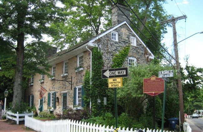
Photographed by Alan Edelson, June 19, 2009
2. Vansant House
Credits. This page was last revised on July 14, 2021. It was originally submitted on June 20, 2009, by Alan Edelson of Union Twsp., New Jersey. This page has been viewed 3,662 times since then and 155 times this year. Last updated on April 8, 2020, by Carl Gordon Moore Jr. of North East, Maryland. Photos: 1, 2. submitted on June 20, 2009, by Alan Edelson of Union Twsp., New Jersey. • Bill Pfingsten was the editor who published this page.
