Murray River in Kings County, Prince Edward Island — The Atlantic Provinces (North America)
The Murray Harbour Branch / L’Embranchement Menant À Murray Harbour
Inscription.
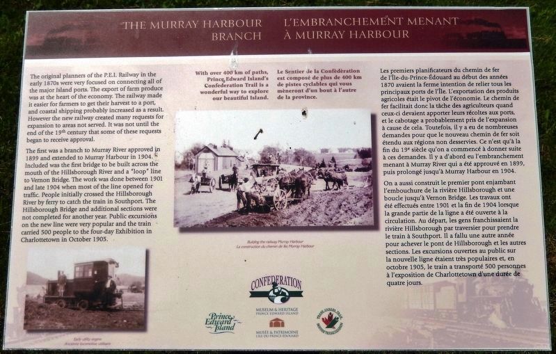
The original planners of the P.E.I. Railway in the early 1870s were very focused on connecting all of the major Island ports. The export of farm produce was at the heart of the economy. The railway made it easier for farmers to get their harvest to a port, and coastal shipping probably increased as a result. However the new railway created many requests for expansion to areas not served. It was not until the end of the 19th century that some of these requests began to receive approval.
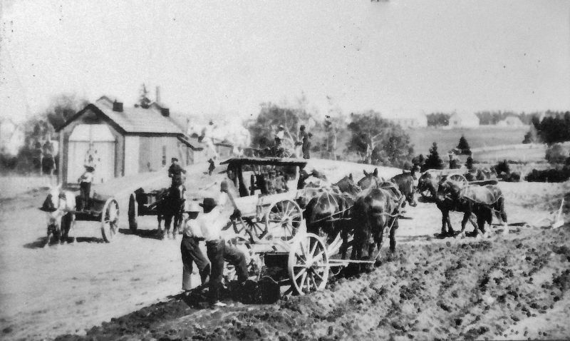
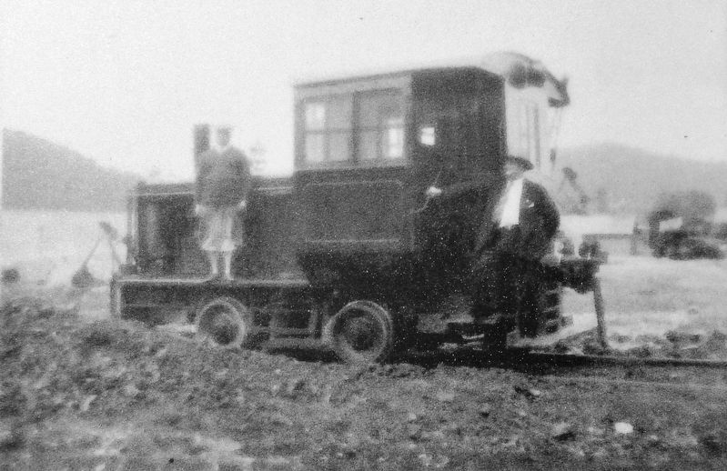
The first was a branch to Murray River approved in 1899 and extended to Murray Harbour in 1904. Included was the first bridge to be built across the mouth of the Hillsborough River and a “loop” line to Vernon Bridge. The work was done between 1901 and late 1904 when most of the line opened for traffic. People initially crossed the Hillsborough River by ferry to catch the train in Southport. The Hillsborough Bridge and additional sections were not completed for another year. Public excursions on the new line were very popular and the train carried 500 people to the four-day Exhibition in Charlottetown in October 1905.
With over 400 km of paths, Prince Edward Island's Confederation Trail is a wonderful way to explore our beautiful Island.
Les premiers planificateurs du chemin de fer de l'Île-du-Prince-Édouard au début des années 1870 avaient la ferme intention de relier tous les principaux ports de l'Île. L'exportation des produits agricoles était le pivot de l'économie. Le chemin de fer facilitait donc la tâche des agriculteurs quand ceux-ci devaient apporter leurs récoltes aux ports, et le cabotage a probablement pris de l'expansion à cause de cela. Toutefois, il y a eu de nombreuses demandes pour que le nouveau chemin de fer soit étendu aux régions non desservies. Ce n'est qu'à la fin du 19e siècle qu'on a commencé à donner suite à ces demandes. Il y a d'abord eu l'embranchement menant à Murray River qui a été approuvé en 1899, puis prolongé jusqu'à Murray Harbour en 1904.
On a aussi construit le premier pont enjambant l'embouchure de la rivière Hillsborough et une boucle jusqu'à Vernon Bridge. Les travaux ont été effectués entre 1901 et la fin de 1904 lorsque la grande partie de la ligne a été ouverte à la circulation. Au départ, les gens franchissaient la rivière Hillsborough par traversier pour prendre le train à Southport. Il a fallu une autre année pour achever le pont de Hillsborough et les autres sections. Les excursions ouvertes au public sur la nouvelle ligne étaient très populaires et, en octobre 1905, le train a transporté 500 personnes à l'exposition de Charlottetown d'une durée de quatre jours.
Le Sentier de la Confédération est composé de plus de 400 km de pistes cyclables qui vous mèneront d'un bout à l'autre de la province.
Erected by Prince Edward Island Museum & Heritage, Confederation Trail, and Trans Canada Trail.
Topics. This historical marker is listed in these topic lists: Agriculture • Industry & Commerce • Railroads & Streetcars.
Location. 46° 0.676′ N, 62° 36.527′ W. Marker is in Murray River, Prince Edward Island, in Kings County. Marker is on School Street just west of Main Street (Prince Edward Island Route 4), on the left when traveling west. Marker is located beside the Confederation Trail. Touch for map. Marker is in this post office area: Murray River PE C0A 1W0, Canada. Touch for directions.
Other nearby markers. At least 8 other markers are within 21 kilometers of this marker, measured as the crow flies. The Fishery at Murray Harbour / La Pêche À Murray Harbour (approx. 6.3 kilometers away); Getting the Train to the Track / L’Arrivée du Train sur la Voie Ferrée (approx. 6.3 kilometers away); Cape Bear Lighthouse / Phare de Cape Bear (approx. 6.3 kilometers away); The “Harbour” / Le « Harbour » (approx. 6.6 kilometers away); Murray Harbour War Memorial (approx. 6.9 kilometers away); Cape Bear (approx. 11.7 kilometers away); The Wood Islands Family of Lighthouses (approx. 12.6 kilometers away); Georgetown’s New Railway Station (approx. 19.6 kilometers away).
Also see . . . Prince Edward Island Railway (Wikipedia). Construction began in 1871 but costs almost bankrupted the government by the next year, a problem that helped pave PEI's entrance into Confederation. The work was picked up by the Canadian Government Railways and largely completed by the mid-1880s. The line officially closed on 31 December 1989 and the rails were removed between 1990 and 1992. The provincial government purchased the properties in 1994, and 75 per cent of the route now forms the basis of the Confederation Trail rail trail system. (Submitted on April 12, 2020, by Cosmos Mariner of Cape Canaveral, Florida.)
Credits. This page was last revised on September 25, 2020. It was originally submitted on April 11, 2020, by Cosmos Mariner of Cape Canaveral, Florida. This page has been viewed 115 times since then and 14 times this year. Photos: 1. submitted on April 11, 2020, by Cosmos Mariner of Cape Canaveral, Florida. 2, 3, 4. submitted on April 12, 2020, by Cosmos Mariner of Cape Canaveral, Florida.


