Mount Vernon in Fairfax County, Virginia — The American South (Mid-Atlantic)
George Washington's Fisheries
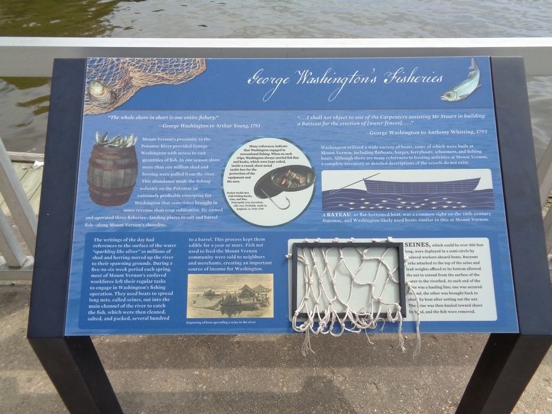
"The whole shore in short is one entire fishery."
-George Washington to Arthur Young, 1793
Mount Vernon's proximity to the Potomac River provided George Washington with access to vast quantities of fish. In one season alone, more than one million shad and herring were pulled from the river. This abundance made the fishing industry on the Potomac an extremely profitable enterprise for Washington that sometimes brought in more revenue than crop cultivation. He owned and operated three fisheries—landing places to salt and barrel fish—along Mount Vernon's shoreline.
"…I shall not object to one of the Carpenters assisting Mr Stuart in building a Batteau for the erection of [water fences]…."
-George Washington to Anthony Whitting, 1793
Washington utilized a wide variety of boats, some of which were built at Mount Vernon, including flatboats, barges, ferryboats, schooners, and fishing boats. Although there are many references to boating activities at Mount Vernon, a complete inventory or detailed descriptions of the vessels do not exist.
(caption)
A bateau, or flat-bottomed boat, was a common sight on the 18th-century Potomac, and Washington likely used boats similar to this at Mount Vernon.
(center sidebar)
Many references indicate that Washington engaged in recreational fishing. When on such trips, Washington always carried fish line and hooks, which were kept coiled, inside a round, sheet metal tackle box for the protection of the equipment and the user.
(bottom sidebar)
The writings of the day had references to the surface of the water "sparking like silver" as millions of shad and herring moved up the river to their spawning grounds. During a five-to-six week period each spring, most of Mount Vernon's enslaved workforce left their regular tasks to engage in Washington's fishing operation. They used boats to spread long nets, called seines, out into the main channel of the river to catch the fish, which were then cleaned, salted, and packed, several hundred to a barrel. This process kept them edible for a year or more. Fish not used to feed the Mount Vernon community were sold to neighbors and merchants, creating an important source of income for Washington.
Seines, which could be over 300 feet long, were deployed in a semi-circle by enslaved workers aboard boats. Buoyant corks attached to the top of the seine and lead weights affixed to its bottom allowed the net to extend from the surface of the water to the riverbed. At each end of the seine was a hauling line; one was secured on land, the other was brought back to shore by boat after setting
out the net. The seine was then hauled toward shore by hand, and the fish were removed.
Topics and series. This historical marker is listed in these topic lists: Industry & Commerce • Waterways & Vessels. In addition, it is included in the Former U.S. Presidents: #01 George Washington series list.
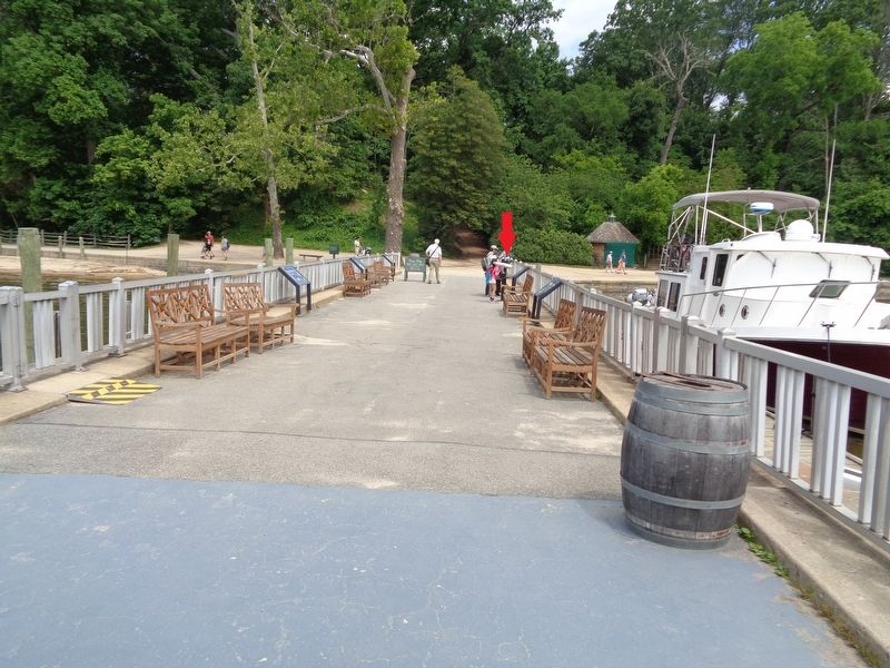
Location. 38° 42.311′ N, 77° 5.294′ W. Marker is in Mount Vernon, Virginia, in Fairfax County. Marker can be reached from Mount Vernon Highway (Virginia Route 235) near George Washington Memorial Parkway. Marker is located at the Mount Vernon Wharf, which is on the grounds of George Washington's Mount Vernon estate. Touch for map. Marker is at or near this postal address: 3200 Mount Vernon Hwy, Alexandria VA 22309, United States of America. Touch for directions.
Other nearby markers. At least 8 other markers are within walking distance of this marker. The Potomac Watershed (here, next to this marker); War at our Doorstep (a few steps from this marker); Preserving the Viewshed (a few steps from this marker); History of the Wharf (a few steps from this marker); Commerce and Transportation (a few steps from this marker); Home of George and Martha Washington / See Mount Vernon From The Water! (within shouting distance of this marker); The Mount Vernon Wharf (within shouting distance of this marker); Visionary Farmer (within shouting distance of this marker). Touch for a list and map of all markers in Mount Vernon.
Credits. This page was last revised on July 17, 2023. It was originally submitted on April 12, 2020, by Jason Voigt of Glen Carbon, Illinois. This page has been viewed 238 times since then and 20 times this year. Photos: 1, 2. submitted on April 13, 2020, by Jason Voigt of Glen Carbon, Illinois. • Bernard Fisher was the editor who published this page.

