Petersburg in Dinwiddie County, Virginia — The American South (Mid-Atlantic)
The Battle of White Oak Road
The Union Counterattack
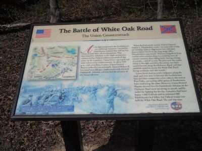
When the final attack started, Federal General Joshua L. Chamberlain wrote, “we went with a rush, not minding ranks or alignments, but with open front to lessen loss from the long-range rifles…” Chamberlain’s men struck “Hunton’s brigade in front and for a few minutes there is a seething wave of counter currents, then rolling back, leaving a fringe of wrecks, - and all is over. We pour over the works, swing to the right and drive the enemy into their entrenchments along the Claiborne Road, and then establish ourselves across the White Oak Road facing northeast, and take breath.”
Union forces had secured a lodgment along the road, and were now in between the Confederates here and their compatriots a few miles to the west at Five Forks, preventing either group of Southerners from reinforcing the other. However, Union General Warren deemed that the Confederate defenses on the Claiborne Road were too strong to assault, and he ended the fighting for the day. Casualties had been heavy: 1,865 Federals and an estimated 800 Confederates had fallen, but Federal troops now held the White Oak Road. The end was near.
Erected by Civil War Preservation Trust.
Topics. This historical marker is listed in these topic lists: Notable Events • Notable Places • War, US Civil.
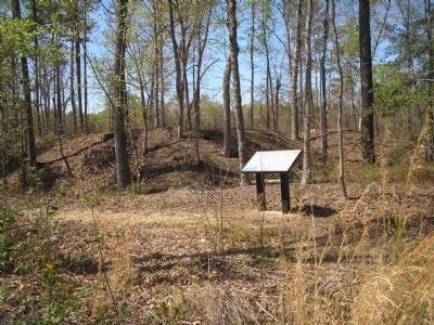
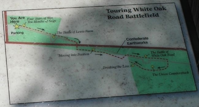
Location. 37° 9.052′ N, 77° 32.755′ W. Marker is in Petersburg, Virginia, in Dinwiddie County. Marker can be reached from White Oak Road, on the left when traveling west. Marker is on the Battle of White Oak Road walking trail. The trail starts from the parking lot at the corner of White Oak Road and Clairborne Road. Touch for map. Marker is in this post office area: Petersburg VA 23803, United States of America. Touch for directions.
Other nearby markers. At least 8 other markers are within 2 miles of this marker, measured as the crow flies. A different marker also named The Battle of White Oak Road (within shouting distance of this marker); a different marker also named The Battle of White Oak Road (about 300 feet away, measured in a direct line); a different marker also named The Battle of White Oak Road (about 500 feet away); a different marker also named The Battle of White Oak Road (approx. 0.2 miles away); a different marker also named The Battle of White Oak Road (approx. 0.2 miles away); White Oak Road Engagement (approx. 0.2 miles away); Gravelly Run Quaker Meeting House (approx. 1.4 miles away); Raceland (approx. 1.4 miles away). Touch for a list and map of all markers in Petersburg.
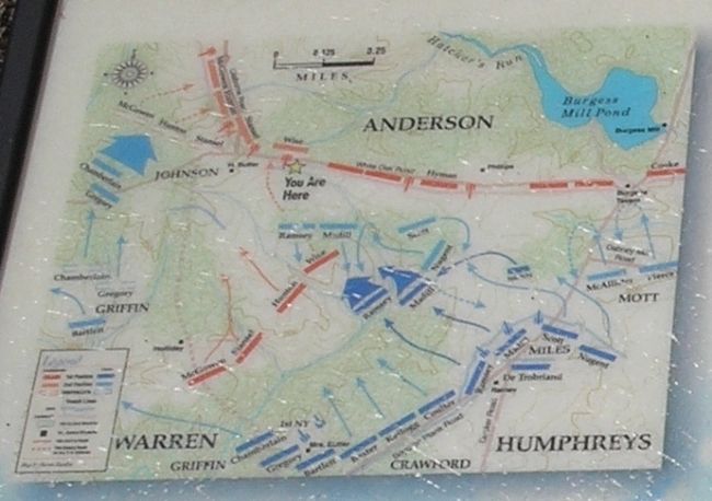
More about this marker. The lower left of the marker contains a picture of attacking Federals with the caption, “This R. F. Zogbaum drawing entitled “From Five Forks to Appomattox” does not specifically depict the fighting along the White Oak Road, but illustrates how the final Federal attack may have appeared that late afternoon of March 31, 1865. Shown are men of Humphreys’ Second Corps which supported Chamberlain’s assault as they do battle with Confederates just east of this point.” Above this is a battle map showing the Union counterattack.
Related markers. Click here for a list of markers that are related to this marker. Virtual Tour by Markers of the White Oak Road Battlefield. To better understand
the relationship, study each marker in the order shown.
Also see . . .
1. White Oak Road. The Civil War Siege of Petersburg. (Submitted on December 28, 2008, by Bill Coughlin of Woodland Park, New Jersey.)
2. Saving America’s Threatened Civil War Battlefields. Civil War Preservation Trust. (Submitted on December 28, 2008, by Bill Coughlin of Woodland Park, New Jersey.)
Credits. This page was last revised on February 2, 2023. It was originally submitted on December 28, 2008, by Bill Coughlin of Woodland Park, New Jersey. This page has been viewed 1,607 times since then and 44 times this year. Photos: 1. submitted on December 28, 2008, by Bill Coughlin of Woodland Park, New Jersey. 2. submitted on March 30, 2009. 3, 4, 5, 6. submitted on December 28, 2008, by Bill Coughlin of Woodland Park, New Jersey.
