Fort Kent in Aroostook County, Maine — The American Northeast (New England)
One People in Two Countries / Une Vallée sans frontière
Inscription.
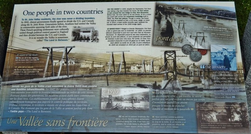
To St. John Valley residents, the river was never a dividing boundary.
In 1842, distant governments finally agreed to divide the U.S. and Canada along the St. John River. Generations before, Acadians had settled the Valley in communities spanning both sides of the river. These French-speaking settlements were culturally united though political control passed to England and then divided between the U.S. and Canada. It is no wonder the Valley is sometimes called "The Land In Between.”
Voices of the Valley
“We are all in this together. Let me know how I can help.”
—Ghislain Morin, Saint Hilaire Historical Society
Did you know?
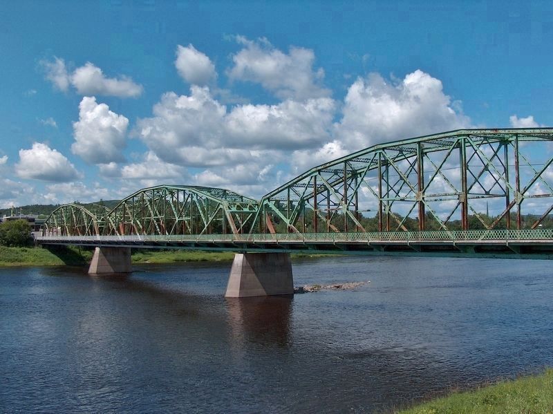
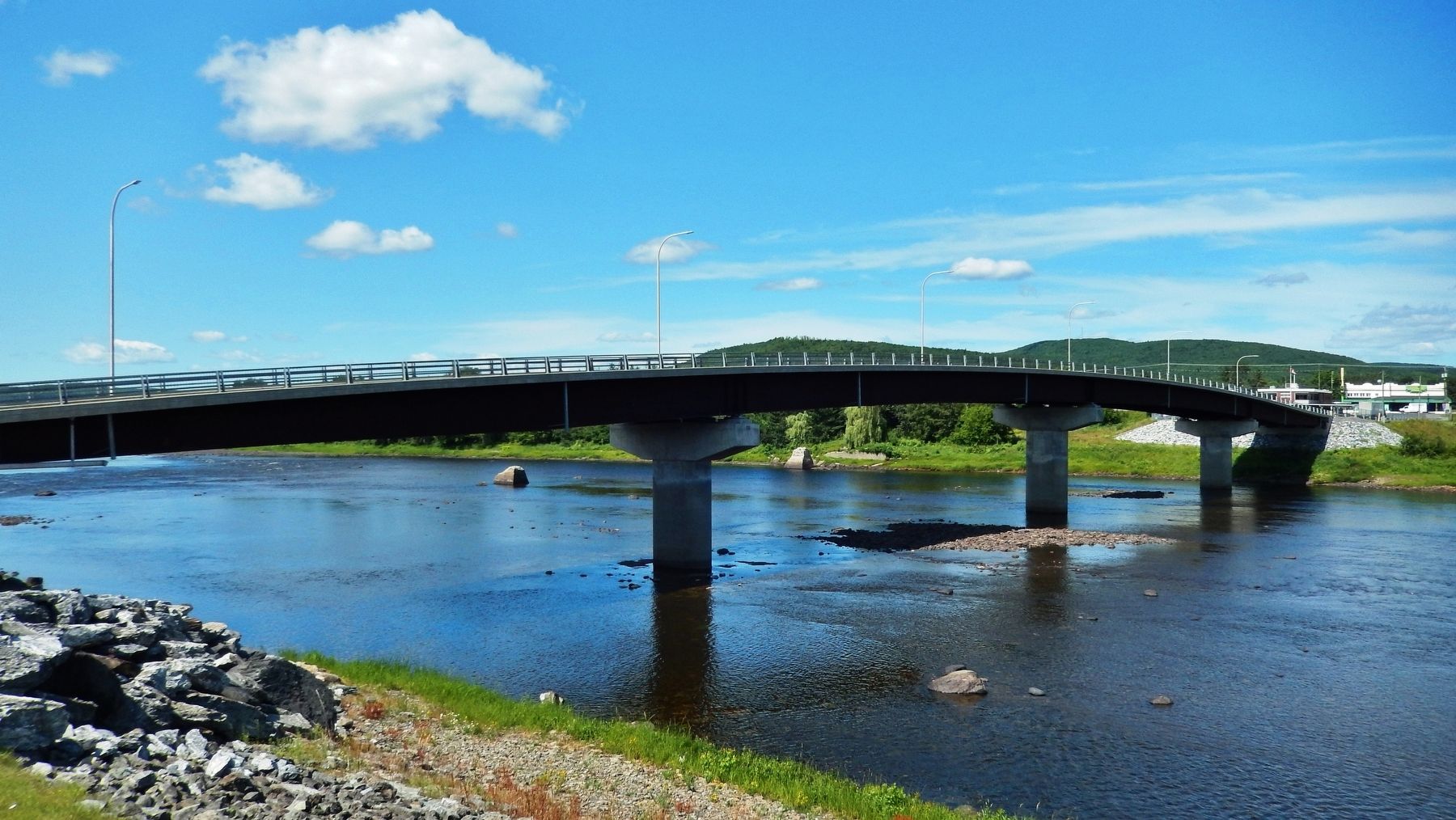
In 1930, despite the Depression, Fort Kent was taking a big step towards the future. Its first vehicle at last crossed the new bridge to Clair, New Brunswick. Before that, the town relied on its two ferries. Or for a nickel you could walk across the suspension footbridge built in 1905, the Pont des piétons. Though in winter, the frozen river could be crossed on foot, or by horse, sleigh, or motor car. In 2014, a lower profile concrete span replaced the rounded steel arches of the 1930 bridge.
“We are la colonne vertébrale, the spinal column, from Acadian settlements stretched along the river. If we have one problem, the whole Valley is affected!
—Father Jacques LaPointe, historian
Jamais les gens de la Vallée n’ont considéré la rivière Saint-Jean comme une frontière infranchissable.
En 1842, des gouvernements lointains se sont entendus pour établir la frontière internationale au milieu de cette rivière. Pourtant depuis des générations, les Acadiens avaient établi leurs communautés sur les deux rives. Ces établissements peuplés de francophones étaient culturellement homogènes peu importe le contrôle politique du territoire. D'abord britannique, le territoire a ensuite été divisé entre les États-Unis et le Canada. Pas étonnant que les gens de la Vallée se sentent parfois pris dans « l'entre pays » (The Land in Between).
Voix de la Vallée
« On est tous dans le même bateau comment ne pas s'entraider ? »
—Ghislain Morin, Société historique de Saint-Hilaire
Le Saviez-vous?
Malgré la Grande Dépression, Fort Kent a fait un grand pas vers la modernité : en 1930, un premier véhicule empruntait le pont tout neuf vers Clair au Nouveau-Brunswick. On
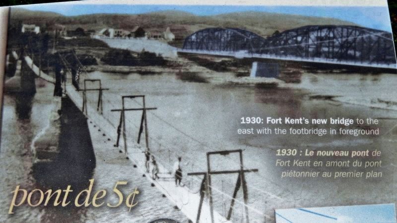
2. Marker detail: Fort Kent Footbridge, circa 1930
Fort Kent’s new bridge to the east with the footbridge in foreground. ”the anxiety with which one… cross(ed) from one side to the other… when a strong wind blew or when at flood times the waters of the river rose to within a few inches from the (swaying) unsteady floor”
Le nouveau pont de Fort Kent en amont du pont piétonnier au premier plan. « l’inquiétude qui accompagne celui… qui traverse la rivière… parfois avec un vent violent ou encore par temps d’inondation quand l’eau atteint presque le niveau du plancher instable et oscillant de la passerelle »
Le nouveau pont de Fort Kent en amont du pont piétonnier au premier plan. « l’inquiétude qui accompagne celui… qui traverse la rivière… parfois avec un vent violent ou encore par temps d’inondation quand l’eau atteint presque le niveau du plancher instable et oscillant de la passerelle »
« Nous sommes comme la colonne vertébrale des établissements acadiens du long de la rivière. Si un membre a un problème, tout le corps est affecté! »
—Le père Jacques LaPointe, historien
Erected 2014 by Maine Department of Transportation.
Topics. This historical marker is listed in these topic lists: Bridges & Viaducts • Settlements & Settlers • Waterways & Vessels. A significant historical year for this entry is 1842.
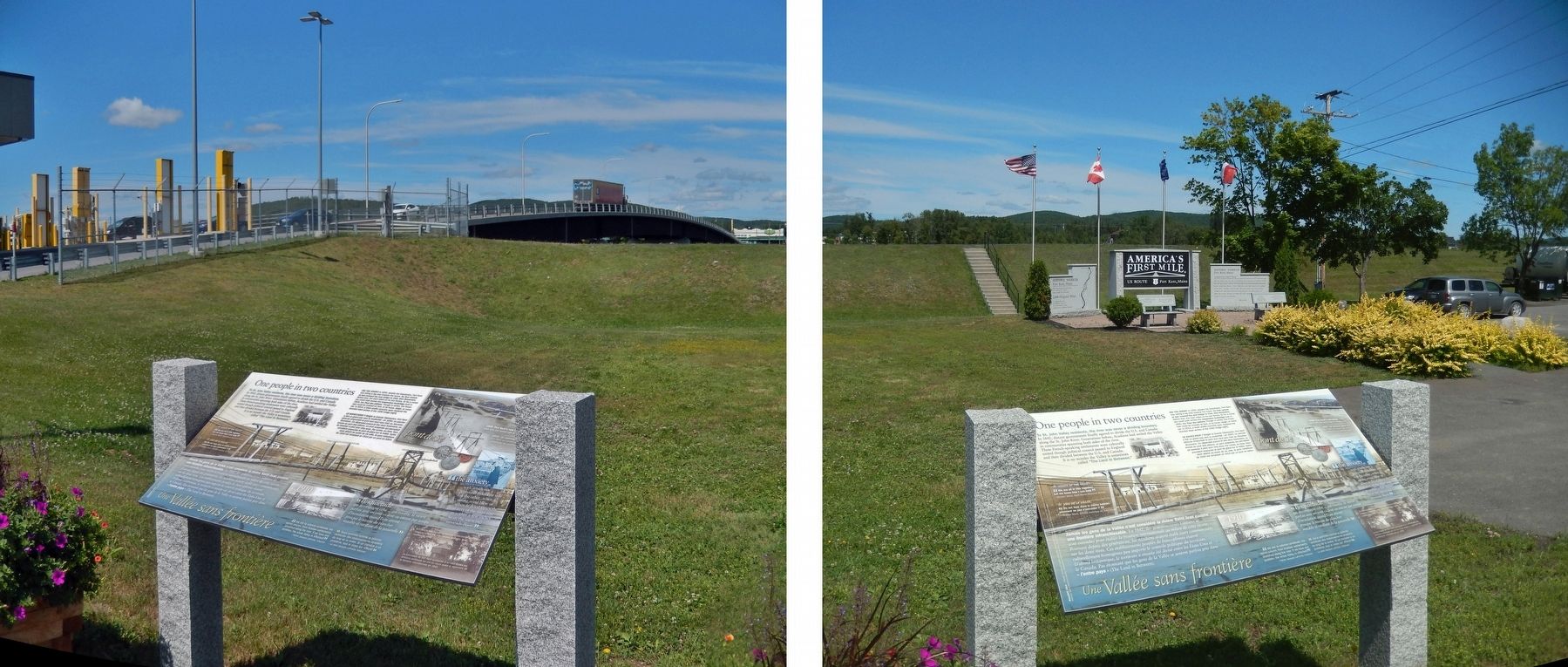
Location. 47° 14.909′ N, 68° 36.129′ W. Marker is in Fort Kent, Maine, in Aroostook County. Marker is at the intersection of West Main Street (U.S. 1) and Clair-Fort Kent International Bridge, on the right when traveling west on West Main Street. Marker is located beside the sidewalk near the United States (south) entrance to the Clair-Fort Kent International Bridge. Touch for map. Marker is in this post office area: Fort Kent ME 04743, United States of America. Touch for directions.
Other nearby markers. At least 7 other markers are within 9 miles of this marker, measured as the crow flies. America's First Mile (a few steps from
this marker); The Aroostook War (approx. 0.4 miles away); Fort Kent (approx. 0.4 miles away); Allagash and St. John Rivers (approx. 0.6 miles away); When "going across" Was Like Crossing the Street (approx. ¾ mile away); Rail Fuels Growth, Cultural Change (approx. 0.9 miles away); La paroisse de Ste. Luce 150e anniversaire (approx. 8½ miles away).
Photographed By Cosmos Mariner, August 1, 2019
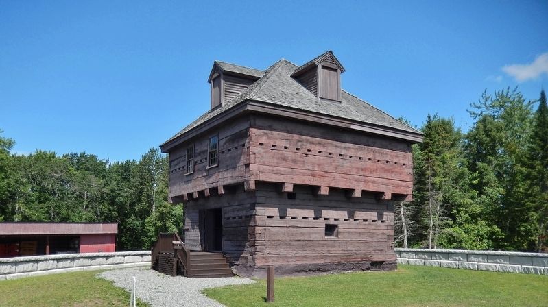
4. Fort Kent Blockhouse
Fort Kent’s Blockhouse symbolizes cross-border political tensions before the international boundary was resolved in 1842.
Le blockhaus de Fort Kent symbolise à lui seul toutes les tensions politiques qui ont eu cours avant le règlement de la frontière internationale en 1842.
Le blockhaus de Fort Kent symbolise à lui seul toutes les tensions politiques qui ont eu cours avant le règlement de la frontière internationale en 1842.
Credits. This page was last revised on April 16, 2020. It was originally submitted on April 14, 2020, by Cosmos Mariner of Cape Canaveral, Florida. This page has been viewed 326 times since then and 21 times this year. Photos: 1, 2, 3, 4, 5, 6. submitted on April 14, 2020, by Cosmos Mariner of Cape Canaveral, Florida.
