Fort Kent in Aroostook County, Maine — The American Northeast (New England)
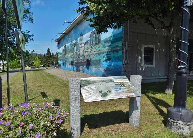
When "going across" Was Like Crossing the Street
Lorsque « changer de pays » était comme traverser la rue
Inscription.
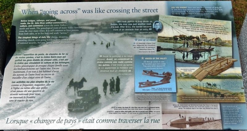
Before bridges, railways, and paved roads, the St. John River unified communities, culture, and commerce across the entire Valley — north and south. The genealogical roots of many Valley families cross the river many times. It is still common to have parents from both sides, or to live here and work "across."
The simplest things of daily life: dating, shopping, attending church, even going bowling, were never a matter of national security, but just “going across" the border casually.
“It took politics to truly divide us. Before, the river was just another road. It's sad. After 9/11, the border became more of an obstacle than an entry.”
—Don Levesque, author
Did You Know?
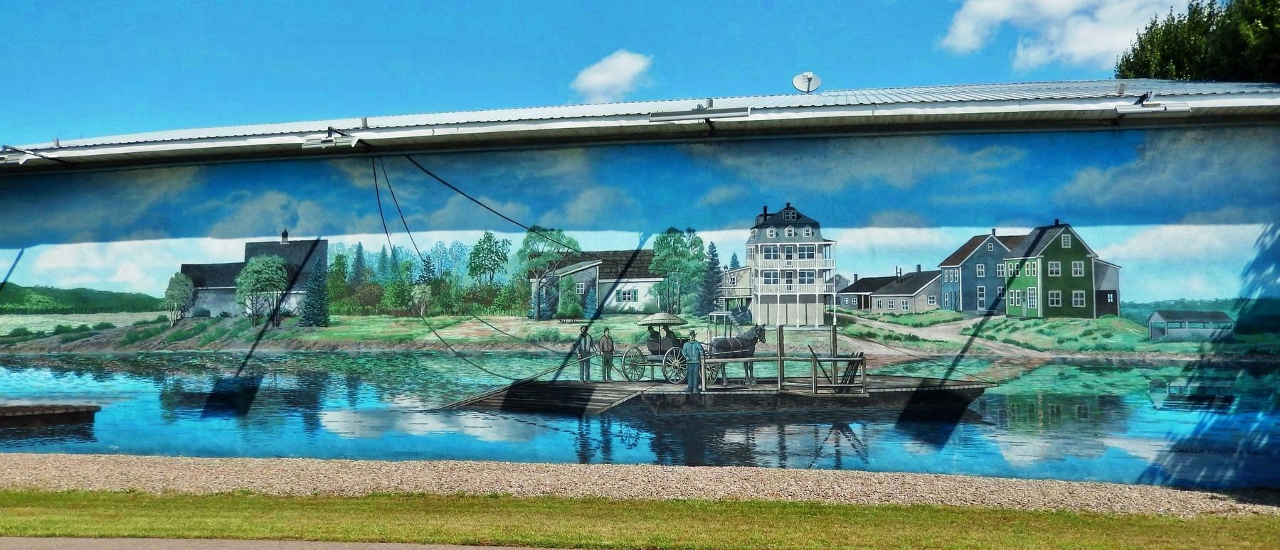
There were once ferry crossings all along the St. John River from Allagash to Van Buren. Two here in Fort Kent, also in Frenchville, St. Francis, Grand Isle, Madawaska, and Van Buren. Visit local historical societies to learn more.
(background photo caption)
In winter, the frozen St. John River was even less of a physical barrier. Winter sports thrived: Here, sulky horse races in Grand Isle. (Claude Hébert)
Avant l'apparition de ponts, de chemins de fer ou de routes pavées, c'est la rivière Saint-Jean qui unifiait les gens établis de chaque côté, c'est par la rivière que circulaient la culture et les échanges. L'arbre généalogique de presque chaque famille avait des embranchements sur l'autre rive. Encore maintenant, il est tout à fait habituel d'avoir des parents de l'autre bord ou encore de travailler d'un côté et vivre de l'autre.
Les activités les plus simples de la vie comme se fréquenter, magasiner, aller à l'église ou même aller aux quilles n'ont jamais été une question de sécurité nationale pour nous, on traversait la frontière sans se soucier de rien.
« Seule la politique a pu nous séparer. Avant, on considérait la rivière comme une route comme les autres. C’est triste qu’après le 11 septembre la frontière est devenue tout un obstacle ».
—Don Levesque, auteur
Le Saviez-vous ?
Autrefois, des traversiers faisaient la navette entre les deux pays partout le long de la rivière Saint-Jean, de l'Allagash à Van Buren. Par exemple il y en avait deux à Fort Kent et d'autres à Frenchville, St. Francis, Grande Isle, Madawaska et Van Buren. Les Sociétés historiques pourront vous en apprendre plus sur ce sujet.
(légende
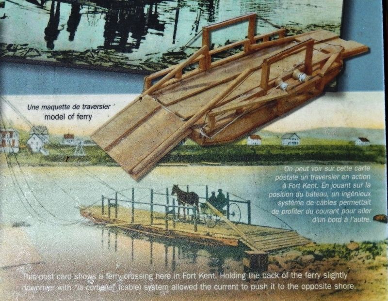
2. Marker detail: Model of Ferry / Une maquette de traversier
This post card shows a ferry crossing here in Fort Kent. Holding the back of the ferry slightly downriver with “la corbelle” (cable) system allowed the current to push it to the opposite shore.
On peut voir sur cette carte postale un traversier en action à Fort Kent. En jouant sur la position du bateau, un ingénieux système de câbles permettait de profiter du courant pour aller d'un bord à l’autre.
On peut voir sur cette carte postale un traversier en action à Fort Kent. En jouant sur la position du bateau, un ingénieux système de câbles permettait de profiter du courant pour aller d'un bord à l’autre.
Quand la rivière était gelée, plus rien ne pouvait nous arrêter. Les sports d'hiver étaient à leur meilleur : ici une course de sulky à Grande Isle. (Claude Hébert)
Erected 2014 by Maine Department of Transportation.
Topics. This historical marker is listed in these topic lists: Settlements & Settlers • Sports • Waterways & Vessels.
Location. 47° 15.36′ N, 68° 35.43′ W. Marker is in Fort Kent, Maine, in Aroostook County. Marker is at the intersection of East Main Street (U.S. 1) and River Street, on the right when traveling south on East Main Street. Touch for map. Marker is in this post office area: Fort Kent ME 04743, United States of America. Touch for directions.
Other nearby markers. At least 8 other markers are within 10 miles of this marker, measured as the crow flies. Rail Fuels Growth, Cultural Change (about 700 feet away, measured in a direct line); Allagash and St. John Rivers (approx. 0.2 miles away); Fort Kent (approx. 0.3 miles away); The Aroostook War (approx. 0.3 miles away); America's First Mile (approx. ¾ mile away); One People in Two Countries / Une Vallée sans frontière (approx. ¾ mile away); La paroisse de Ste. Luce 150e anniversaire (approx. 7.9 miles away); Farming Then & Now / L'agriculture d'hier à aujourd'hui (approx. 9.6 miles away). Touch for a list and map of all markers in Fort Kent.
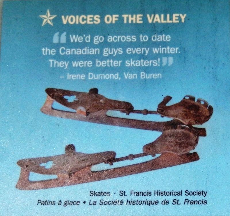
St. Francis Historical Society
3. Marker detail: Skates / Patins à glace
”We’d go across to date the Canadian guys every winter. They were better skaters!” —Irene Dumond, Van Buren
« On traversait chaque hiver pour fréquenter les Canadiens de l’autre bord. Ils patinaient beaucoup mieux ». —Irene Dumond, Van Buren
« On traversait chaque hiver pour fréquenter les Canadiens de l’autre bord. Ils patinaient beaucoup mieux ». —Irene Dumond, Van Buren
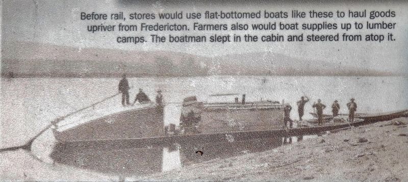
4. Marker detail: Flat-Bottomed Boats / Barges à pond plat
Before rail, stores would use flat-bottomed boats like these to haul goods upriver from Fredericton. Farmers also would boat supplies up to lumber camps. The boatman slept in the cabin and steered from atop it.
Avant l'arrivée du rail, on transportait les marchandises depuis Fredericton sur des barges à fond plat comme celles-ci. Elles servaient également aux fermiers pour expédier leurs produits vers les chantiers situés plus haut sur la rivière. Le capitaine dirigeait le bateau depuis le toit de la cabine où il dormait.
Avant l'arrivée du rail, on transportait les marchandises depuis Fredericton sur des barges à fond plat comme celles-ci. Elles servaient également aux fermiers pour expédier leurs produits vers les chantiers situés plus haut sur la rivière. Le capitaine dirigeait le bateau depuis le toit de la cabine où il dormait.
Credits. This page was last revised on April 16, 2020. It was originally submitted on April 14, 2020, by Cosmos Mariner of Cape Canaveral, Florida. This page has been viewed 194 times since then and 11 times this year. Photos: 1, 2, 3, 4, 5, 6. submitted on April 14, 2020, by Cosmos Mariner of Cape Canaveral, Florida.
