Fort Kent in Aroostook County, Maine — The American Northeast (New England)
Allagash and St. John Rivers
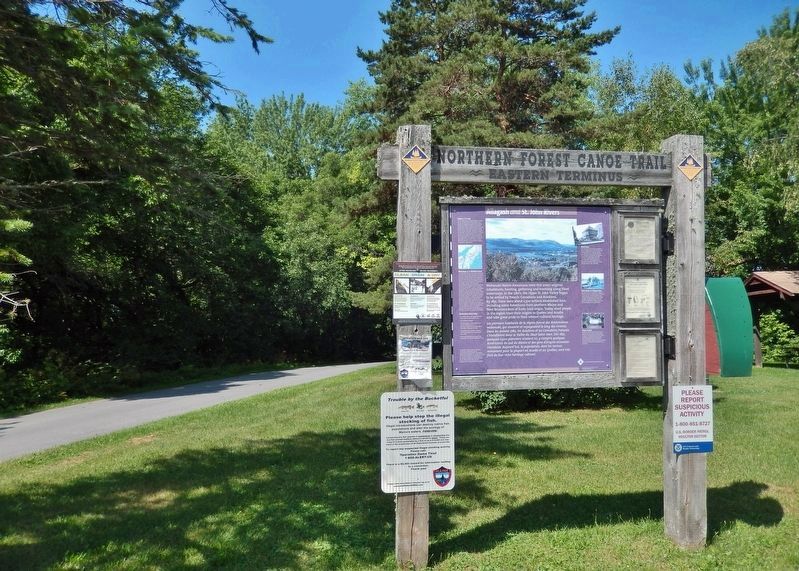
Northern Forest Canoe Trail
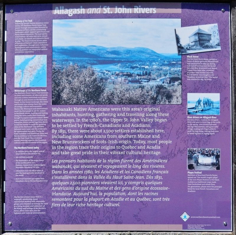
Wabanaki Native Americans were this area's original inhabitants, hunting, gathering and traveling along these waterways. In the 1780's, the Upper St. John Valley began to be settled by French-Canadians and Acadians. By 1831, there were about 2,500 settlers established here, including some Americans from southern Maine and New Brunswickers of Scots-Irish origin. Today, most people in the region trace their origins to Quebec and Acadia and take great pride in their vibrant cultural heritage.
History of the Trail
Following ancient Native American travel routes, the Northern Forest Canoe Trail passes through communities founded by European settlers and the surrounding landscapes which support agricultural and forest-based economies. The land speaks of its history—of rocks and ruins, people and plants, of natural and economic forces at play. The Trail traverses 10,000 years of human settlement—from subsistence and exploration, through wars, industrial development and conservation—while offering paddlers an unequalled outdoor recreational experience.
Les premiers habitants de la région furent des Amérindiens wabanaki, qui vivaient et voyageaient le long des rivières. Dans les années 1780, les Acadiens et les Canadiens français s'installèrent dans la Vallée du Haut Saint-Jean. Dès 1831, quelques 2,500 pionniers vivaient ici, y compris quelques Américains du sud du Maine et des gens d'origine écossaise-irlandaise. Aujourd'hui, la population, dont les racines remontent pour la plupart en Acadie et au Ouébec, sont très te fiers de leur riche héritage culturel.
Histoire du sentier (Google Translate)
À la suite d’anciennes routes de voyage amérindiennes, le Sentier de canot de la forêt du Nord traverse les communautés fondées par les colons européens et les paysages environnants qui soutiennent les économies agricoles et forestières. La terre parle de son histoire, de roches et de ruines, de personnes et de plantes, de forces naturelles et économiques en jeu. Le Sentier traverse 10 000 ans d’établissement humain, de la subsistance et de l’exploration, en passant par les guerres, le développement industriel et la conservation, tout en offrant aux pagayeurs une expérience récréative extérieure inégalée.
Sign Construction: Wood & Wood Sign Systems
Graphic Panel Fabrication: iZone
Cartography: Maphero.com
Graphic Design: proundesign.com
Erected by
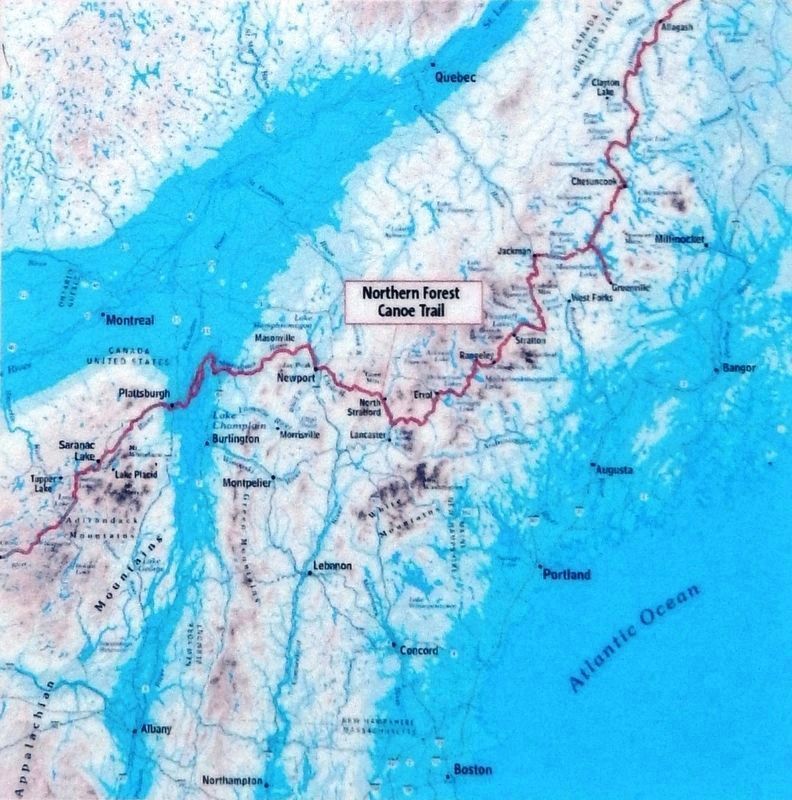
2. Marker detail: Waterways of the Northern Forest
The Northern Forest Canoe Trail traverses 22 rivers and streams, 56 lakes and ponds and over a dozen watersheds as it passes through an area known as the Northern Forest. In this boreal landscape, the rivers and forests have always been the center of ecology, culture and economics. Names like Missisquoi and Ammonoosuc recall the first people to ply the waters in birchbark canoes, hunting and trading along the same routes that eventually brought European explorers inland. Water power fueled growing communities and industries. Rivers carried logs from forest to mill for lumber to build the growing cities of the Northeast. City-dwellers followed waterways into the wilderness for rejuvenation and sport. Today, for both recreation and livelihood, rivers and forests continue to be central to life here, and the Trail flows like a common thread, weaving together the historical, cultural and natural stories of the region.
The Northern Forest today
• 30 million acres: the largest area of intact forest in the eastern U.S.
• one million residents
• the headwaters of the major rivers of the northeastern U.S.: Hudson, Connecticut, Androscoggin, Kennebec, Penobscot, St. John
• reforested since the 1850s when it was the leading timber producer in the world
• more boat launches per capita than anywhere else in the northeastern U.S.!
Topics. This historical marker is listed in these topic lists: Native Americans • Settlements & Settlers • Waterways & Vessels. A significant historical year for this entry is 1842.
Location. 47° 15.322′ N, 68° 35.628′ W. Marker is in Fort Kent, Maine, in Aroostook County. Marker can be reached from Dufour Street north of Church Street, on the left when traveling north. Marker is located at the Northern Forest Canoe Trail Eastern Terminus trailhead in Riverside Park. Touch for map. Marker is at or near this postal address: 40 Dufour Street, Fort Kent ME 04743, United States of America. Touch for directions.
Other nearby markers. At least 7 other markers are within 8 miles of this marker, measured as the crow flies. When "going across" Was Like Crossing the Street (approx. 0.2 miles away); Fort Kent (approx. 0.2 miles away); The Aroostook War (approx. 0.2 miles away); Rail Fuels Growth, Cultural Change (approx. ¼ mile away); America's First Mile (approx. 0.6 miles away); One People in Two Countries / Une Vallée sans frontière (approx. 0.6 miles away); La paroisse de Ste. Luce 150e anniversaire (approx. 8 miles away).
More about this marker. The Northern Forest Canoe Trail is a nonprofit, membership-based organization working with community groups and volunteers to manage the route as a living reminder and celebration
Courtesy Lisa Ornstein
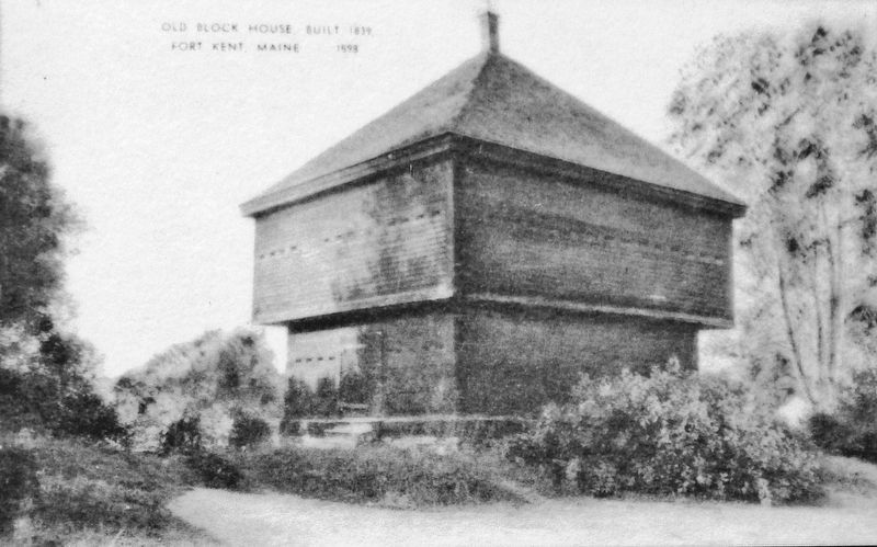
3. Marker detail: Fort Kent Block House
The Fort Kent Block House, named in honor of Maine governor Edward Kent, was constructed in 1839-40 during a period of tensions over the border between New Brunswick and Maine. Troops from both sides mustered to protect their lumber interests, but no battles were fought in the "Bloodless Aroostook War." The border was resolved in 1842 by treaty.
Related markers. Click here for a list of markers that are related to this marker. Northern Forest Canoe Trail
Also see . . . Wabanaki Confederacy (Wikipedia). Members of the Wabanaki Confederacy, the Wabanaki peoples, are in and named for the area which they call Wabanahkik ("Dawnland"), roughly the area that became the French colony of Acadia. The confederacy has historically united five North American Algonquian language-speaking First Nations peoples. Members of the Wabanaki Confederacy are:
• (Eastern) Abenaki or Panuwapskek (Penobscot);
• (Western) Abenaki;
• Míkmaq (Mi'kmaq, L'nu, or Micmac);
• Peskotomuhkati (Passamaquoddy); and
• Wolastoqew , Wolastoq (Maliseet or Malicite). (Submitted on April 15, 2020, by Cosmos Mariner of Cape Canaveral, Florida.)
Courtesy of Faye Hafford
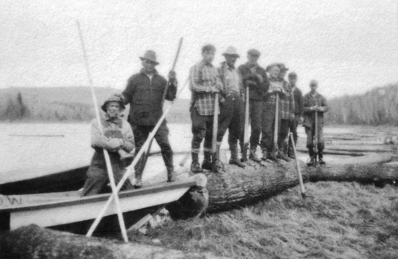
4. Marker detail: River Drivers on Allagash River
For more than a century, the Allagash River was used to move logs to the mills. In the spring, river drivers followed the logs downstream, riding the rafts of logs, wading into frigid water to push the logs along, risking their lives to break logjams in raging rapids.
Courtesy of Janice Bouchard
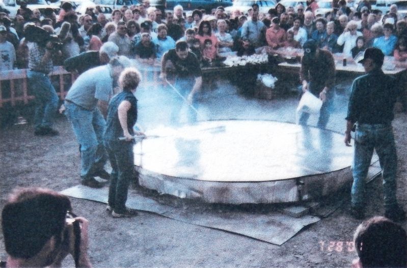
5. Marker detail: Ployes Festival
Ployes Festival Members of Bouchard Family Farms spread out "the world's largest ploye" at the 2001 Ployes Festival in Fort Kent. A ploye is a traditional crepe made from buckwheat and wheat flour. For generations, ployes were the principal bread for local French-Canadians and Acadians.
Credits. This page was last revised on June 25, 2020. It was originally submitted on April 15, 2020, by Cosmos Mariner of Cape Canaveral, Florida. This page has been viewed 256 times since then and 19 times this year. Photos: 1, 2, 3, 4, 5, 6. submitted on April 15, 2020, by Cosmos Mariner of Cape Canaveral, Florida.
