Dover in Stewart County, Tennessee — The American South (East South Central)
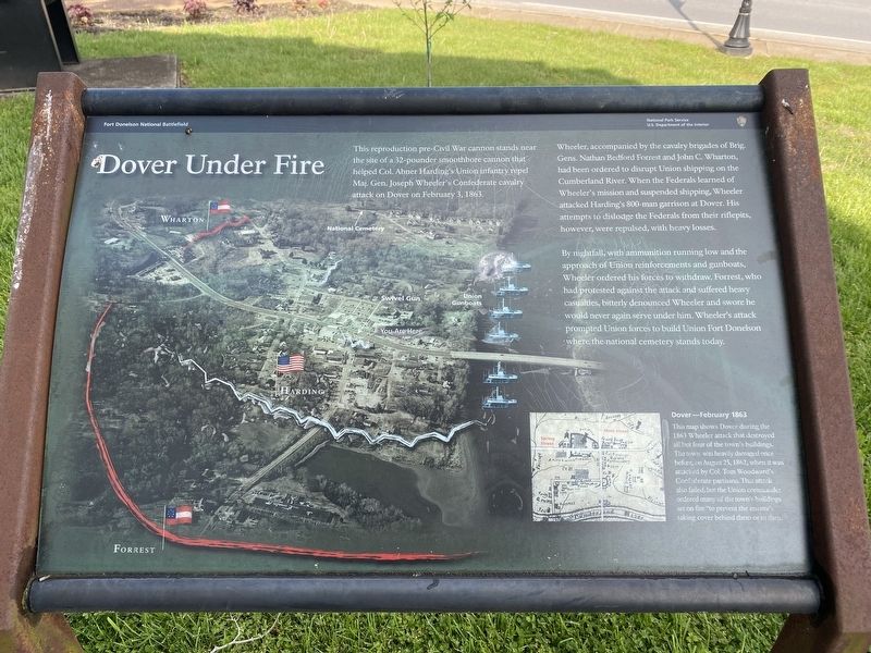
Dover Under Fire
Fort Donelson National Battlefield
This reproduction pre-Civil War cannon stands near the site of a 32-pounder smoothbore cannon that helped Col. Abner Harding's Union infantry repel Maj. Gen. Joseph Wheeler's Confederate cavalry attack on Dover on February 3, 1863.
Wheeler, accompanied by the cavalry brigades of Brig. Gens. Nathan Bedford Forrest and John C. Wharton, had been ordered to disrupt Union shipping on the Cumberland River. When the Federals learned of Wheeler's mission and suspended shipping, Wheeler attacked Harding's 800-man garrison at Dover. His attempts to dislodge the Federals from their riflepits, however, were repulsed, with heavy losses.
By nightfall, with ammunition running low and the approach of Union reinforcements and gunboats, Wheeler ordered his forces to withdraw. Forrest, who had protested against the attack and suffered heavy casualties, bitterly denounced Wheeler and swore he would never again serve under him. Wheeler's attack prompted Union forces to build Union Fort Donelson where the national cemetery stands today.
Dover - February 1863
This map shows Dover during the 1863 Wheeler attack that destroyed all but four of the town's buildings. The town was heavily damaged once before, on August 25, 1862, when it was attacked by Col. Tom Woodward's Confederate partisans. That attack also failed, but the Union commander ordered many of the town's buildings set on fire “to prevent the enemy's taking cover behind them or in then."
Erected by National Park Service, U.S. Department of the Interior.
Topics. This historical marker is listed in this topic list: War, US Civil. A significant historical date for this entry is February 3, 1863.
Location. 36° 29.294′ N, 87° 50.353′ W. Marker is in Dover, Tennessee, in Stewart County. Marker is on Main Street just south of Pillow Street, on the left when traveling south. Touch for map. Marker is in this post office area: Dover TN 37058, United States of America. Touch for directions.
Other nearby markers. At least 8 other markers are within walking distance of this marker. To All Who Served (a few steps from this marker); History of the Stewart County Courthouse (within shouting distance of this marker); The Stewart County Iron Industry (about 300 feet away, measured in a direct line); Surrender House (about 700 feet away); Rice House (about 700 feet away); a different marker also named Rice House (about 700 feet away); C.S.A. Headquarters (about 700 feet away); Dover Hotel (approx. 0.2 miles away). Touch for a list and map of all markers in Dover.
Credits. This page was last revised on April 3, 2021. It was originally submitted on April 18, 2020, by Darren Jefferson Clay of Duluth, Georgia. This page has been viewed 269 times since then and 39 times this year. Photos: 1. submitted on May 14, 2020, by Darren Jefferson Clay of Duluth, Georgia. 2. submitted on April 3, 2021, by Darren Jefferson Clay of Duluth, Georgia. • J. Makali Bruton was the editor who published this page.

