
Colonia Centro de Azcapotzalco in Ciudad de México, Mexico — The Valley of Mexico (The Central Highlands)
The Dominican Convent of Atzcapotzalco
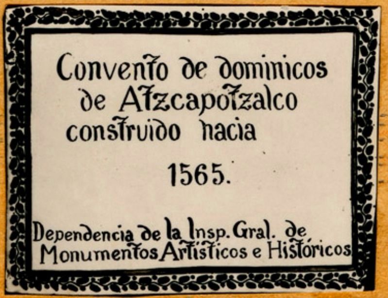
circa 1955
1. The Dominican Convent of Atzcapotzalco Marker
This photo of the marker is courtesy of the Mediateca INAH. It was originally placed ca. 1955.

Dependencia de la Insp. Gral. de Monumentos Artísticos e Históricas
The Dominican Convent of Atzcapotzalco was constructed here starting in 1565.
Dependence of the Inspector General of Artistic and Historic Monuments
Erected by Dependencia de la Inspectoría General de Monumentos Artísticos e Históricas.
Topics. This historical marker is listed in these topic lists: Colonial Era • Religion & Religious Structures. A significant historical year for this entry is 1565.
Location. 19° 28.828′ N, 99° 11.125′ W. Marker is in Ciudad de México. It is in Colonia Centro de Azcapotzalco. It is on Avenida Azcapotzalco just north of Morelos y Pavón, on the right when traveling north. Touch for map. Marker is in this post office area: Ciudad de México 02000, Mexico. Touch for directions.

Regionally, this marker is in Central Mexico and specifically in Mexico City Metropolitan Area. Globally, it is in North America, specifically in Mesoamerica, on the Ring of Fire, and in the Western Hemisphere. Historically, it finds itself in what
this page online
Other nearby markers. At least 8 other markers are within 6 kilometers of this marker, measured as the crow flies: Plaza of the Tree of the Night of Sorrows (approx. 2.8 kilometers away); The American Cemetery in Mexico City (approx. 4.8 kilometers away); 400th Anniversary of the Virgin at Tepeyac (approx. 5.2 kilometers away); Francisco Díaz Covarrubias (approx. 5.3 kilometers away); Ignacio Manuel Altamirano (approx. 5.3 kilometers away); José Rosas Moreno (approx. 5.4 kilometers away); Antonio Caso (approx. 5.4 kilometers away); Guillermo Prieto (approx. 5.4 kilometers away). Touch for a list and map of all markers in Ciudad de México.
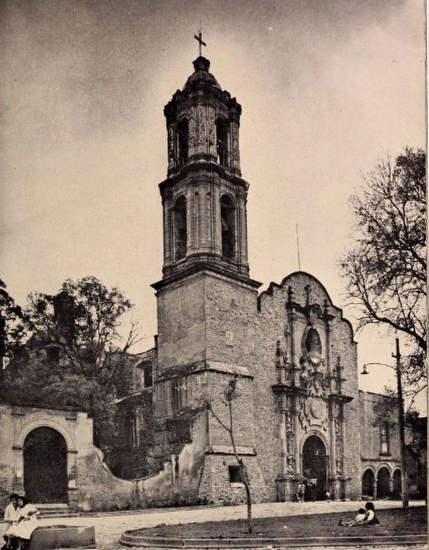
1963
2. The Entrance of the Large Church (at Atzcapotzalco)
La entrada de la iglesia grande. Image from "Los dominicos y Azcapotzalco: estudio sobre el Convento de Predicadores en la antigua villa", by Manrique, Jorge Alberto; Maya S., Agustín, 1963. Note that the marker can likely be seen to the right of the church's entrance.
Credits. This page was last revised on April 18, 2020. It was originally submitted on April 18, 2020, by J. Makali Bruton of Washington, District of Columbia. This page has been viewed 347 times since then and 28 times this year. Photos: 1, 2. submitted on April 18, 2020, by J. Makali Bruton of Washington, District of Columbia.
Editor’s want-list for this marker. A photo of the marker if it still exists. • A photo of the previous location of the marker at or near today's Catedral de los Santos Apóstoles Felipe y Santiago. • Can you help?
