North Memphis in Shelby County, Tennessee — The American South (East South Central)
The Brick Church
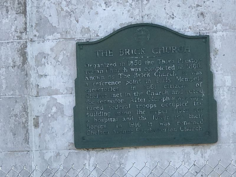
Photographed by Duane and Tracy Marsteller, April 18, 2020
1. The Brick Church Marker
Erected by Shelby County Historical Commission.
Topics. This historical marker is listed in these topic lists: Religion & Religious Structures • War, US Civil. A significant historical year for this entry is 1856.
Location. 35° 9.785′ N, 90° 2.317′ W. Marker is in Memphis, Tennessee, in Shelby County. It is in North Memphis. It is at the intersection of Chelsea Avenue (Tennessee Route 3) and North 6th Street, on the right when traveling east on Chelsea Avenue. Touch for map. Marker is at or near this postal address: 299 Chelsea Avenue, Memphis TN 38107, United States of America. Touch for directions.

Regionally, this marker is in West Tennessee. It is also in the American South, specifically in the
this page online
Other nearby markers. At least 8 other markers are within walking distance of this marker: American Studios / Elvis Presley at American Studios (about 600 feet away, measured in a direct line); Burkle Estate (approx. 0.3 miles away); Porter-Leath Children's Center (approx. 0.4 miles away); Humes High School (approx. 0.4 miles away); St.Jude Children's Research Hospital Memphis to Peoria Run (approx. 0.6 miles away); William Herbert Brewster, Sr. (approx. 0.6 miles away); Isaac Hayes (approx. 0.6 miles away); Manassas High School / The Cora P. Taylor Auditorium (approx. 0.7 miles away). Touch for a list and map of all markers in Memphis.
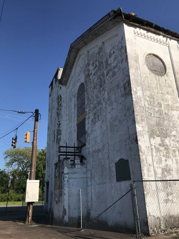
Photographed by Duane and Tracy Marsteller, April 18, 2020
2. The Brick Church Marker
Credits. This page was last revised on February 7, 2023. It was originally submitted on April 20, 2020, by Duane and Tracy Marsteller of Murfreesboro, Tennessee. This page has been viewed 2,544 times since then and 141 times this year. Photos: 1, 2. submitted on April 20, 2020, by Duane and Tracy Marsteller of Murfreesboro, Tennessee. • Bernard Fisher was the editor who published this page.
