Newport Beach in Orange County, California — The American West (Pacific Coastal)
Upper Newport Bay
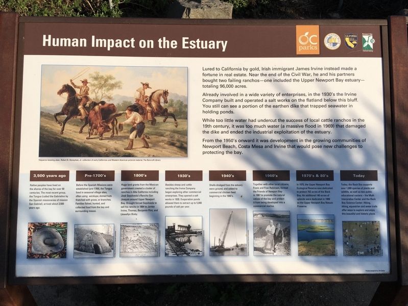
Human Impact on the Estuary
Lured to California by gold, Irish immigrant James Irvine instead made a fortune in real estate. Near the end of the Civil War, he and his partners bought two failing ranchos — one included the Upper Newport Bay estuary totaling 96,000 acres.
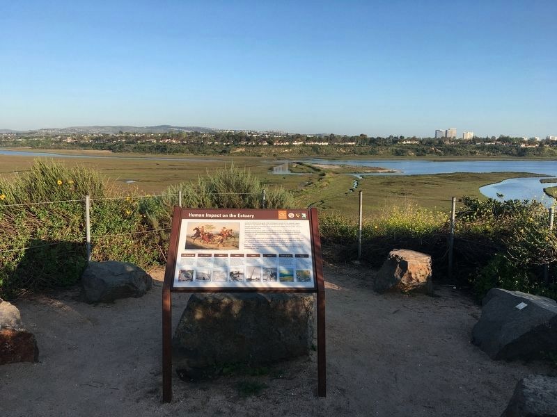
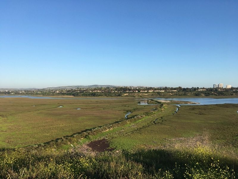
Already involved in a wide variety of enterprises, in the 1930's the Irvine Company built and operated a salt works on the flatland below this bluff. You still can see a portion of the earthen dike that trapped seawater in holding ponds.
While too little water had undercut the success of local cattle ranchos in the 19th century, it was too much water (a massive flood in 1969) that damaged the dike and ended the industrial exploitation of the estuary.
From the 1950's onward it was development in the growing communities of Newport Beach, Costa Mesa and Irvine that would pose new challenges to protecting the bay.
3,500 years ago
Native peoples have lived on the shores of the bay for over 90 centuries. The most recent group, the Tongva (called the Gabrielino by the Spanish missionaries of mission San Gabriel), arrived about 3,500 years ago.
Pre-1700's
Before the Spanish Missions were established (pre-1769), the Tongva lived in seasonal village sites, often using wickiups, domed huts thatched with grass, or branches. Families fished, hunted, and collected food from the bay and surrounding mesas.
1800's
Huge land grants from the Mexican government created a cluster of ranchos in Alta California including Jose Sepulveda's Rancho San Joaquin around Upper Newport Bay. Drought forced Sepulveda to sell his rancho in 1864 to James Irvine, Thomas, Benjamin Flint, and Llewellyn Bixby.
1930's
Besides sheep and cattle ranching the Irvine Company began exploring other commercial enterprises. They opened a salt works in 1935. Evaporation ponds allowed them to extract up to 5,000 pounds of salt per year.
1940's
Shells dredged from the estuary were ground, and added to commercial chicken feed beginning in the 1940's.
1960's
Together with other local citizens, Frank and Fran Robinson, formed the Friends of Newport Bay in 1967 to promote the natural values of the bay and protect it from being developed into a commercial marina.
1970's & 80's
In 1975, the Upper Newport Bay Ecological Reserve was dedicated to protect 752 acres of the Back Bay. An additional 140 acres of uplands were dedicated in 1989 as the Upper Newport Bay Nature Preserve.
Today
Today, the Back Bay supports over 1,000 species of plants and wildlife, as well as two public educational centers — the Muth Interpretive Center and the Back Bay Science Center. Hiking, biking, equestrian and water trails offer ways to explore and enjoy this beautiful and historic place.
Topics. This historical marker is listed in these topic lists: Hispanic Americans • Industry & Commerce • Native Americans • Settlements & Settlers.
Location. 33° 39.106′ N, 117° 53.339′ W. Marker is in Newport Beach, California, in Orange County. Marker can be reached from University Drive east of Irvine Avenue. Park at the Upper Newport Bay Interpretive Center and hike a half-mile south along the bluff trails to the marker. Touch for map. Marker is at or near this postal address: 2301 University Drive, Newport Beach CA 92660, United States of America. Touch for directions.
Other nearby markers. At least 8 other markers are within 2 miles of this marker, measured as the crow flies. Santa Ana Army Air Base Site (approx. 1.4 miles away); Safeway Store 1929(c) (approx. 1.8 miles away); Middaugh Shoes 1929(c) (approx. 1.8 miles away); Mesa Cleaners 1926(c) (approx. 1.8 miles away); Pennant Bakery 1925(c) (approx. 1.8 miles away); Chapman Billiard Parlor 1928(c) (approx. 1.8 miles away); Braddy's Barber Shoppe 1921(c) (approx. 1.8 miles away); Mesa Tavern 1928(c) (approx. 1.8 miles away).
Credits. This page was last revised on November 2, 2020. It was originally submitted on April 21, 2020, by Craig Baker of Sylmar, California. This page has been viewed 350 times since then and 45 times this year. Photos: 1, 2, 3. submitted on April 21, 2020, by Craig Baker of Sylmar, California. • Syd Whittle was the editor who published this page.


