Spokane in Spokane County, Washington — The American West (Northwest)
An Evolving Shoreline
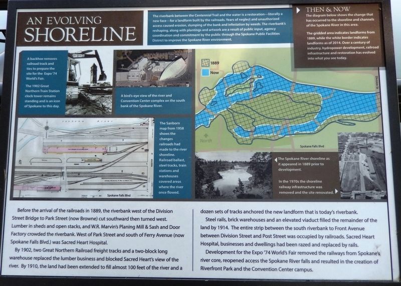
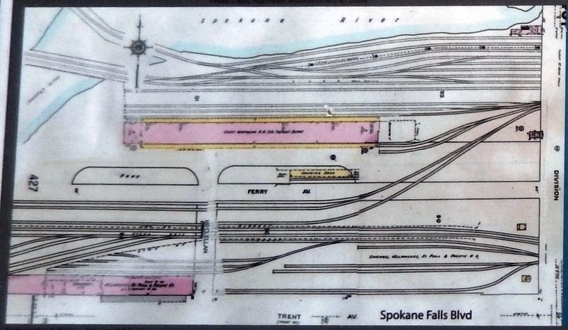
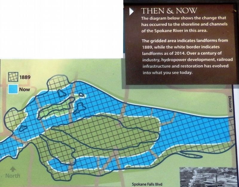
By 1902, two Great Northern Railroad freight tracks and a two-block long warehouse replaced the lumber business and blocked Sacred Heart's view of the river. By 1910, the land had been extended to fill almost 100 feet of the river and a dozen sets of tracks anchored the new landform that is today's riverbank.
Steel rails, brick warehouses and an elevated viaduct filled the remainder of the land by 1914. The entire strip between the south riverbank to Front Avenue between Division Street and Post Street was occupied by railroads. Sacred Heart Hospital, businesses and dwellings had been razed and replaced by rails.
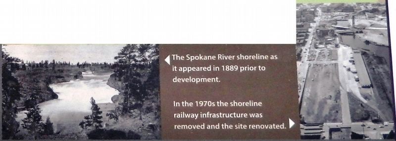
Development for the Expo '74 World's Fair removed the railways from Spokane's river core, reopened access the Spokane River falls and resulted in the creation of Riverfront Park and the Convention Center campus.
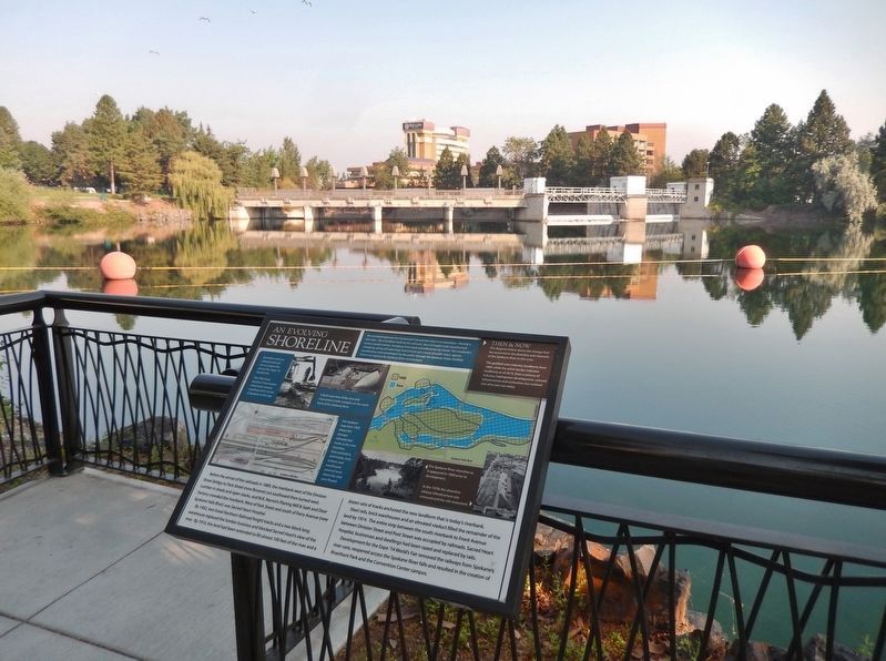
The riverbank between the Centennial Trail and the water is a restoration—literally a new face — for a landform built by the railroads. Years of neglect and unauthorized access caused erosion, slumping of the bank and infestation by weeds. The riverbank's reshaping, along with plantings and artwork are a result of public input, agency coordination and commitment by the public through the Spokane Public Facilities District to improve the Spokane River environment.
Topics. This historical marker is listed in these topic lists: Industry & Commerce • Parks & Recreational Areas • Railroads & Streetcars • Waterways & Vessels. A significant historical year for this entry is 1889.
Location. 47° 39.711′ N, 117° 24.853′ W. Marker is in Spokane, Washington, in Spokane County. Marker can be reached from North Spokane Falls Court, 0.1 miles north of West Spokane Falls Boulevard. Marker is located along the Centennial Trail, overlooking the Spokane River, on the north side of the Spokane Convention Center. Touch for map. Marker is at or near this postal address: 322 North Spokane Falls Court, Spokane WA 99201, United States of America. Touch for directions.
Other nearby markers. At least 8 other markers are within walking distance of this marker. Industry on the Spokane River (within shouting distance of this marker); A Legacy of Railroads (within shouting distance of this marker); What's in the Water (about 300 feet away, measured in a direct line); How the River Became Home for Sqelix — Spokane Tribe (about 300 feet
2. Marker detail: Then & Now
This diagram shows the change that has occurred to the shoreline and channels of the Spokane River in this area. The gridded area indicates landforms from 1889, while the white border indicates landforms as of 2014. Over a century of industry, hydropower development, railroad infrastructure and restoration has evolved into what you see today.
Also see . . . Rediscovering the River. Riverfront Park was once a tangled mess of railroad tresses and industrial overgrowth. During the 1960s it was hard to even tell that a river flowed through the city because it was largely covered by railroad tracks and parking lots. The story of Riverfront Park is a story of several influential Spokanites whose goal was to rejuvenate Spokane’s central business district and reclaim the beauty of the river. (Submitted on April 23, 2020, by Cosmos Mariner of Cape Canaveral, Florida.)
3. Marker detail: Convention Center
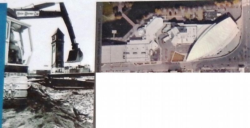
(left) A backhoe removes railroad track and ties to prepare the site for the Expo '74 World's Fair. The 1902 Great Northern Train Station clock tower remains standing and is an icon of Spokane to this day.
(right) A bird's-eye view of the river and Convention Center complex on the south bank of the Spokane River.
(right) A bird's-eye view of the river and Convention Center complex on the south bank of the Spokane River.
Credits. This page was last revised on April 23, 2020. It was originally submitted on April 21, 2020, by Cosmos Mariner of Cape Canaveral, Florida. This page has been viewed 142 times since then and 10 times this year. Photos: 1, 2, 3, 4, 5, 6. submitted on April 23, 2020, by Cosmos Mariner of Cape Canaveral, Florida.
