Upland in San Bernardino County, California — The American West (Pacific Coastal)
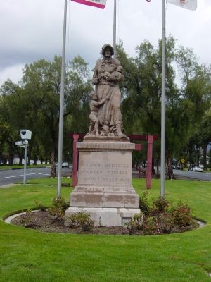
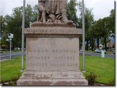
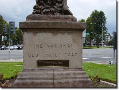
Madonna of the Trail
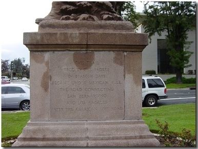
(East Face) This trail, trod by the Padres in Spanish Days, became, under Mexican rule, the road connecting Los Angeles, later the American Post Road.
(North Face) The National Old Trails Road.
(West Face) Over this trail, November 1826, Jedediah Smith, seeking a river flowing westward, led a band of sixteen trappers, the first Americans to enter California overland.
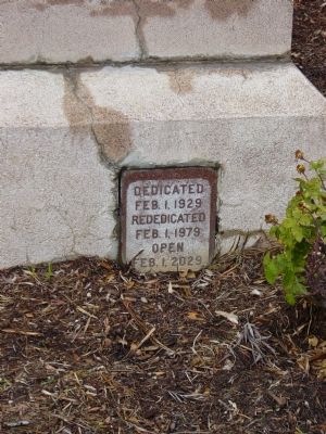
Erected 1929 by National Society of the Daughters of the American Revolution. (Marker Number 1028.)
Topics and series. This historical marker is listed in these topic lists: Roads & Vehicles • Settlements & Settlers. In addition, it is included in the California Historical Landmarks, the Daughters of the American Revolution, and the Madonnas of the Trail series lists. A significant historical date for this entry is November 28, 1826.
Location. 34° 6.435′ N, 117° 39.071′ W. Marker is in Upland, California, in San Bernardino County. Marker is at the intersection of Euclid Avenue (California Route 83) and Foothill Boulevard (California Route 66), in the median on Euclid Avenue. Touch for map. Marker is in this post office area: Upland CA 91786, United States of America. Touch for directions.
Other nearby markers. At least 8 other markers are within 2 miles of this marker, measured as the crow flies. George Chaffey, Jr. (approx. 0.6 miles away); City of Upland History (approx. 0.6 miles away); Veterans' Monument Project (approx. 0.6 miles away); San Antonio Hospital History (approx. 0.6 miles away); Upland Public Library (approx. 0.6 miles away); Magic Lamp Inn (approx. 1.4 miles away); Bear Gulch (approx. 1.6 miles away); Armsley Square Historic District (approx. 1.6 miles away). Touch for a list and map of all markers in Upland.
Regarding Madonna of the Trail. This is the westernmost of 12 statues placed in the early 20th Century along what became U.S. Routes 40 and 66. All 12 statues are exactly the same.
This is California Historical Landmark No. 1028.
Related markers. Click here for a list of markers that are related to this marker.
Credits. This page was last revised on April 30, 2020. It was originally submitted on March 12, 2006, by Joseph Beeman of Upland, California. This page has been viewed 4,737 times since then and 56 times this year. Last updated on April 29, 2020, by Craig Baker of Sylmar, California. Photos: 1, 2. submitted on March 12, 2006, by Joseph Beeman of Upland, California. 3, 4, 5, 6. submitted on March 13, 2006, by Joseph Beeman of Upland, California. • Syd Whittle was the editor who published this page.
