Hazard in Los Angeles in Los Angeles County, California — The American West (Pacific Coastal)
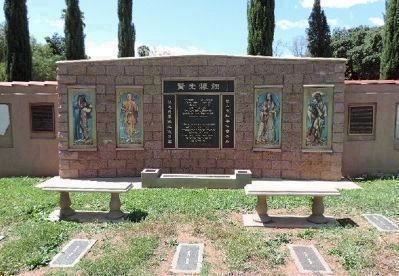
Chinese Cemetery Shrine
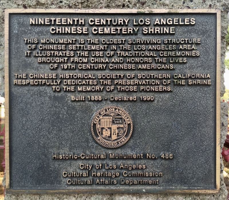
Nineteenth Century Los Angeles
— Evergreen Cemetery —
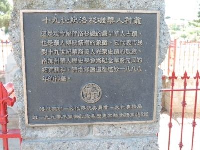
This monument is the oldest surviving structure of Chinese settlement in the Los Angeles area. It illustrates the use of traditional ceremonies brought from China and honors the lives of 19th century Chinese Americans.
The Chinese Historical Society of Southern California respectfully dedicates the preservation of the shrine to the memory of those pioneers.
Built 1888. Declared 1990, Historic-Cultural Monument No. 486, City of Los Angeles, Cultural Heritage Commission, Cultural Affairs Department.
Erected 1990 by City of Los Angeles. (Marker Number 486.)
Topics and series. This historical marker is listed in these topic lists: Asian Americans • Cemeteries & Burial Sites. In addition, it is included in the Los Angeles Historic-Cultural Monument series list. A significant historical year for this entry is 1888.
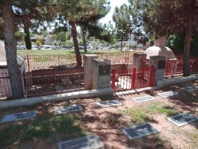
Location. 34° 2.327′ N, 118° 11.68′ W. Marker is in Los Angeles, California, in Los Angeles County. It is in Hazard. Marker can be reached from Evergreen Avenue north of 1st Street. The shrine is located in Section "L" of Evergreen Cemetery - near its southeast corner. It is accessible only via the cemetery's main entrance off Evergreen Avenue. Touch for map. Marker is at or near this postal address: 204 N Evergreen St, Los Angeles CA 90033, United States of America. Touch for directions.
Other nearby markers. At least 8 other markers are within walking distance of this marker. Chinese Memorial (a few steps from this marker); Evergreen Cemetery (about 600 feet away, measured in a direct line); Mexican American All Wars Monument (approx. 0.2 miles away); Japanese-American Soldiers (approx. 0.4 miles away); Japanese Hospital (approx. 0.8 miles away); Otomisan Restaurant (approx. 0.8 miles away); Brooklyn Avenue (approx. 0.9 miles away); Brooklyn & Soto (approx. 0.9 miles away). Touch for a list and map of all markers in Los Angeles.
Also see . . . Graveyards of L.A.: "Evergreen Cemetery - Snapshots of a Forever Changing Boyle Heights". by Hadley Meares, August 30, 2013. (Submitted on May 27, 2014, by Richard E. Miller of Oxon Hill, Maryland.)
Photographed By Richard E. Miller, April 26, 2014
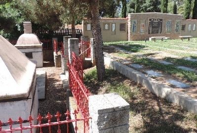
5. Chinese Memorial wall, erected in 2010
"... The extension of the [L.A. Metro Rail] Gold Line in 2005 brought Evergreen's ugly past of racial discrimination into the spotlight. A crew digging under a large 1950s retaining wall that bordered the potter's field portion of the cemetery unearthed the remains of more than 100 people, most of them Asian males. Jade bracelets, rice bowls, opium pipes, and a few gravestones were also found. It seems that after the Chinese stopped their burials, the cemetery slowly erased almost all signs that the Chinese had ever been there at all. The remains were reburied with honor at Evergreen, and a 'Memorial Wall' was erected in 2010 next to the restored 1888 ceremonial shrine."
Credits. This page was last revised on February 2, 2023. It was originally submitted on May 27, 2014, by Richard E. Miller of Oxon Hill, Maryland. This page has been viewed 1,078 times since then and 39 times this year. Last updated on April 30, 2020, by Craig Baker of Sylmar, California. Photos: 1. submitted on January 25, 2022, by Craig Baker of Sylmar, California. 2, 3, 4, 5. submitted on May 27, 2014, by Richard E. Miller of Oxon Hill, Maryland. • Syd Whittle was the editor who published this page.
