Canastota in Madison County, New York — The American Northeast (Mid-Atlantic)
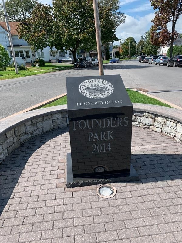
Founders Park
2014
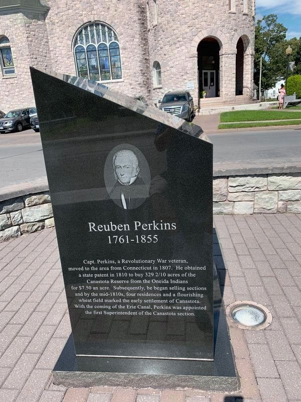
Reuben Perkins
1761-1855
Capt. Perkins, a Revolutionary War veteran, moved to the area from Connecticut in 1807. He obtained a state patent in 1810 to buy 329 2/10 acres of the Canastota Reserve from the Oneida Indians for $7.50 an acre. Subsequently, he began selling sections and by the mid-1810s, four residences and a flourishing wheat field marked the early settlement of Canastota. With the coming of the Erie Canal, Perkins was appointed the first Superintendent of the Canastota section.
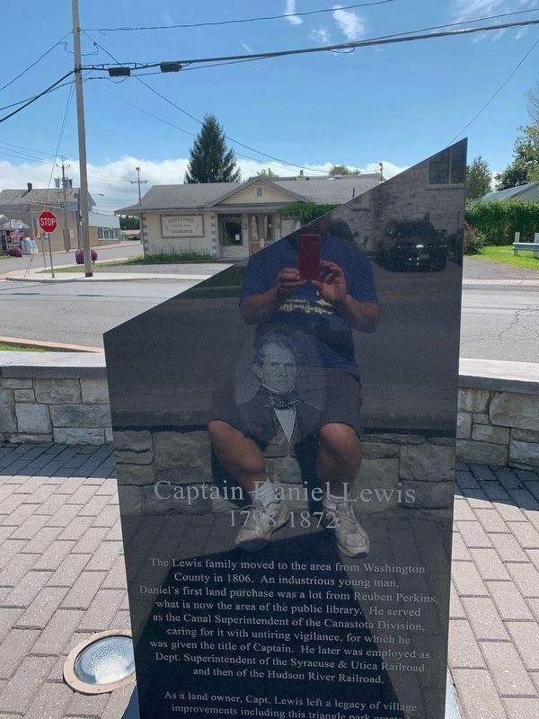
Captain Daniel Lewis
1798 – 1872
The Lewis family moved to the area from Washington County in 1806. An industrious young man, Daniel's first land purchase was a lot from Reuben Perkins, what is now the area of the public library. He served as the Canal Superintendent of the Canastota Division, caring for it with untiring vigilance, for which he was given the title of Captain. He later was employed as Dept. Superintendent of the Syracuse & Utica Railroad and then of the Hudson River Railroad.
As a land owner, Capt. Lewis left a legacy of village improvements including this triangle park corner.
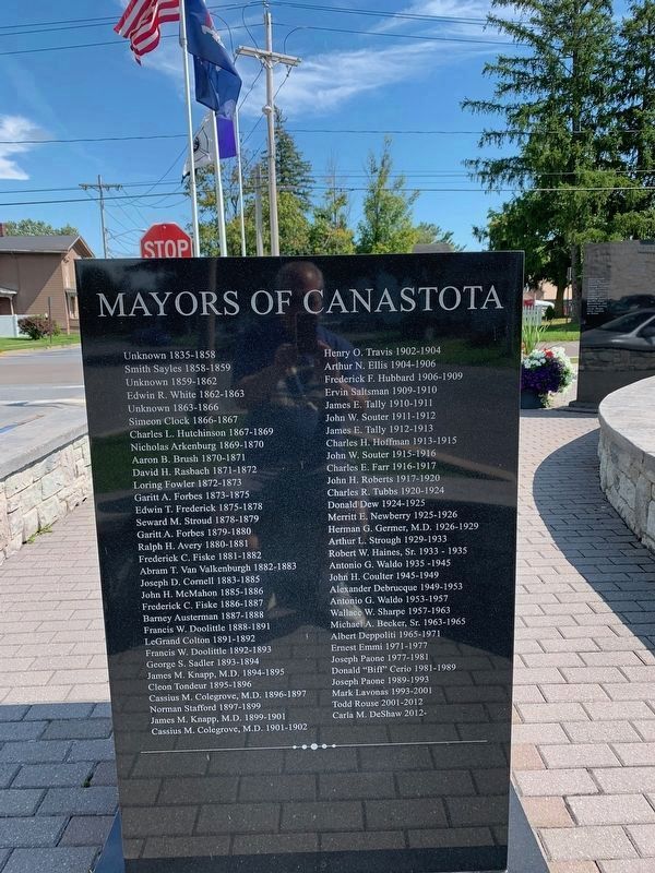
Mayors Of Canastota
Unknown 1835 – 1858
Smith Sayles 1858-1859
Unknown 1859-1862
Edwin R. White 1862-1863
Unknown 1863 – 1866
Simeon Clock 1866-1867
Charles L. Hutchinson 1867-1869
Nicholas Arkenburg 1869-1870
Aaron B. Brush 1870-1871
David H. Rasbach 1871-1872
Loring Fowler 1872-1873
Garitt A. Forbes 1873-1875
Edwin T. Frederick 1875-1878
Seward M. Stroud 1878-1879
Garitt A. Forbes 1879-1880
Ralph H. Avery 1880-1881
Frederick C. Fiske 1881-1882
Abram T. Van Valkenburgh 1882-1883
Joseph D. Cornell 1883-1885
John H. McMahon 1885-1886
Frederick C. Fiske 1886-1887
Barney Austerman 1887-1888
Francis W. Doolittle 1888-1891
LeGrand Colton 1891-1892
Francis W. Doolittle 1892-1893
George S. Sadler 1893-1894
James M. Knapp, M.D. 1894-1895
Cleon Tondeur 1895-1896
Cassius M. Colegrove, M.D. 1896-1897
Norman Stafford 1897-1899
James M. Knapp, M.D. 1899-1901
Cassius M. Colegrove, M.D. 1901-1902
Henry O. Travis 1902-1904
Arthur N. Ellis 1904-1906
Frederick F. Hubbard 1906-1909
Ervin Saltsman 1909-1910
James E. Tally 1910-1911
John W. Souter 1911-1912
James E. Tally 1912-1913
Charles H. Hoffman 1913-1915
John W. Souter 1915-1916
Charles E. Farr 1916-1917
John H. Roberts 1917-1920
Charles R. Tubbs 1920-1924
Donald Dew 1924-1925
Merritt E. Newberry 1925-1926
Herman G. Germer, M.D. 1926-1929
Arthur L. Strough 1929-1933
Robert W. Haines, Sr. 1933-1935
Antonio G. Waldo 1935 -1945
John H. Coulter 1945-1949
Alexander Debrucque 1949-1953
Antonio G. Waldo 1953-1957
Wallace W. Sharpe 1957-1963
Michael A. Becker, Sr. 1963-1965
Albert Deppoliti 1965-1971
Ernest Emmi 1971-1977
Joseph Paone 1977-1981
Donald "Biff’ Cerio 1981-1989
Joseph Paone 1989-1993
Mark Lavonas 1993-2001
Todd Rouse 2001-2012
Carla M. DeShaw 2012-
Topics. This historical marker is listed in these topic lists: Parks & Recreational Areas • Settlements & Settlers. A significant historical year for this entry is 1807.
Location. 43° 4.85′ N, 75° 45.307′ W. Marker is in Canastota, New York, in Madison County. Marker is at the intersection of North Main Street and New Boston Street, on the left when traveling north on North Main Street. Touch for map. Marker is in this post office area: Canastota NY 13032, United States of America. Touch for directions.
Other nearby markers. At least 8 other markers are within walking distance of this marker. Carmen Basilio (about 400 feet away, measured in a direct line); Enlarging the Erie Canal (approx. 0.2 miles away); Canastota's Basin (approx. 0.2 miles away); Canal Town (approx. 0.2 miles away); Canal Street (approx. 0.2 miles away); Peterboro Street Lift Bridge (approx. 0.2 miles away); Canastota's Lift Bridge (approx. 0.2 miles away); Reuben Perkins (approx. 0.2 miles away). Touch for a list and map of all markers in Canastota.
Credits. This page was last revised on May 5, 2020. It was originally submitted on May 2, 2020, by Steve Stoessel of Niskayuna, New York. This page has been viewed 167 times since then and 22 times this year. Photos: 1, 2, 3, 4. submitted on May 2, 2020, by Steve Stoessel of Niskayuna, New York. • Michael Herrick was the editor who published this page.


