Murphys in Calaveras County, California — The American West (Pacific Coastal)
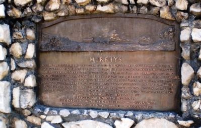
Murphys
Erected 1937 by Ruby Parlor No. 46, Native Daughters of the Golden West, Chispa Parlor No. 139, Native Sons of the Golden West. (Marker Number 275.)
Topics and series. This historical marker is listed in these topic lists: Industry & Commerce • Settlements & Settlers • War, US Civil • Waterways & Vessels. In addition, it is included in the California Historical Landmarks, and the Native Sons/Daughters of the Golden West series lists. A significant historical month for this entry is May 1863.
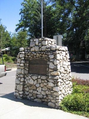
Location. 38° 8.252′ N, 120° 27.714′ W. Marker is in Murphys, California, in Calaveras County. Marker is at the intersection of Main Street and Jones Street on Main Street. Bronze plaque placed on granite & quartz pedistal at center of intersection. Touch for map. Marker is at or near this postal address: Main Street, Murphys CA 95247, United States of America. Touch for directions.
Other nearby markers. At least 8 other markers are within walking distance of this marker. Murphy Brothers (within shouting distance of this marker); Stangetti – Solari – Cademartori Store (within shouting distance of this marker); Albert A. Michelson (about 300 feet away, measured in a direct line); Masonic Hall (about 400 feet away); Murphys' Oldest Wooden Home (about 500 feet away); Native Sons of the Golden West (about 600 feet away); Old Segale Building (about 700 feet away); The Murphys Pokey (about 800 feet away). Touch for a list and map of all markers in Murphys.
Credits. This page was last revised on May 4, 2020. It was originally submitted on November 30, 2007, by Mathew H. Kohnen of San Jose, California. This page has been viewed 2,707 times since then and 29 times this year. Last updated on May 2, 2020, by Craig Baker of Sylmar, California. Photos: 1. submitted on April 30, 2008, by Andrew Ruppenstein of Lamorinda, California. 2. submitted on January 11, 2008, by Kevin W. of Stafford, Virginia. 3, 4. submitted on May 2, 2009. • Syd Whittle was the editor who published this page.


