Near Henrico in Henrico County, Virginia — The American South (Mid-Atlantic)
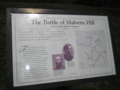
The Battle of Malvern Hill
Advance of the Excelsior Regiments
- H. C. Ford, 72nd New York Infantry
The earliest Confederate attacks on this part of the battlefield came from across Western Run, a stream located several hundred yards to the northeast. Men from Couch’s division stopped these attacks without great exertion, but ammunition dwindled and Confederate troops began to accumulate on the edge of the hill.
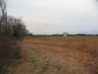
General Couch called for reinforcements and received six fresh regiments. Two of them, under the supervision of 27-year-old Francis C. Barlow, established a line of battle here in the open field just to the right of this road. They soon were joined by two other regiments from Daniels Sickles’s Excelsior Brigade of New York City.
Colonel Nelson Taylor’s 72nd New York approached the front lines along this very farm lane: “I moved my regiment … up a narrow road on the left of [a] piece of woods until I reached an open field on the right skirted on three sides by woods, and in this field our forces were engaging the enemy …”
Topics. This historical marker is listed in this topic list: War, US Civil.
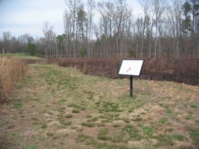
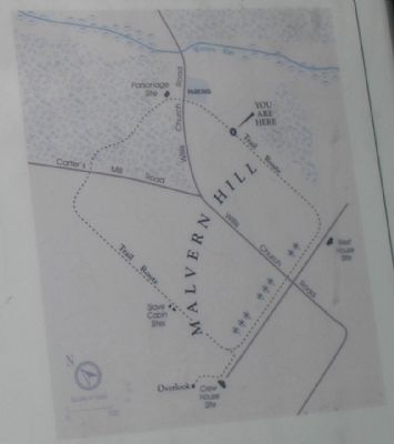
Location. 37° 25.002′ N, 77° 14.774′ W. Marker is near Henrico, Virginia, in Henrico County. Marker can be reached from Willis Church Road (Virginia Route 156) 0.2 miles north of Carter Mills Road, on the left when traveling south. Marker is located along a hiking trail that passes through the parking lot on the east side of Willis Church Road. Touch for map. Marker is at or near this postal address: 9051 Malvern Hill Battlefield Terrain, Henrico VA 23231, United States of America. Touch for directions.
Other nearby markers. At least 8 other markers are within walking distance of this marker. Infantry Against Infantry (within shouting distance of this marker); Confederate Attacks Stall (about 300 feet away, measured in a direct line); a different marker also named The Battle of Malvern Hill (about 300 feet away); Twilight Action (about 500 feet away); Malvern Hill Trail (about 500 feet away); Methodist Parsonage (about 700 feet away); Battle Commences (about 700 feet away); Willis Church Parsonage (about 700 feet away). Touch for a list and map of all markers in Henrico.
More about this marker. The bottom of the marker contains photographs of two Union officers. They have captions of “At Malvern Hill Col. Nelson Taylor commanded the 72nd New York, part of Sickles’s brigade. Taylor later became a brigadier general, but resigned from the army in January 1863.” And “Francis C. Barlow, who ended the

2. Malvern Hill - CWPT
Civil War Preservation Trust's efforts to preserve portions of the battlefield.
Click for more information.
Click for more information.
Also see . . .
1. Malvern Hill. CWSAC Battle Summaries. (Submitted on January 1, 2009, by Bill Coughlin of Woodland Park, New Jersey.)
2. Malvern Hill Battlefield Podcast. National Park Service website. (Submitted on January 1, 2009, by Bill Coughlin of Woodland Park, New Jersey.)
Credits. This page was last revised on July 7, 2021. It was originally submitted on January 1, 2009, by Bill Coughlin of Woodland Park, New Jersey. This page has been viewed 1,278 times since then and 15 times this year. Photos: 1. submitted on January 1, 2009, by Bill Coughlin of Woodland Park, New Jersey. 2. submitted on March 28, 2010, by Craig Swain of Leesburg, Virginia. 3, 4. submitted on March 31, 2010, by Craig Swain of Leesburg, Virginia. 5. submitted on January 1, 2009, by Bill Coughlin of Woodland Park, New Jersey.


