Micanopy in Alachua County, Florida — The American South (South Atlantic)
Micanopy, Florida
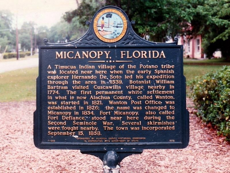
Photographed by Tim Fillmon, circa 1993
1. Micanopy, Florida Marker
Erected 1972 by Alachua County Historical Commission In Cooperation With Department of State. (Marker Number F-202.)
Topics. This historical marker is listed in these topic lists: Exploration • Indigenous Peoples and Communities • Settlements & Settlers. A significant historical year for this entry is 1834.
Location. This marker has been replaced by another marker nearby. It was located near 29° 30.356′ N, 82° 16.776′ W. Marker was in Micanopy, Florida, in Alachua County. It was at the intersection of Northeast 1st Street (County
this page online

Regionally, this marker was in North Florida. It was also in the American South. Globally, it was in the North Atlantic Region, North America, a Gulf of Mexico state, the Western Hemisphere, the Western World, and the Anglosphere. Historically, it found itself in what was once New Spain, the territory of the Mississippian Culture, one of the Confederate States of America, and the Antebellum South.
Other nearby markers. At least 8 other markers are within walking distance of this location: A different marker also named Micanopy (here, next to this marker); Moses Elias Levy (within shouting distance of this marker); Micanopy Veterans Memorial (about 400 feet away, measured in a direct line); Steamboat Chacala Anchor (about 400 feet away); Thrasher Warehouse (about 600 feet away); Stagecoach Stop (about 600 feet away); The History of Pepsi Cola (about 700 feet away); Home Made Tractor (about 700 feet away). Touch for a list and map of all markers in Micanopy.
More about this marker. This maker was replaced in 2010 with marker number F-706.
Credits. This page was last revised on August 26, 2024. It was originally submitted on March 17, 2020, by Tim Fillmon of Webster, Florida. This page has been viewed 897 times since then and 101 times this year. Last updated on May 3, 2020, by Tim Fillmon of Webster, Florida. Photo 1. submitted on March 17, 2020, by Tim Fillmon of Webster, Florida. • Bernard Fisher was the editor who published this page.
