
Near Clear Spring in Washington County, Maryland — The American Northeast (Mid-Atlantic)
The Federal Signal Station
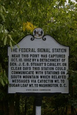
Photographed by Christopher Busta-Peck, September 9, 2007
1. The Federal Signal Station Marker
Erected 1937 by State Roads Commission.
Topics and series. This historical marker is listed in these topic lists: Communications • Roads & Vehicles • War, US Civil. In addition, it is included in the Maryland Historical Trust series list. A significant historical year for this entry is 1862.
Location. 39° 38.754′ N, 77° 58.097′ W. Marker is near Clear Spring, Maryland, in Washington County. It can be reached from Historic National Road, on the left when traveling west. The marker is on an old National Road alignment which arcs off from the current alignment - most maps do not show this as an actual road. Touch for map. Marker is in this post office area: Clear Spring MD 21722, United States of America. Touch for directions.

Regionally, this marker is in Western Maryland. It is also in the American Mid-Atlantic, in Appalachia, and specifically in Northern Appalachia. Globally, it is in North America, the Western Hemisphere, the Western World, and the Anglosphere. Historically, it finds itself in what was once one of the original Thirteen Colonies.
Other nearby markers. At least 8 other markers are within 3 miles of this marker, measured as the crow flies: Gen. J. E. B. Stuart’s (approx. 0.8 miles away); Lancelot Jacques (approx. 1.7 miles away); Fort Frederick (approx. 1.9 miles away); Clear Spring Veterans Memorial (approx. 2 miles away); a different marker also named Fort Frederick (approx. 2.1 miles away); Clear Spring (approx. 2.1 miles away); A Road Nurtures A Vision (approx. 2.3 miles away); Vital Crossroads
this page online
Another marker is no longer nearby. Gettysburg Campaign (was approx. 2.3 miles away but has been permanently removed).
More about this marker. The height of Fairview Mountain continues to make this an important location for communications, as illustrated by the tower atop it.
A service station, which appears to have been converted into a private residence, remains from the days when automobiles, traveling the National Road, would have had trouble climbing up an incline such as this.
The tablet also remains here from a more recent marker, but the text is missing.
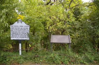
Photographed by Christopher Busta-Peck, September 9, 2007
2. This Marker and Unknown Marker
This may be a Civil War Trails marker is awaiting an inset.
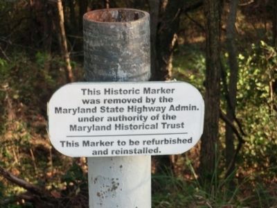
Photographed by Don Morfe
3. Marker was removed for maintenance
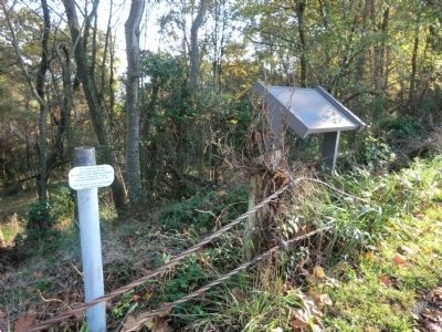
Photographed by Don Morfe
4. Marker removed for maintenance
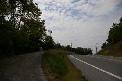
Photographed by Christopher Busta-Peck, September 9, 2007
5. Two Alignments
The older alignment of the National Road, with wire guard rails, on the left, and the newer one, on the right. The marker is to the left.
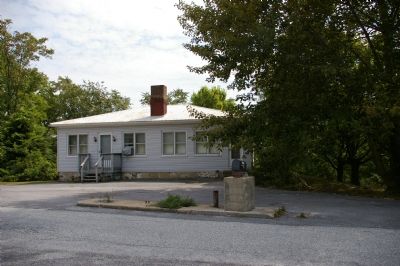
Photographed by Christopher Busta-Peck, September 9, 2007
6. Old Service Station
This old service station is now a private residence. The concrete island in front of the house once held gas pumps.
Credits. This page was last revised on December 30, 2024. It was originally submitted on January 24, 2008, by Christopher Busta-Peck of Shaker Heights, Ohio. This page has been viewed 2,186 times since then and 58 times this year. Last updated on May 5, 2020, by Bradley Owen of Morgantown, West Virginia. Photos: 1, 2. submitted on January 24, 2008, by Christopher Busta-Peck of Shaker Heights, Ohio. 3, 4. submitted on October 26, 2012, by Don Morfe of Baltimore, Maryland. 5, 6. submitted on January 24, 2008, by Christopher Busta-Peck of Shaker Heights, Ohio. • Bill Pfingsten was the editor who published this page.
