Hopewell, Virginia — The American South (Mid-Atlantic)
Beyond the Big House
Petersburg National Battlefield
| — | National Park Service, U.S. Department of the Interior | — |
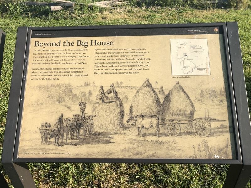
By 1860, Richard Eppes owned 2,300 acres divided into four farms on all sides of the confluence of these two rivers and held 113 people as slaves ranging in an age from a few months old to 79 years old. He hired two men as overseers and one free black man before the Civil War.
Enslaved field hands planted, tended, and harvested wheat, corn, and oats; they also fished, slaughtered livestock, picked fruit, and did other jobs that generated income for the Eppes family.
Eppes' skilled enslaved men worked as carpenters, blacksmiths, and sawyers. One enslaved woman was a weaver and another was a midwife. The enslaved community worked on Eppes' Bermuda Hundred farm (across the Appomattox River where the factory is), on Eppes' Island to the east (across the James River), and south of here at the Appomattox and Hopewell farms. Only the island remains undeveloped today.
Erected by National Park Service, U.S. Department of the Interior.
Topics. This historical marker is listed in these topic lists: African Americans • Agriculture • Industry & Commerce. A significant historical year for this entry is 1860.
Location. 37° 19.043′ N,
this page online

Regionally, this marker is in Central Virginia. It is also in the American South, specifically in the Upper South, and on the Eastern Seaboard. Globally, it is in the North Atlantic Region, North America, the Western Hemisphere, the Western World, and the Anglosphere. Historically, it finds itself in what was once the territory of the Mississippian Culture, one of the original Thirteen Colonies, one of the Confederate States of America, and the Antebellum South.
Other nearby markers. At least 8 other markers are within walking distance of this marker: Resistance and Punishments (here, next to this marker); Preserving and Conserving (within shouting distance of this marker); Grant's Cabin (about 400 feet away, measured in a direct line); The Depot Field Hospital (about 600 feet away); A Busy Supply Hub (about
Photographed by Devry Becker Jones (CC0), May 8, 2020
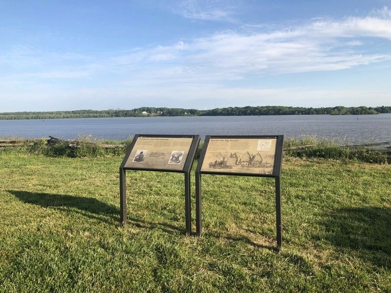
2. Beyond the Big House Marker
The marker is on the right.
Other markers no longer nearby. A Supply Hub (was about 500 feet away but has been replaced with another marker now near it); City Point (was about 700 feet away but has been replaced with another marker now near it); The Peacemaker (was about 700 feet away but has been replaced with another marker now near it); A Busy Port (was about 700 feet away but has been confirmed missing).
Additional keywords. slavery, forced labor
Credits. This page was last revised on March 2, 2022. It was originally submitted on May 9, 2020, by Devry Becker Jones of Washington, District of Columbia. This page has been viewed 478 times since then and 47 times this year. Photos: 1, 2. submitted on May 9, 2020, by Devry Becker Jones of Washington, District of Columbia.
