Ettrick in Chesterfield County, Virginia — The American South (Mid-Atlantic)
The Beginning of Ettrick
Virginia State University
Photographed by Devry Becker Jones (CC0), May 8, 2020
1. The Beginning of Ettrick Marker
Inscription.
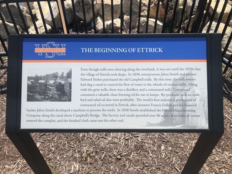
Even though mills were thriving along the riverbank, it was not until the 1830s that the village of Ettrick took shape. In 1830, entrepreneur Jabez Smith and partner Edward Stokes purchased the old Campbell mills. By this time, the mill owners had dug a canal to control the flow of water to the wheels of various mills. Along with the grist mills, there was a distillery and a cottonseed mill. Cottonseed contained a valuable clean-burning oil used for lamps. By-products such as cattle feed and salad oil also were profitable. The world's first industrial production of cottonseed oil occurred in Ettrick, after inventor Francis Follett and his financial backer Jabez Smith developed a machine to process the seeds. In 1838 Smith established the Ettrick Manufacturing Company along the canal above Campbell's Bridge. The factory and canals sprawled over 46 acres. Raw bales of cotton entered the complex, and finished cloth came out of the other end.
Location. 37° 13.99′ N, 77° 25.033′ W. Marker is in Ettrick, Virginia, in Chesterfield County. It is on Chesterfield Avenue (Virginia Route 36), on the right when traveling west. Touch for map. Marker is in this post office area: Fayetteville NC 28303, United States of America. Touch for directions.
Regionally, this marker is in Virginia’s Piedmont, in Central Virginia, and in the Richmond Metropolitan Area. It is also in the American South, specifically in the Upper South, and on the Eastern Seaboard. Globally, it is in the North Atlantic Region, North America, the Western Hemisphere, the Western World, and the Anglosphere. Historically, it finds itself in what was once the territory of the Mississippian Culture, one of the original Thirteen Colonies, one of the Confederate States of America, and the Antebellum South.
Credits. This page was last revised on May 9, 2020. It was originally submitted on May 9, 2020, by Devry Becker Jones of Washington, District of Columbia. This page has been viewed 910 times since then and 55 times this year. Photos:1, 2. submitted on May 9, 2020, by Devry Becker Jones of Washington, District of Columbia.