San Juan Capistrano in Orange County, California — The American West (Pacific Coastal)
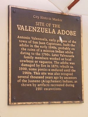
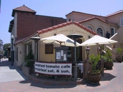
Site of the Valenzuela Adobe
Topics. This historical marker is listed in these topic lists: Hispanic Americans • Notable Places • Settlements & Settlers. A significant historical year for this entry is 1879.
Location. 33° 30.077′ N, 117° 39.771′ W. Marker is in San Juan Capistrano, California, in Orange County. Marker is on Camino Capistrano, on the right when traveling south. Touch for map. Marker is at or near this postal address: 31781 Camino Capistrano, San Juan Capistrano CA 92675, United States of America. Touch for directions.
Other nearby markers. At least 8 other markers are within walking distance of this marker. Franciscan Plaza (a few steps from this marker); Nick's Café (within shouting distance of this marker); Avila Adobe (within shouting distance of this marker); Mission San Juan Capistrano (about 300 feet away, measured in a direct line); San Juan Capistrano Mission (about 300 feet away); Capistrano Depot (about 300 feet away); a different marker also named Mission San Juan Capistrano (about 300 feet away); a different marker also named The Capistrano Depot (about 300 feet away). Touch for a list and map of all markers in San Juan Capistrano.
Credits. This page was last revised on September 22, 2023. It was originally submitted on January 24, 2012, by Michael Kindig of Elk Grove, California. This page has been viewed 939 times since then and 47 times this year. Last updated on May 11, 2020, by Craig Baker of Sylmar, California. Photos: 1, 2. submitted on January 24, 2012, by Michael Kindig of Elk Grove, California. • J. Makali Bruton was the editor who published this page.

