Mechanicsville in Hanover County, Virginia — The American South (Mid-Atlantic)
Seven Days’ Battles
Battle of Beaver Dam Creek
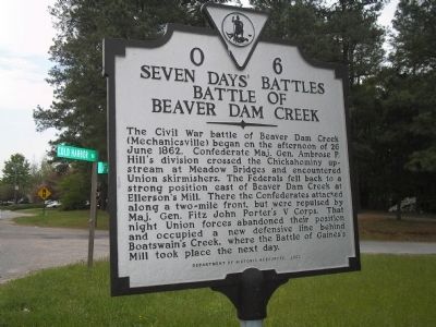
Photographed by Bill Coughlin, April 24, 2007
1. Battle of Beaver Dam Creek Marker
Erected 2002 by Department of Historic Resources. (Marker Number O-6.)
Topics and series. This historical marker is listed in this topic list: War, US Civil. In addition, it is included in the Virginia Department of Historic Resources (DHR) series list. A significant historical date for this entry is June 26, 1862.
Location. 37° 36.147′ N, 77° 22.214′ W. Marker is in Mechanicsville, Virginia, in Hanover County. It is at the intersection of Cold Harbor Road (Virginia Route 156) and Fast Lane, on the right when traveling east on Cold
this page online

Regionally, this marker is in Virginia’s Piedmont, in Central Virginia, and in the Richmond Metropolitan Area. It is also in the American South, specifically in the Upper South, and on the Eastern Seaboard. Globally, it is in the North Atlantic Region, North America, the Western Hemisphere, the Western World, and the Anglosphere. Historically, it finds itself in what was once the territory of the Mississippian Culture, one of the original Thirteen Colonies, one of the Confederate States of America, and the Antebellum South.
Other nearby markers. At least 8 other markers are within walking distance of this marker: Mechanicsville (approx. 0.2 miles away); a different marker also named Seven Days Battles (approx. ¼ mile away); a different marker also named Seven Days Battles (approx. 0.6 miles away); Beaver Dam Creek (approx. ¾ mile away); Lee’s First Strike (approx. ¾ mile away); a different marker also named Beaver Dam Creek (approx. ¾ mile away); Sheridan's Raid (approx. 0.8
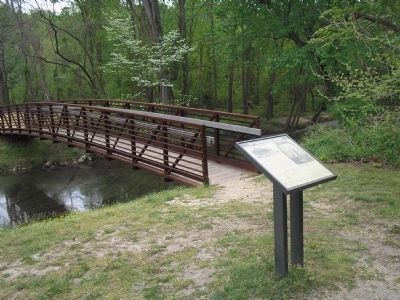
Photographed by Bill Coughlin, April 24, 2007
2. Beaver Dam Creek
On June 26, 1862, troops of Maj. Gen. A.P. Hill confronted Federals of Maj. Gen. Fitz John Porter’s V Corps at this location on Beaver Dam Creek. The creek is located about ¾ of a mile west of the marker.
Other markers no longer nearby. Beaver Dam Creek (was approx. ¾ mile away but has been reported to have been replaced with another marker now near it); The Creek Runs Red (was approx. ¾ mile away but has been confirmed missing); The Confederates Attack (was approx. 0.8 miles away but has been confirmed missing).
Also see . . .
1. Beaver Dam Creek. CWSAC Battle Summaries website. (Submitted on January 2, 2009, by Bill Coughlin of Woodland Park, New Jersey.)
2. The Seven Days Battle. HistoryCentral.com website. (Submitted on January 2, 2009, by Bill Coughlin of Woodland Park, New Jersey.)
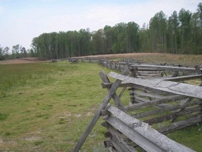
Photographed by Bill Coughlin, April 24, 2007
3. Gaines Mill
This is the location where the Union troops fell back to after the Battle of Beaver Dam Creek. The Battle of Gaines Mill was fought here on June 27, 1862.
Credits. This page was last revised on June 16, 2016. It was originally submitted on January 2, 2009, by Bill Coughlin of Woodland Park, New Jersey. This page has been viewed 1,763 times since then and 39 times this year. Photos: 1, 2, 3. submitted on January 2, 2009, by Bill Coughlin of Woodland Park, New Jersey.
