Cumberland Township near Gettysburg in Adams County, Pennsylvania — The American Northeast (Mid-Atlantic)
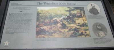
The Tenacious 20th Maine
July 2, 1863 - The Second Day
Col. Joshua L. Chamberlain, U.S.A.
Commander, 20th Maine Volunteers
Late on the second day, the 358 men of the 20th Maine Volunteers found themselves anchoring the southern end of the Union line. If they could not stop the Confederate tide here on the southern slopes of Little Round Top, the Federal line might be unhinged.
For more than an hour, waves of Alabamians repeatedly stormed this hillside from below, but were repulsed each time. So deadly was the struggle that "blood stood in puddles on the rocks." When the New Englanders' ammunition was nearly spent, Col. Joshua L. Chamberlain ordered a desperate bayonet charge that drove the Alabamians back for good, thus securing the Union left flank.
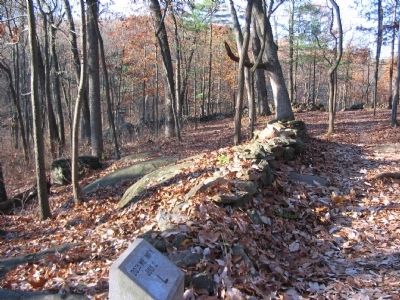
The short walk in front of you leads to the secluded 20th Maine monument. It rests on ground Chamberlain was ordered to hold "at all hazards."
Erected by Gettysburg National Military Park.
Topics. This historical marker is listed in this topic list: War, US Civil.
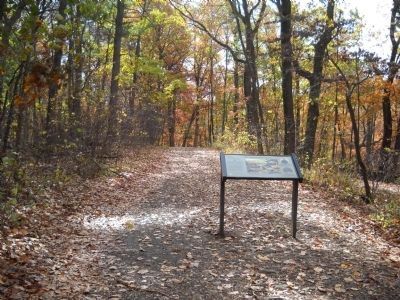
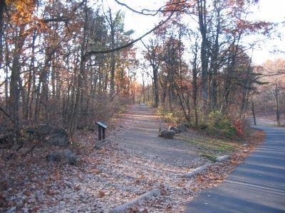
Location. 39° 47.431′ N, 77° 14.186′ W. Marker is near Gettysburg, Pennsylvania, in Adams County. It is in Cumberland Township. Marker is on Sykes Avenue, on the right when traveling north. Located on a trail extending from the Little Round Top pull off to the 20th Maine monument in Gettysburg National Military Park. Touch for map. Marker is in this post office area: Gettysburg PA 17325, United States of America. Touch for directions.
Other nearby markers. At least 8 other markers are within walking distance of this marker. "Hold The Ground At All Hazards" (a few steps from this marker); Third Brigade (within shouting distance of this marker); 83rd Pennsylvania Infantry (within shouting distance of this marker); Gen. Strong Vincent (within shouting distance of this marker); …built for defense (about 300 feet away, measured in a direct line); Historic Breastworks (about 300 feet away); 12th and 44th New York Infantry (about 300 feet away); Col. Strong Vincent (about 300 feet away).
More about this marker. In the center of the marker is a painting depicting the fighting. Union infantry of the 20th Maine took advantage of natural defenses here to repulse superior numbers of attacking Confederates. Painting by Keith Rocco.
In the upper right is a portrait of Col. Joshua L. Chamberlain, a professor before the war, led the charge here that secured the Union left flank. For gallantry he was awarded the Medal of Honor. Later, he officiated the surrender of Lee's army at Appomattox and was elected Governor of Maine.
In the lower right is a portrait of Col. William C. Oates who commanded the 15th Alabama which lost 343 men and 19 officers - nearly half their strength - in an attempt to dislodge the 20th Maine. His beloved brother, John, was hit by six bullets, and fell mortally wounded here. Oates recalled, "The dead literally covered the ground."
Also see . . . Report of Col. Joshua L. Chamberlain. Chamberlain described adjustments to his defensive lines:
In the midst of this, an officer from my center informed me that some important movement of the enemy was going on in his front, beyond that of the line with which we were engaged. Mounting a large rock, I was able to see a considerable body of the enemy moving by the flank in rear of their line engaged, and passing from the direction of the foot of Great Round Top through the valley toward the front of my left. The close engagement not allowing any change of front, I immediately stretched my regiment to the left, by taking intervals by the left flank, and at the same time "refusing" my left wing, so that it was nearly at right angles with my right, thus occupying about twice the extent of our ordinary front, some of the companies being brought into single rank when the nature of the ground gave sufficient strength or
shelter. My officers and men understood wishes so well that this movement was executed under fire, the right wing keeping up fire, without giving the enemy any occasion to seize or even to suspect their advantage. But we were not a moment too soon; the enemy's flanking column having gained their desired direction, burst upon my left, where they evidently had expected an unguarded flank, with great demonstration. (Submitted on January 2, 2009, by Craig Swain of Leesburg, Virginia.)
Credits. This page was last revised on February 7, 2023. It was originally submitted on January 2, 2009, by Craig Swain of Leesburg, Virginia. This page has been viewed 2,175 times since then and 25 times this year. Photos: 1. submitted on January 2, 2009, by Craig Swain of Leesburg, Virginia. 2. submitted on November 14, 2010, by Bill Coughlin of Woodland Park, New Jersey. 3, 4, 5. submitted on January 2, 2009, by Craig Swain of Leesburg, Virginia.


