Charlottetown in Queens County, Prince Edward Island — The Atlantic Provinces (North America)
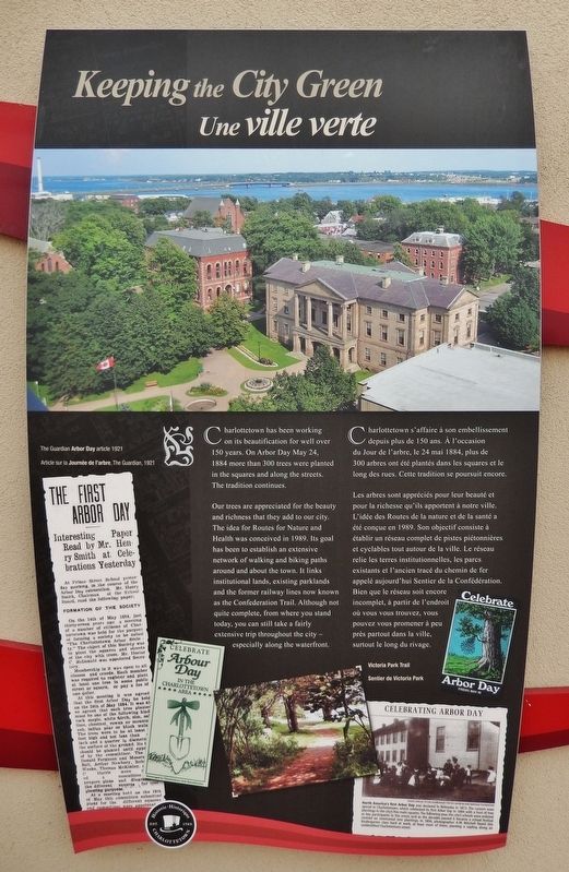
Keeping the City Green
Une ville verte
Charlottetown has been working on its beautification for well over 150 years. On Arbor Day May 24, 1884 more than 300 trees were planted in the squares and along the streets. The tradition continues.
Our trees are appreciated for the beauty and richness that they add to our city. The idea for Routes for Nature and Health was conceived in 1989. Its goal has been to establish an extensive network of walking and biking paths around and about the town. It links institutional lands, existing parklands and the former railway lines now known as the Confederation Trail. Although not quite complete, from where you stand today, you can still take a fairly extensive trip throughout the city — especially along the waterfront.
(photo captions)
• The Guardian Arbor Day article 1921
• Victoria Park Trail
Charlottetown s'affaire à son embellissement depuis plus de 150 ans. À l'occasion du Jour de l'arbre, le 24 mai 1884, plus de 300 arbres ont été plantés dans les squares et le long des rues. Cette tradition se poursuit encore.
Les arbres sont appréciés pour leur beauté et pour la richesse qu'ils apportent à notre ville. L'idée des Routes de la nature et de la santé a été conçue en 1989. Son objectif consiste à établir un réseau complet de pistes piétonnières et cyclables tout autour de la ville. Le réseau relie les terres institutionnelles, les parcs existants et l'ancien tracé du chemin de fer appelé aujourd'hui Sentier de la Confédération. Bien que le réseau soit encore incomplet, à partir de l'endroit où vous vous trouvez, vous pouvez vous promener à peu près partout dans la ville, surtout le long du rivage.
(légendes de photos)
• Article sur la Journée de l’arbre, The Guardian, 1921
• Sentier de Victoria Park
Erected by Historic Charlottetown.
Topics. This historical marker is listed in this topic list: Parks & Recreational Areas. A significant historical date for this entry is May 24, 1884.
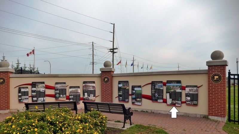
Location. 46° 14.474′ N, 63° 6.886′ W. Marker is in Charlottetown, Prince Edward Island, in Queens County. Marker is at the intersection of Grafton Street and Water Street (Prince Edward Island Route 1), on the right when traveling east on Grafton Street. Marker is located in the "Welcome to Charlottetown" plaza at the southwest corner of the intersection. Touch for map. Marker is in this post office area: Charlottetown PE C1A 1M1, Canada. Touch for directions.
Other nearby markers. At least 8 other markers are within walking distance of this marker. Preserving Our History (here, next to this marker); Open Green Spaces in the City

2. Marker detail: Celebrating Arbor Day
Photo Special to The Guardian by the P.E.I. Museum and Heritage Foundation
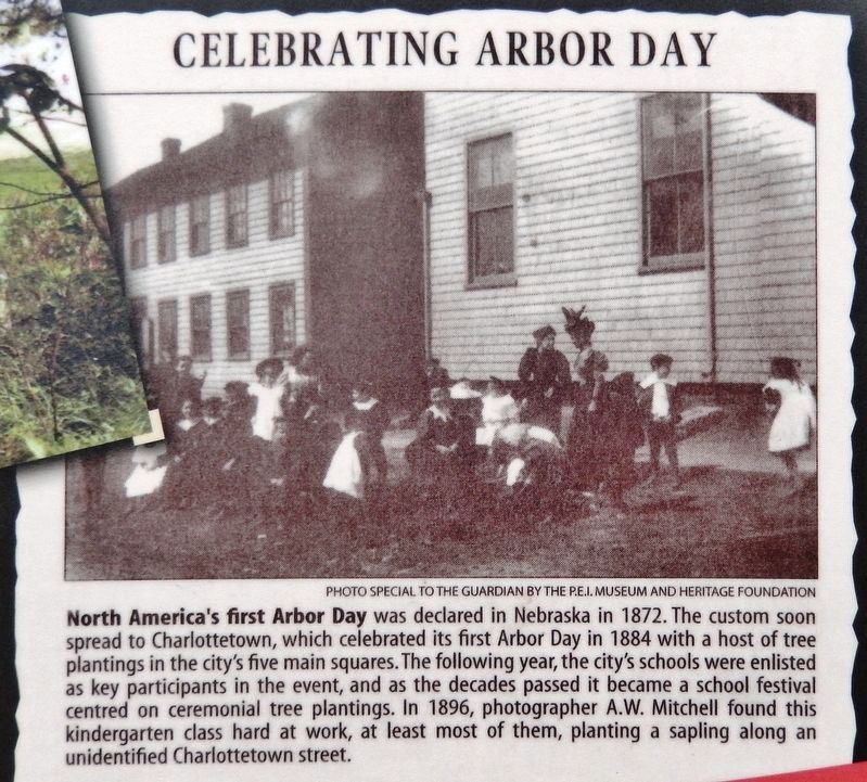
North America's first Arbor Day was declared in Nebraska in 1872. The custom soon spread to Charlottetown, which celebrated its first Arbor Day in 1884 with a host of tree plantings in the city's five main squares. The following year, the city's schools were enlisted as key participants in the event, and as the decades passed it became a school festival centred on ceremonial tree plantings. In 1896, photographer A.W. Mitchell found this kindergarten class hard at work, at least most of them, planting a sapling along an unidentified Charlottetown street.
North America's first Arbor Day was declared in Nebraska in 1872. The custom soon spread to Charlottetown, which celebrated its first Arbor Day in 1884 with a host of tree plantings in the city's five main squares. The following year, the city's schools were enlisted as key participants in the event, and as the decades passed it became a school festival centred on ceremonial tree plantings. In 1896, photographer A.W. Mitchell found this kindergarten class hard at work, at least most of them, planting a sapling along an unidentified Charlottetown street.
Related markers. Click here for a list of markers that are related to this marker. Historic Charlottetown, Prince Edward Island
Also see . . . The History of Arbor Day in Canada. In the late nineteenth century, some settlers began to take issue with the vast changes to the landscape. Many began to consider ideas of civic beautification and initiatives to plant trees, flowers, and shrubs in an effort to recapture some of the lost beauty. One such initiative was Arbor Day. Arbor Day was established in Nebraska in 1872. Very shortly after it became popular in other states as well as in Canadian provinces. (Submitted on May 15, 2020, by Cosmos Mariner of Cape Canaveral, Florida.)
Credits. This page was last revised on May 17, 2020. It was originally submitted on May 13, 2020, by Cosmos Mariner of Cape Canaveral, Florida. This page has been viewed 71 times since then and 7 times this year. Photos: 1, 2, 3. submitted on May 15, 2020, by Cosmos Mariner of Cape Canaveral, Florida.

