Cumberland Township near Gettysburg in Adams County, Pennsylvania — The American Northeast (Mid-Atlantic)
Fifth U.S. Cavalry
Reserve Brigade - First Division - Cavalry Corps
| — | Army of the Potomac | — |
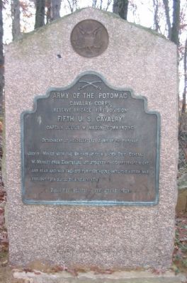
Photographed by Craig Swain, November 11, 2008
1. Fifth U.S. Cavalry Tablet
Cavalry Corps
Reserve Brigade First Division
Fifth U.S. Cavalry
Captain Julius W. Mason Commanding
Detachment at Headquarters Army of the Potomac
Casualties Wounded 4 men. Missing 1 man.
Erected 1907 by Gettysburg National Military Park Commission.
Topics. This historical marker is listed in this topic list: War, US Civil. A significant day of the year for for this entry is July 3.
Location. 39° 46.639′ N, 77° 15.23′ W. Marker is near Gettysburg, Pennsylvania, in Adams County. It is in Cumberland Township. It can be reached from Ridge Road, on the left when traveling north. The tablet is located a short walk off Ridge Road along what once was Merritt Avenue. The avenue was removed by the park service and is maintained as a foot trail only. Touch for map. Marker is in this post office area: Gettysburg PA 17325, United States of America. Touch for directions.

Regionally, this marker is in South-Central Pennsylvania. It is also in the American Northeast, in the Mid-Atlantic, in Appalachia, and specifically in Northern Appalachia. Globally, it is in North America, the Western Hemisphere, the Western World, and the Anglosphere. Historically, it finds itself in what was once the Haudenosaunee (Iroquois) Confederacy and also one of the original Thirteen Colonies.
Other nearby markers. At least 8 other markers are within walking distance of this marker: 1st & 2nd Regiments United States Cavalry (approx. 0.2 miles away); Houghtelin Farmhouse (approx. 0.4 miles away); 6th Pennsylvania Cavalry (approx. 0.4 miles away); Chaplain Samuel Henry Stein (approx. 0.4 miles away); Reilly's Battery - Henry's Battalion
this page online
Another marker is no longer nearby. Longstreet Attacks at 4 p.m. (was approx. half a mile away but has been permanently removed).
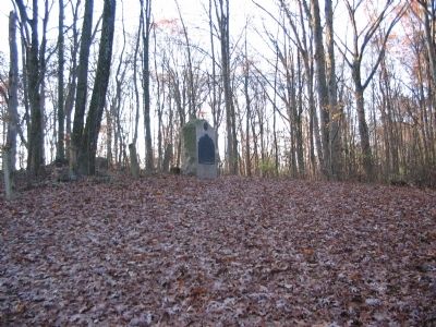
Photographed by Craig Swain, November 11, 2008
2. Tablet Area
The tablet stands on a rise in what is now a wooded strip between homes.
Credits. This page was last revised on February 7, 2023. It was originally submitted on January 3, 2009, by Craig Swain of Leesburg, Virginia. This page has been viewed 1,304 times since then and 30 times this year. Photos: 1, 2. submitted on January 3, 2009, by Craig Swain of Leesburg, Virginia.
