La Grange in Lewis County, Missouri — The American Midwest (Upper Plains)
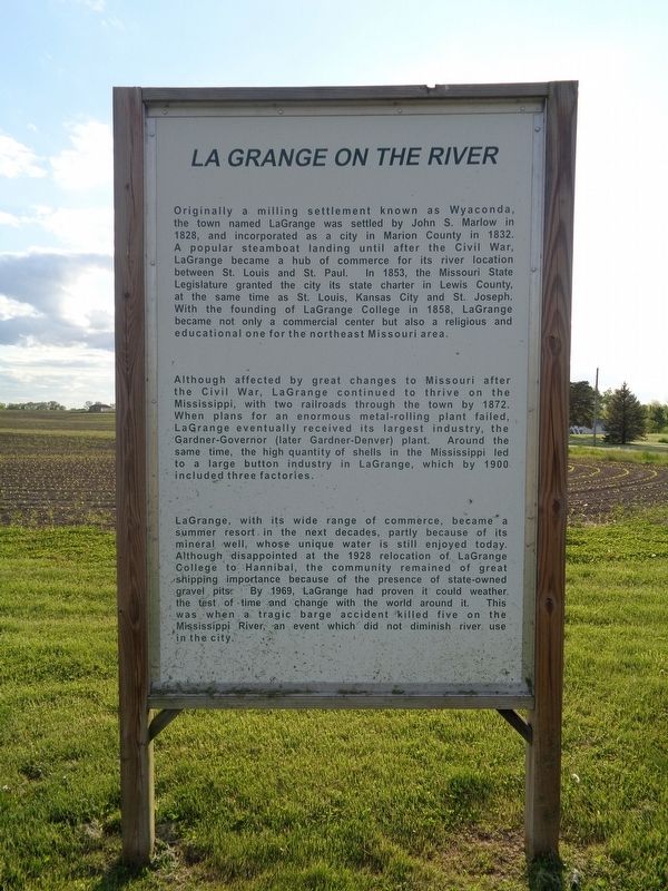
LaGrange on the River
(front side)
Originally a milling settlement known as Wyaconda, the town named LaGrange was settled by John S. Marlow in 1828, and incorporated as a city in Marion County in 1832. A popular steamboat landing until after the Civil War, LaGrange became a hub of commerce for its river location between St. Louis and St. Paul. In 1853, the Missouri State Legislature granted the city its state charter in Lewis County, at the same time as St. Louis, Kansas City and St. Joseph. With the founding of LaGrange College in 1858, LaGrange became not only a commercial center but also a religious and educational one for the northeast Missouri area.
Although affected by great changes to Missouri after the Civil War, LaGrange continued to thrive on the Mississippi, with two railroads through the town by 1872. When plans for an enormous metal-rolling plant failed, LaGrange eventually received its largest industry, the Gardner-Governor (later Gardner-Denver) plant. Around the same time, the high quantity of shells in the Mississippi led to a large button industry in LaGrange, which by 1900 included three factories.
LaGrange, with its wide range of commerce, became a summer resort in the next decades, partly because of its mineral well, whose unique water is still enjoyed today. Although disappointed at the 1928 relocation of LaGrange College to Hannibal, the community remained of great shipping importance because of the presence of state-owned gravel pits. By 1969, LaGrange had proven it could weather the test of time and change with the world around it. This was when a tragic barge accident killed five on the Mississippi River, an event which did not diminish river use in the city.
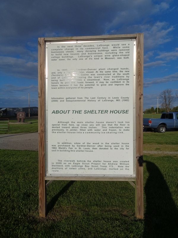
(reverse side)
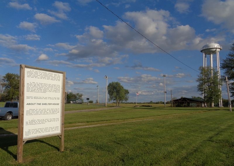
In the next three decades, LaGrange would see a complete change in its commercial face. While some businesses closed, many decaying buildings were removed to build new houses and businesses, including the old college buildings. LaGrange's unique wine glass-shaped water tower, the only one of it's kind in Missouri, was built.
In 1995, the Gardner-Denver plant changed hands, and only a few years later, closed. At the same time, the new (Terrible's) Mark Twain Casino was constructed at the south end of LaGrange, keeping the town's river traditions by being built to resemble a steamboat. Now, as LaGrange honors its past and heads forward, it may be confident in its future because it has the potential to grow and improve the town within everyone of its people.
Information gathered from The Last Century in Lewis County (2000) and Sesquicentennial History of LaGrange, MO. (1982)
About the Shelter House
Although the main shelter house doesn't look too special from here, up close you will see that the floor is dented inward about three inches. This indentation was previously, in winter, filled with water and frozen, to make the shelter house into a community ice skating rink.
In addition, some of the wood in the shelter house was purchased by Gardner-Denver after being used in the 1904 World's Fair in St. Louis, then donated to the city for use in building this shelter house.
The riverwalk behind the shelter house was created in 2009 as an Eagle Scout Project for Andrew William Steinbeck with LaGrange Boy Scout Troop 173. Note the positions of selected cities, and LaGrange, marked on the route.
Topics. This historical marker is listed in these topic lists: Industry & Commerce • Settlements & Settlers • War, US Civil • Waterways & Vessels. A significant historical year for this entry is 1828.
Location. 40° 2.88′ N, 91° 30.941′ W. Marker is in La Grange, Missouri, in Lewis County. Marker is on State Highway C, 0.6 miles east of U.S. 61, on the right when traveling east. Marker is located west of the LaGrange Ball Field. Touch for map. Marker is at or near this postal address: 33248 State Hwy C, La Grange MO 63448, United States of America. Touch for directions.
Other nearby markers. At least 8 other markers are within 9 miles of this marker, measured as the crow flies. La Grange Missouri (approx. one mile away); La Grange Artesian Well (approx. 1.1 miles away);
Canton (approx. 5.3 miles away); History Along The Mississippi River Parkway (approx. 5.4 miles away); Lincoln School (approx. 5.4 miles away); Welcome to Illinois (approx. 8.3 miles away in Illinois); Indian Removals - A Memorial (approx. 8.7 miles away in Illinois); Stone Smokehouse (approx. 8.7 miles away in Illinois). Touch for a list and map of all markers in La Grange.
Credits. This page was last revised on May 19, 2020. It was originally submitted on May 19, 2020, by Jason Voigt of Glen Carbon, Illinois. This page has been viewed 396 times since then and 56 times this year. Photos: 1, 2, 3. submitted on May 19, 2020, by Jason Voigt of Glen Carbon, Illinois. • Bernard Fisher was the editor who published this page.


