Near Lompoc in Santa Barbara County, California — The American West (Pacific Coastal)
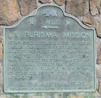
La Purisima Mission
← 1 Mile
Erected by Department of Public Works – Division of Highways. (Marker Number 340.)
Topics and series. This historical marker is listed in these topic lists: Churches & Religion • Native Americans • Settlements & Settlers. In addition, it is included in the California Historical Landmarks series list. A significant historical date for this entry is December 8, 1780.
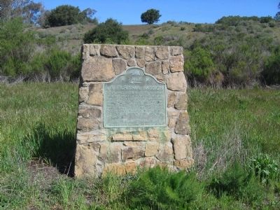
Location. 34° 39.871′ N, 120° 24.191′ W. Marker is near Lompoc, California, in Santa Barbara County. Marker is on State Highway 246 east of Cebada Canyon Road, on the right when traveling west. Touch for map. Marker is in this post office area: Lompoc CA 93436, United States of America. Touch for directions.
Other nearby markers. At least 8 other markers are within 4 miles of this marker, measured as the crow flies. La Purisima Mission State Historic Park (approx. 1.1 miles away); First Successful Cement Job (approx. 3.6 miles away); Lompoc's Mission Vieja (approx. 3.6 miles away); Lompoc Carnegie Library (approx. 3.6 miles away); Italian Stone Pines (approx. 3.6 miles away); Lompoc World War I Monument (approx. 3.6 miles away); a different marker also named La Purisima Mission (approx. 3.7 miles away); Original Site of Mission de La Purisima Concepcion de Maria Santisima (approx. 3.8 miles away). Touch for a list and map of all markers in Lompoc.
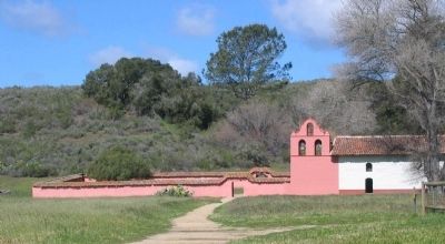
Regarding La Purisima Mission. La Purisima Mission State Park is located at intersection of Mission Gate and Purisima Roads, 3 miles east of Lompoc. See the links and "Other nearby markers" section for more information on the La Purisima Mission.
Also see . . . La Purisima Mission State Historic Park. (Submitted on September 6, 2008, by Syd Whittle of Mesa, Arizona.)
Credits. This page was last revised on May 20, 2020. It was originally submitted on September 6, 2008, by Syd Whittle of Mesa, Arizona. This page has been viewed 2,436 times since then and 19 times this year. Last updated on May 20, 2020, by Craig Baker of Sylmar, California. Photos: 1, 2, 3. submitted on September 6, 2008, by Syd Whittle of Mesa, Arizona.


