Quincy in Adams County, Illinois — The American Midwest (Great Lakes)
Archaic
A Time of Change
| — | 3000 - 1000 B.C. | — |
Photographed by Jason Voigt, May 11, 2020
1. Archaic Marker
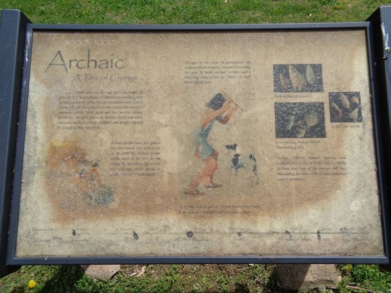
Archaic people hunt and gather, but they invent new tools to do so. By 4,000 BC, Archaic people spend more of the year in one village. By the end of the period, they cultivate native plants to supplement their food supply.
Changes in the sizes of spearpoints are evidence of new weapons. Instead of throwing the spear by hand, Archaic hunters used a throwing stick, called an "atlatl", to hurl stone-tipped darts.
Archaic Indians shaped igneous and metamorphic rocks to make axes by slowly pecking away bits of the surface and then smoothing the stone with abrasive materials such as sandstone.
(photo caption:)
By taming wolves, Archaic Period Native Americans found a new companion and workmate - dogs.
Topics.
this page online
Location. 39° 54.901′ N, 91° 24.598′ W. Marker is in Quincy, Illinois, in Adams County. It is on Indian Mounds Park west of South 5th Street, on the left when traveling north. Marker is on the grounds of Indian Mounds Park. Touch for map. Marker is in this post office area: Quincy IL 62301, United States of America. Touch for directions.

Regionally, this marker is in Central Illinois. It is also in the American Midwest, in the Corn Belt, and in the Great River Road Region. Globally, it is in North America, the Western Hemisphere, the Western World, and the Anglosphere. Historically, it finds itself in what was once the territory of the Mississippian Culture and also the Northwest Territory.
Other nearby markers. At least 8 other markers are within walking distance of this marker: Paleoindian (within shouting distance of this marker); Woodland (within shouting distance of this marker); Mississippian (within shouting distance
Photographed by Jason Voigt, May 11, 2020
2. Archaic Marker
In Indian Mounds Park
Credits. This page was last revised on May 21, 2020. It was originally submitted on May 20, 2020, by Jason Voigt of Glen Carbon, Illinois. This page has been viewed 345 times since then and 34 times this year. Photos: 1, 2. submitted on May 20, 2020, by Jason Voigt of Glen Carbon, Illinois. • Devry Becker Jones was the editor who published this page.
