Near Decatur in Meigs County, Tennessee — The American South (East South Central)
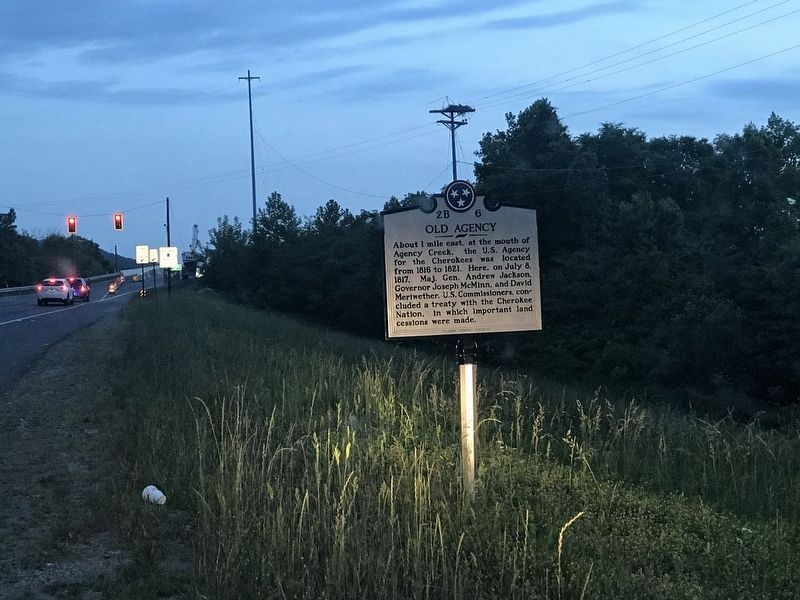
Old Agency

Photographed by Duane and Tracy Marsteller, May 16, 2020
1. Old Agency Marker
Erected by Tennessee Historical Commission. (Marker Number 2B 6.)
Topics and series. This historical marker is listed in these topic lists: Government & Politics • Indigenous Peoples and Communities • Peace. In addition, it is included in the Former U.S. Presidents: #07 Andrew Jackson, and the Tennessee Historical Commission series lists. A significant historical year for this entry is 1816.
Location. 35° 22.293′ N, 84° 54.505′ W. Marker is near Decatur, Tennessee, in Meigs County. It is on State Highway 58 one mile south of Cameron Road, on the right when traveling south. Touch for map. Marker is at or near this postal address: 4710 Highway 58, Decatur TN 37322, United States of America. Touch for directions.

Regionally, this marker is in East Tennessee. It is also in the American South, specifically
this page online
Other nearby markers. At least 8 other markers are within 6 miles of this marker, measured as the crow flies: Dr. Luther Lee Friddell (approx. 4.8 miles away); Native Americans of the Hiwassee Area (approx. 5 miles away); Hiwassee Campground (approx. 5.1 miles away); This Venerable Oak Tree (approx. 5.8 miles away); Prelude (approx. 6 miles away); Consequences (approx. 6 miles away); "Your Fate is Decided" (approx. 6 miles away); General Winfield Scott (approx. 6 miles away).
Photographed by Duane and Tracy Marsteller, May 16, 2020
2. Old Agency Marker
Credits. This page was last revised on August 4, 2020. It was originally submitted on May 25, 2020, by Duane and Tracy Marsteller of Murfreesboro, Tennessee. This page has been viewed 710 times since then and 64 times this year. Photos: 1, 2. submitted on May 25, 2020, by Duane and Tracy Marsteller of Murfreesboro, Tennessee. • Devry Becker Jones was the editor who published this page.
